Two days before we left Port Townsend, some nasty weather ran over us. A low-pressure front sent powerful winds from the south up through the fjord and across our anchorage. We are only three boats here on anchor, the rest have sought refuge in the marinas or on other anchorages. We haven’t had that possibility since Carsten has to be here tomorrow for his driving test (he’s getting an American driver’s license), so we have to just take what comes – we’ve probably tried that which was worse and lest we forget our motto: “In Mantus we trust” – in other words, we trust our anchor.
The strong winds whip up choppy waves that are 4-5 feet, which is not comfortable by any definition. We’ve, of course, decided to stay on board Capri in order to keep an eye on her. We’re also keeping a sharp eye on the other two boats here. They are not manned and if their anchors should drag…………
Our anchor does what it is supposed to – meaning it holds as if it is nailed to sea bottom. So do the other two boats, but the little boat alongside us loses its entire rig over the side in a heavy gust. We call the marina on the VHF to see if they know the owner of the boat, but they don’t. The rig is still attached to the boat by a shroud or two and banging into the side of the boat. We should probably dinghy over and cut away the rig to avoid further damage to the boat, but we really can’t just do that. The owner may still be able to salvage the rig.
Two days later, we make sail for Anacortes, a town approximately 10nm from the San Juan’s. On this 35nm stretch, we will again pass Point Wilson. During the bad weather we’ve just had, Point Wilson had 3-meter high swells. We’ll wait for the seas to calm before we leave. The trip is easy despite having to cross the traffic separation system twice. We only run into 0,5-1 knots of current against us.
When we pass Deceptor Pass, the small pass between Fildago and Whidbey Islands, we see 12-15 boats waiting outside the pass. This is one of the critical passes in the area and the current can run really hard through there. It is necessary to wait for slack water before attempting the passage, otherwise you’ll end up doing something that would reminds you of whitewater rafting – it is truly dangerous. Fortunately, we aren’t going through the pass, but only the pass between Guemes and Fildago islands to Anacortes. We’ve planned to pass through at slack water and we do.
This time we will spend some of our hard-earned money and spend a couple of nights in the marina. The anchorage just outside is crowded beyond belief, the waters are shallow and crab pots abound. In other words – a shit anchorage. As we enter through the breakwater, we see two boats that dragged their anchors and slammed into the rocks.

Anacortes is normally a popular landing for cruising sailors. With three marinas and a boatyard, there is something for everyone. Not to mention a thriving restaurant district in the center of town. But due to Covid-19, many things are closed. The restaurants are only open for take-out and museums etc. are shut tight. There is no doubt that in better times, the town is swinging, but now it is half-dead.
We are lucky. Since we can’t enjoy the sin traps of the city, we have cruising friends nearby. Mizzy, Brian and their cat Feisty are here also, so we can have drinks and dinner with them. This time they entertain us with Mizzy’s life story, the last time it was Brian’s.
Paula and Wags, a cruising couple we first met on the Galapagos and later many times in the Marquesas also live here. They have left their boat on New Zealand and come home during the Covid crisis, since no one knows how long all this will last. Like others, they have no idea when, or if, they will be able to continue their journey – or will they have to sell their boat and cancel one of their life’s dreams.
We are many cruisers facing this issue.
Paula immediately offers to lend us her car so we can go shopping in the big supermarkets further away and they, of course, also invite us to dinner, saying that we should be sure to bring our laundry since they have a huge washing machine and dryer (laundry is a continual problem for cruisers). They live in a remodeled older home outside the city in the forest with an incomparable view over the fjord. It is a charming house, everything is completely modern, but kept in the old style. Every room has a view of the fjord and the living room/kitchen open onto a gigantic deck with a staircase down to the water. They serve up a dinner including crab that Wags has caught in the fjord just below the house.
The evening is delightful and we invited them for dinner aboard Capri the following evening – they shouldn’t forget what it means to live in tight quarters aboard a sailboat. Another delightful evening and they are only a bit envious when we set sail the next morning out into the San Juan’s where we will spend the next 3-4 weeks.

Carsten and I have only had a few days of sailing in the Swedish Archipelagos (before we left on this now 4 ½ year odyssey) and we are therefore very impressed as we sail through Thatcher Pass, the eastern route into the San Juan’s. We glide past the small rock islands, all covered with pine growth – beautiful and idyllic.
Our first stop is a small and unpopulated island, James Island, approximately 10nm from Anacortes. It is a popular destination due to the many paths through the forest growth and its large raccoon population. I’ve never seen a raccoon and am looking forward to meeting one “alive”. The island is a national park and has a few mooring balls that, unfortunately, lie right out to the heavily trafficked pass. The ferries and passing motorboats make the moorage uncomfortable. On the lee side of the island, there is a small pier, but Capri’s long keel make it impossible for us to tie up there. So we drop our hook in a small bay on neighboring Decatur Island, about 1nm away.

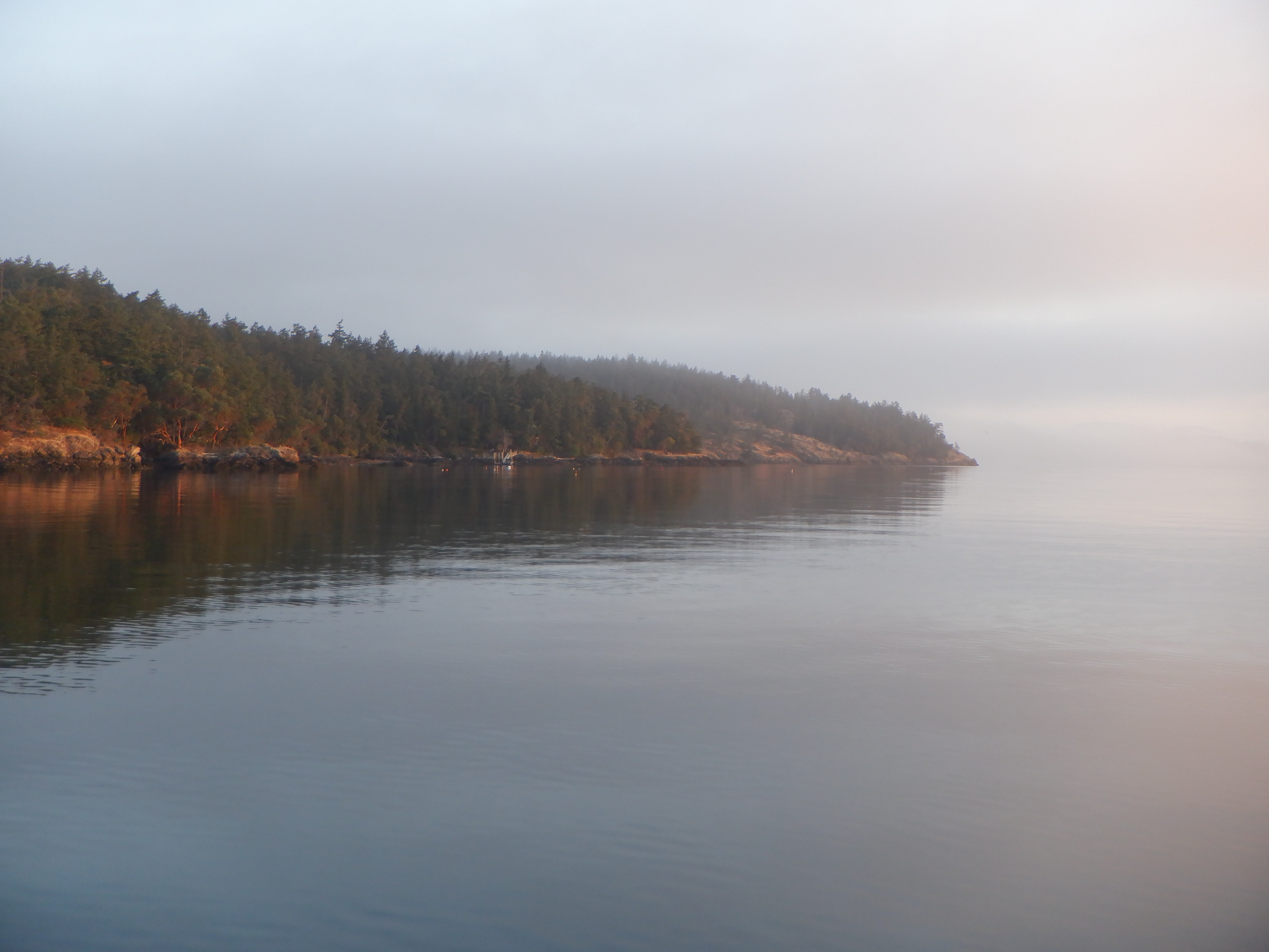
Next morning when we rise, we are greeted with fog as thick as pea soup. We can’t see James Island. We also can’t see Decatur Island nor the other boat at anchor here in the bay. We can barely see the front end of our boat. We’ll just have to drink some more coffee (tea for me) and wait for the fog to dissipate before taking Little Capri over to James. We are going over, because my mind is made up – I want to see a raccoon. By noon, the fog has cleared enough for us to dinghy over. We march clear around the island and I’m disappointed, no raccoons. Carsten has been telling me not to get my hopes up, because raccoons are generally nocturnal animals.
Late that afternoon, we move Capri around to the other side of Decatur, into Sylvan Cove. Sylvan is pure idyll, but we are not allowed to go ashore – everything is privately owned on Decatur.
We intend to spend the three weeks or so meandering throughout the San Juan’s so we spent the night in Sylvan Cove and the following morning ate a relaxed breakfast, then upped anchor and lazed our way through the pass between Decatur and Lopez Islands to Hunter Bay. Hunter is a picturesque bay with a view over many small islands. It is also very popular and there are many boats at anchor. There is also a good quality dinghy dock so we dinghy in and take a long walk around the island. Lopez is one of the bigger islands so we can’t circumnavigate it on foot. There is a town, Fischerman’s Bay on the other side of the island, but once again, Capri’s long legs prohibit us from sailing in there.
But not far from there, lies Spencer Spits, a long narrow peninsula stretching out from the northern side of Lopez. This anchorage is also close to the main traffic pass and the wakes from passing ferries and boats make it an uncomfortable anchorage. It is very popular with cruisers, probably because there are picnic tables and fireplaces (grills) set up on shore for free use. The tides here make landing and tying up a dinghy a major issue. If you go ashore at low tide, then when you return you’ll be wading as much as 50 feet out through (very) cold water to your dinghy. Actually, you’ll probably be swimming the last meters. If you come ashore at high tide, then you’ll end up dragging or carrying your dinghy the 50 feet or more out to the water. As a result, we didn’t come in for a landing at dusk so I could see my raccoon. The dinghy issues would simply have been more than we were willing to put ourselves through.
We rose bright and early the next morning and waited, and waited for the fog to clear so we could sail the 7.5nm to West Sound on Orca, the largest of the San Juan Islands. The pilot books note that before leaving Anacortes, cruisers should make sure to provision enough for their entire time in the islands, since everything out here is 20+% more expensive than in Anacortes. They also note that cruisers should bunker plenty of fuel since that is twice as expensive as on the mainland. Ditto for their water tanks since water is at a premium. Some marinas will let you fill your water tanks without staying for the night, but then you will have to pay for the water. Saving water is easier said than done, when you live on the hook instead of going into marinas. We take our showers on board and no matter how much we try to go easy on the water, the tanks are quickly depleted. Of course you’re now thinking; what about your famous watermaker? You just spent a small fortune getting it repaired in Seattle. Just turn the damned thing on and let it make water. Normally, we would do just that. The watermaker repairman in Seattle advised us not to make water in the San Juan’s – too much algae, he said, you’ll clog your filters within a couple of hours. Mizzy and Brian used their watermaker and told us that they clogged their filters after 4 hours. So no watermaker for us.

This will be the first time in four years that we have had to worry about water. Normally, we just use water as we please and then make some more. The small marina in West Sound lets us fill our tanks if we buy a jerry can (5 gallons) of gas at double the price of the mainland. Oh well – we’ll need the gas anyway. They were nice and let us dump our garbage too – another ongoing problem when sailing here.
We spent the night on the hook outside the marina but there isn’t much to see or do here, so next morning we set sail for Deer Harbor – only 3nm away, but getting there requires going through the infamous Pole Pass. Pole Pass is more than narrow and the rocks just up on both sides just at the edge of the channel. Just to make the passage more entertaining, the current and maelstroms here in the pass are murderous. At peak times, the current can run over 6 knots. We almost can’t believe the chartplotter as it leads us through the twists and turns necessary to negotiate this pass. The rocks are literally only a couple of feet from the side of the boat and Capri needs to turn sharp to starboard and then port and then back again several times to get through. Obviously, there is only room for one boat at a time in the pass and everyone waits patiently for their turn. Some boats get through more confidently than others do. My pulse races along when it is our turn, but we sail through without issue thanks to Carsten’s confident helming.
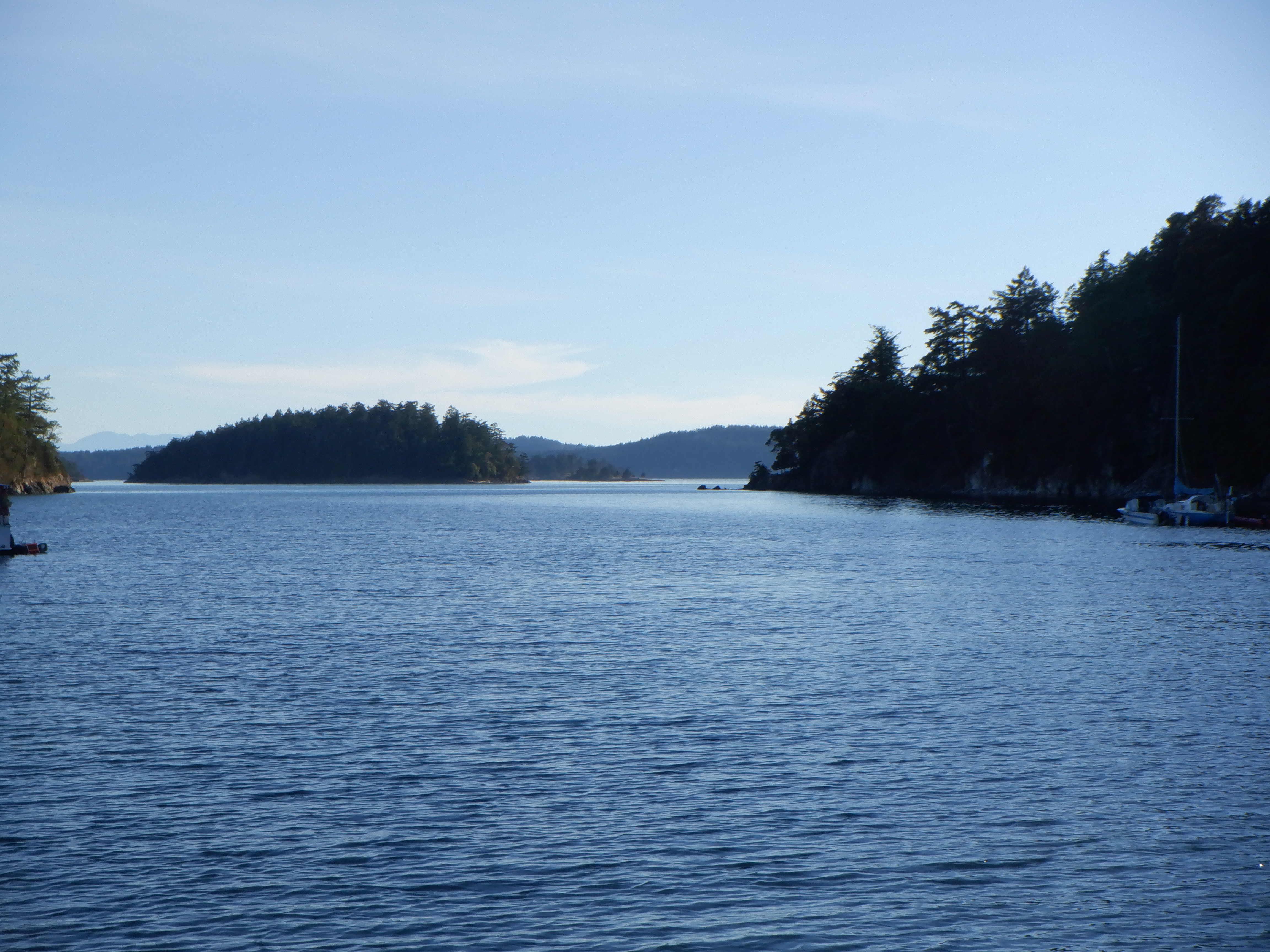
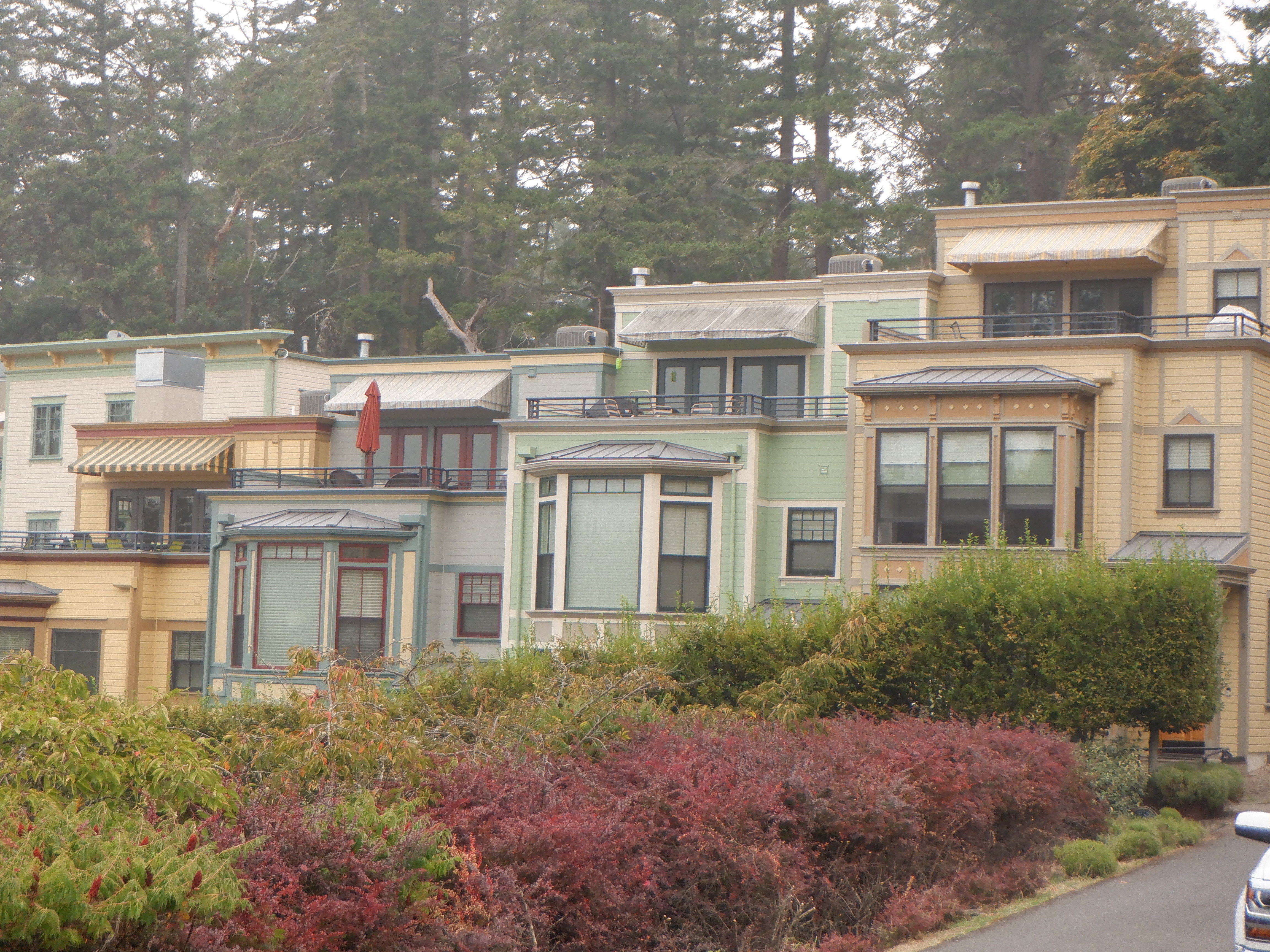
The pass opens into an almost enclosed bay, with an anchorage that looks out over the fjord and the small archipelago islands. This anchorage must be in many a photo album – it is that beautiful. This is amongst the most popular destinations in the San Juan’s and the price level reflects it. We rented a car and drove around the island. Despite seeing many pine forests and cliffs, I find the island more breathtaking from the waterside than the land. From the water, the houses are well hidden behind the trees and blend in with the background. I don’t know if there are local laws that dictate how the houses must be built, but we see few houses that are sitting naked on a hillside or the like.
There are many from Seattle that own summer homes here on these islands. You would think that would mean that all the coasts would be cluttered with huge beach houses, but we see nary a one. Houses or building lots are very expensive here in the islands, but there is no shortage of buyers. Microsoft and other IT companies have their headquarters in Seattle and surrounding area so there are many IT millionaires.

Driving around Orca, we pass through the only true town on the island- East Sound, a true tourist trap. It has a wonderful old hotel (very, very expensive), lots of (expensive) restaurants (burgers only $20-25) and more artsy-craftsy shops than you can shake a stick at. We zip straight through the town and find a state park where we can eat our homemade sandwiches alongside a small lake. The locals are all either swimming or sunbathing while we are fully dressed and not warm at all – our bodies are still on tropical heat time.

There are many things you need to keep an eye out for when sailing here, amongst others this:
A couple of days later we left Deer Harbor to make our way to one of the outlying islands – Stuart. We’ll spend the Labor Day weekend here. We’re hoping that only a few boats will have found their way out here, but we were sadly mistaken. We are not the only ones who want to spend this weekend in the protected Reid Harbor. The bay is big and can easily hold all the boats so we can drop the hook in the middle of the bay.
Our pilotbook notes that there is a population of 30 that live permanently on the island. Their houses are, for the most part, hidden deep in the forests. There is no town here and only 1 public gravel road. The road is the only road we cruisers can use to make the 2 x 5 kilometer trek to the lighthouse at Turn Point.
As we trek, we pass the local school, a 1-room schoolhouse. We wonder how many children there are here on the island and how they can get an education equivalent to schools on the mainland. There is no high-speed internet here, amongst other issues. Two school-age girls come by us on an ATV and we asked them. They were only here for a vacation, but told us that the school had been closed for several years, because there are no school-age children on the island.


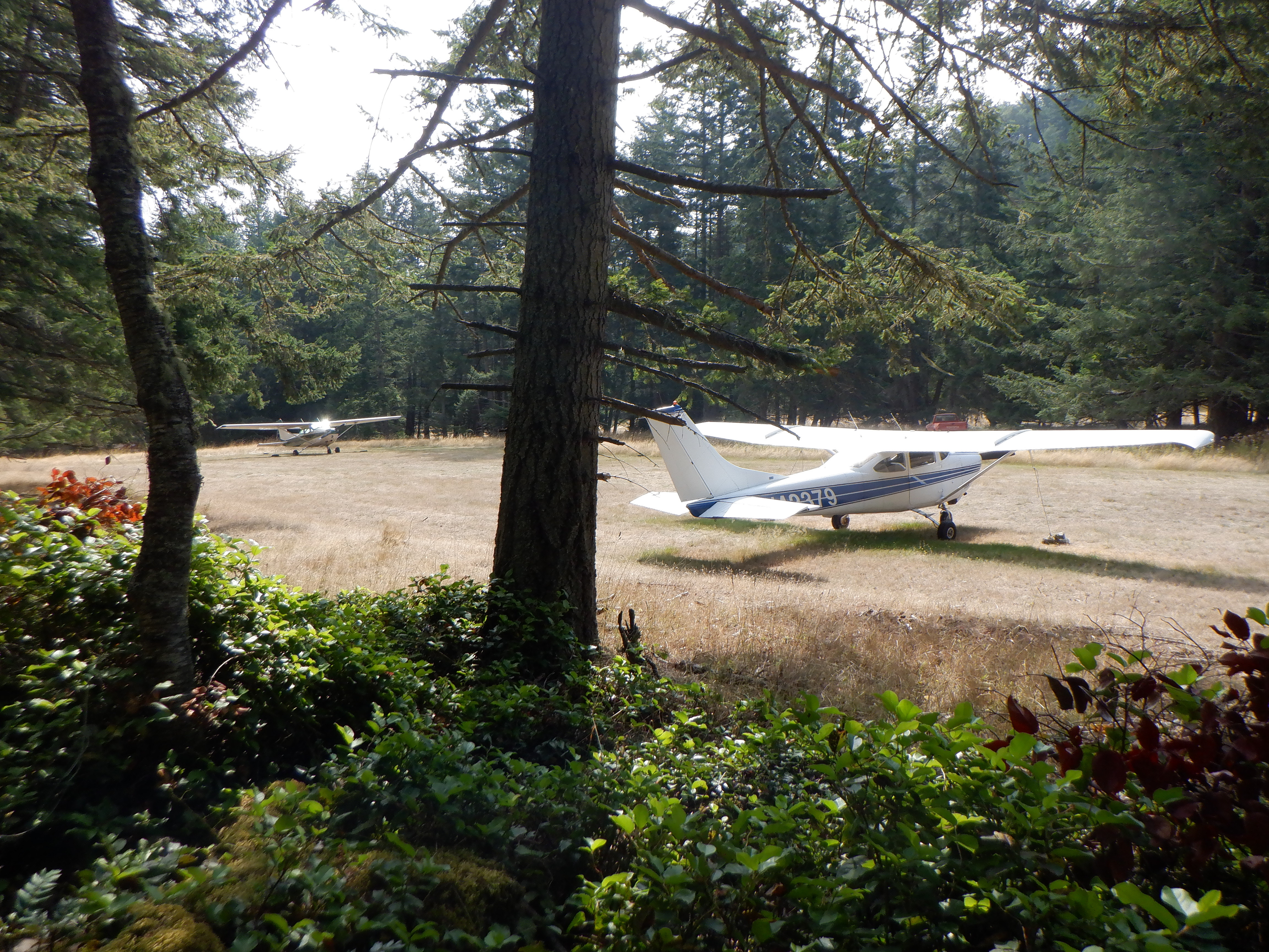
Further on our trek to the lighthouse, we pass the local airport (a grass landing strip), sporting two (2!) small airplanes. Stuart has – get this – two airports! There is another landing strip on the other side of the island. Boats and planes are the only possibilities for getting around in the islands. The ferries run from Anacortes to East Sound, Friday Harbor on San Juan Island and Ferry Landing on Shaw. From there you are on your own. There are a number of waterplanes that traffic the rest of the islands and then some people have their own airplane to commute to work on the mainland.
Our trek finally leads us down a steep (very steep) hill. Will our aging knees get us back up this vertical climb (ok – so maybe not vertical)? We climb down expecting to see a wonderful old lighthouse that is worthy of some picture-taking – but no – the “lighthouse” is just a big aluminum pole with a transmitter on top. No marvelous old lighthouse like the one we saw on Cape Hatteris.
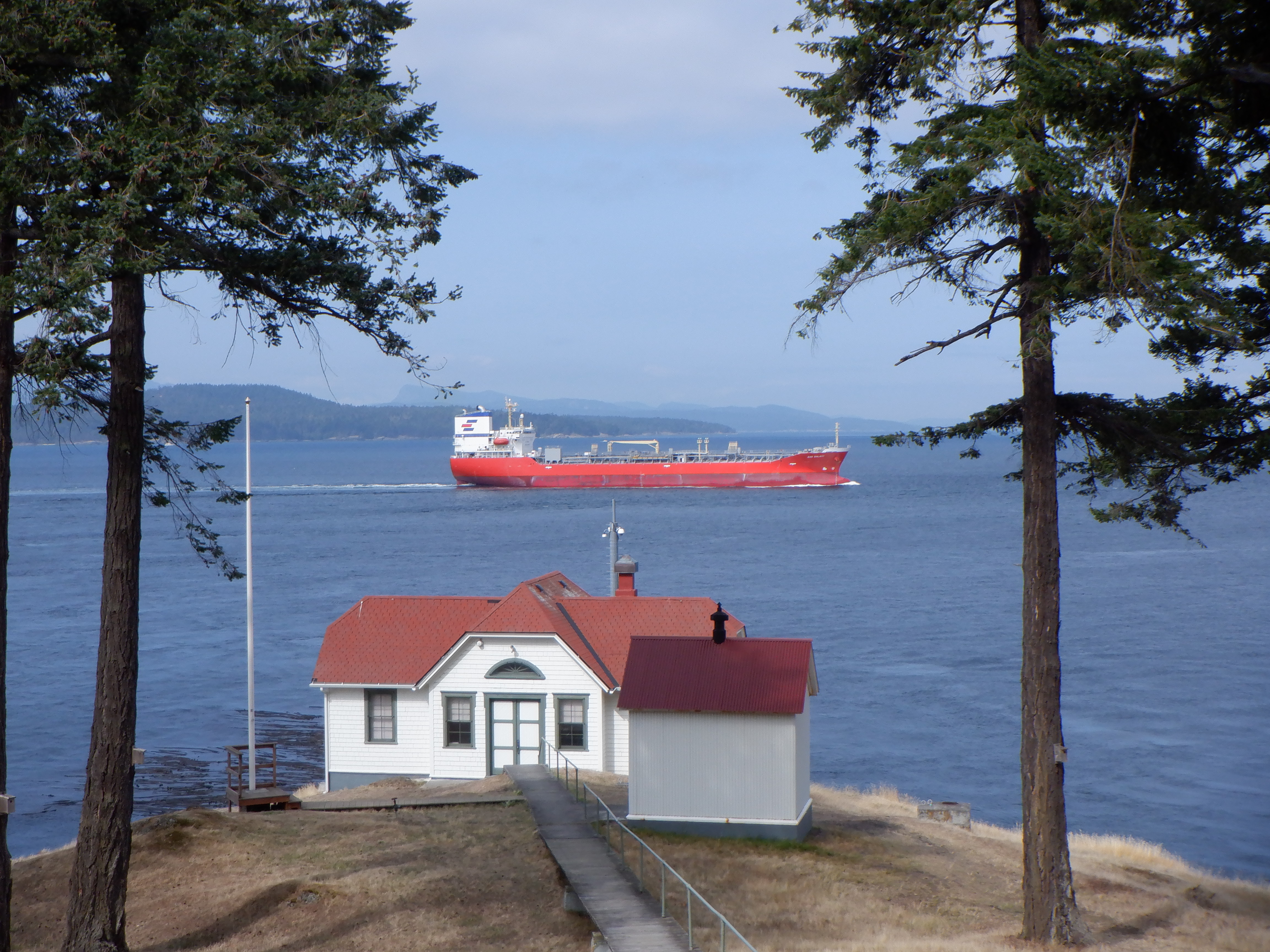
The lighthouse keeper’s cottage and the rest of the buildings are all well-maintained, but stand empty. We sit on the porch and eat our sandwiches while watching the big ships come up the channel and make the 90 degree turn here at Turn Point. The strait is narrow here and makes the sharp turn – it is easy to see that before the advent of GPS and chartplotters, the helmsmen on the ships were entirely dependent on this lighthouse to find their way at night and in the dense fog that frequently descends on this area. While at anchor, we hear their foghorns in the distance every night and early morning.
Believe it or not – Carsten and I make the trek twice. Exercise is good for us (Carsten), but we both complain – we are not is a good shape as we were even in Polynesia. Especially our knees seem to complain.
Carsten has to be back in Port Angeles in 10 days – he has to take a driving test (he getting an American driver’s license so we can register a car in our name and get cheaper insurance). He’s understandably nervous – it has been years since he has taken a driving test. In these Covid-19 days, the DMV office is only open by appointment, you have to make one and then show up wearing a facemask, gloves and bring your own pen etc. Only one person is allowed into the offices at any one time.

Our last stop in the islands is San Juan Island, the “Capital” of the archipelago. It is 10nm to Friday Harbor, a long narrow bay sporting hourly ferries and three anchorages. The first two anchorages are unruly due to ferry wakes (and water planes landing and taking off constantly). The last anchorage is better but shallow and it takes us the better part of an hour to find a spot that can accommodate our long legs.
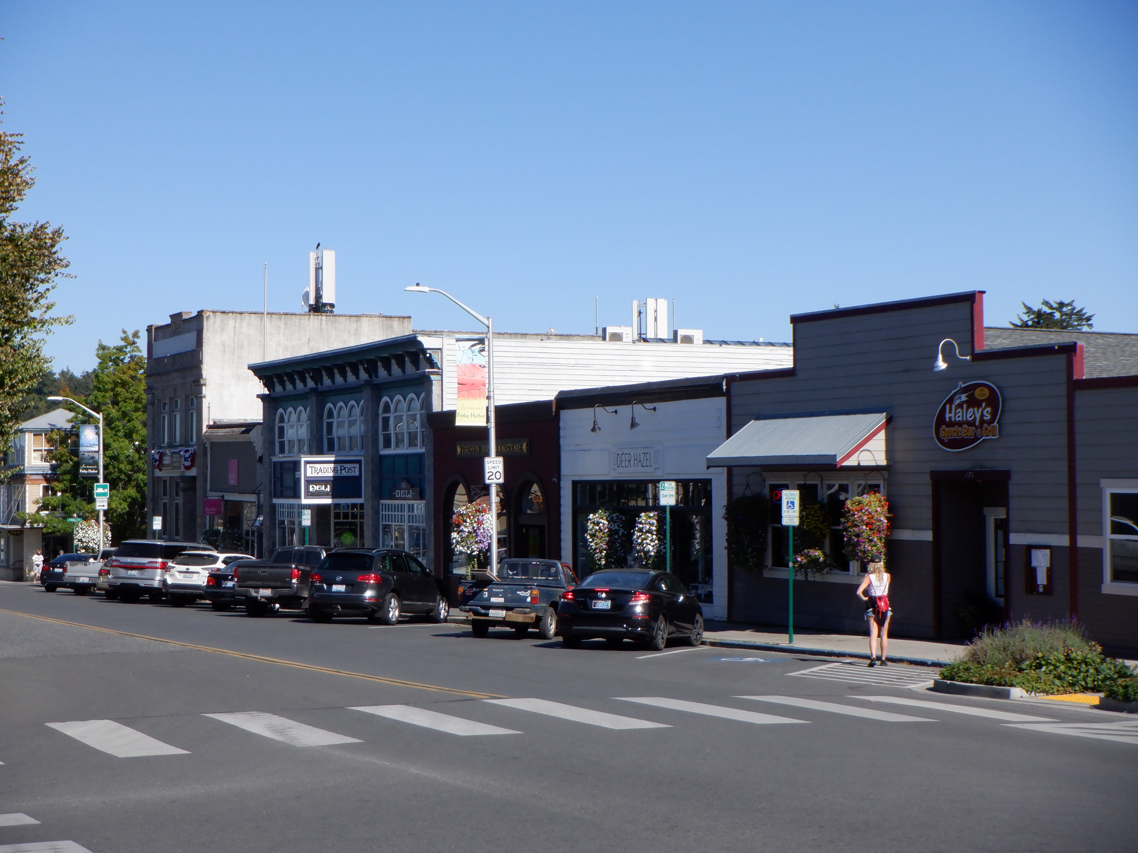
Friday Harbor is undoubtedly the most touristy spot on the islands and it shows in the marina that is full to the gills. The town is authentic and the houses maintained in the old style. Lots of restaurants, a big supermarket and many tourist trap shops. We manage to get rid of five garbage bags here – only 2 bucks for dropping them off. The town is not big – after wandering around for a couple of hours, we’ve seen it all. An ice cream cone with 1 scoop and on a waffle costs the paltry sum of $7 – each.
Yeah – well we’re happy we don’t live here.
A couple of nights later, we slip the 11nm around to the other side of the island to anchor up outside of Roche Harbor. The marina lies behind the small Pearl Island and we found a spot where we were in lee of both islands.

Some private investors bought the marina town several years ago and have modernized almost everything. There are now two restaurants, a hotel, a small grocery store and newly built houses around the marina. The new houses are all built in the old style and the area is actually quite charming and Victorian. We never did learn how expensive they are, but we’re sure they are very expensive. Only the rich live here. A spot in the marina for Capri would have cost almost $100. Use of the shower is $4 for 5 minutes (even if you have rented a slip in the marina). The laundry cost about 5 times what it costs on the mainland. Everything is more expensive out here in the islands, so far we have been fortunate to get free pump-outs and free drinking water in West Sound Harbor, Deer Harbor, Friday Harbor and Roche Harbor.
The marina is known for its elaborate flag ceremony at sundown.
Perhaps there is a bit too much military over this ceremony, but everyone seems to like it and there is a large audience every evening. When they are finished, all the boats sound their foghorns and it all is one big party.
Nearby the marina, out in the forest is John S. MacMillan’s mausoleum. MacMillan founded the town and the chalk industry that began here. In the early days, the chalk industry here was the largest west of the Mississippi. The chalk was mined and then burned in a series of large ovens that still exist next to the harbor. The resultant chalk was then used to make cement.


MacMillan built a private town for himself and his workers. He owned and governed the town for over 50 years. The MacMillan residence has been renovated and today is the home of two restaurants. Hotel de Haro, built in 1886 alongside the marina, is completely restored and today an exclusive hotel. Alongside the MacMillan residence is the Our Lady of Good Voyage church, where the employees and MacMillan family could worship each Sunday. During the week, the church was the school for the employee’s children. The church is also renovated, but not open to the public – but it still sounds its Carillion every hour and serenades us with wonderful music throughout the day.

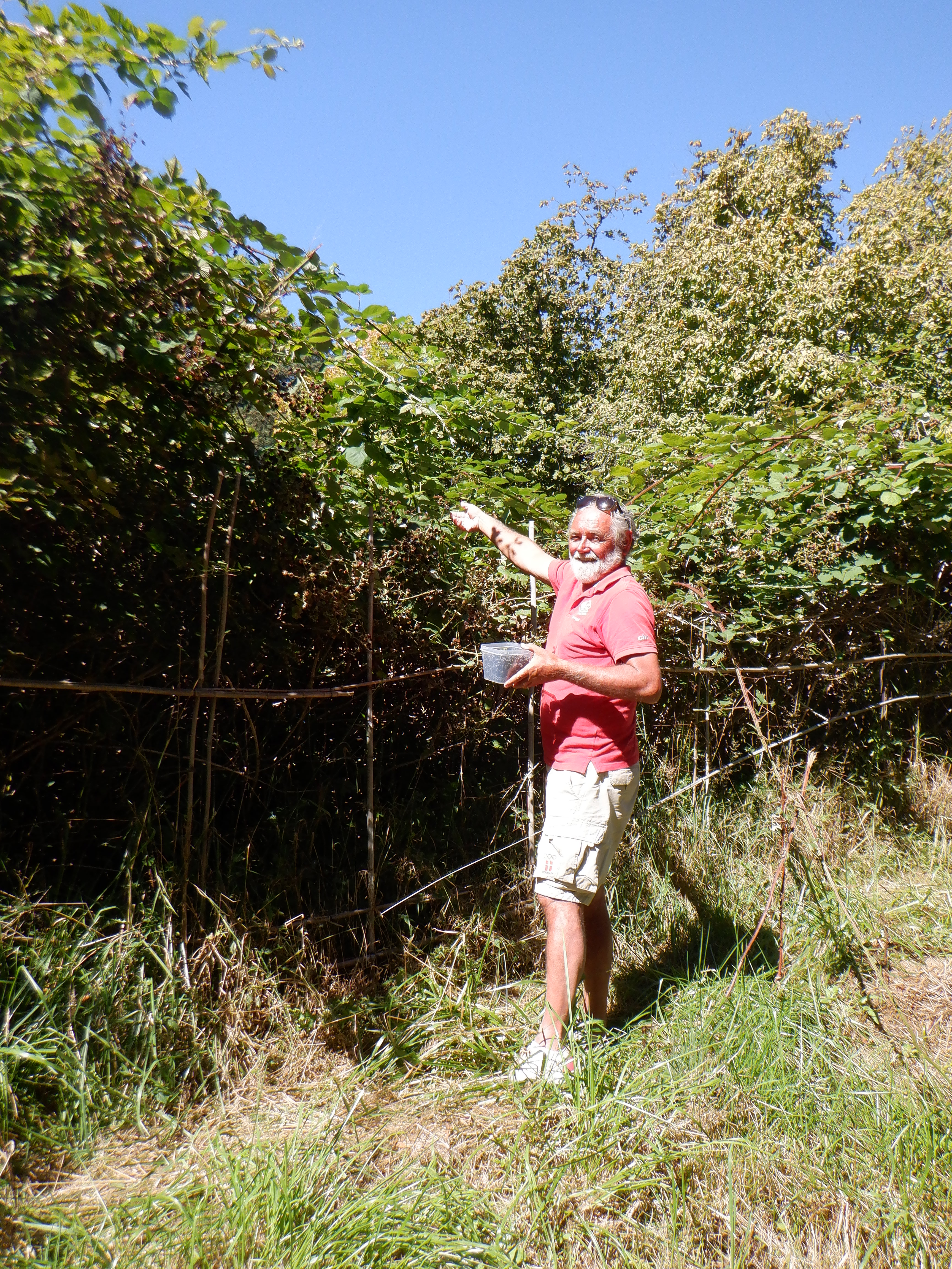
As we walked back from the mausoleum, we visited the (world famous in the San Juan’s) sculpture park that lies just outside of town. The local artists’ imagination knows no bounds, but we do have problems trying to understand what some of the sculptures are supposed to express. The outdoor exhibition is large, but a bit disappointing. We did manage to pick a bucket of blackberries, so the trip and admission was not in vain.

Our last day in Roche, we marched the 2 x 8 kilometers (approximately 5 miles – oh our aching knees) out to English Garrison, a historic site of an old British Fort and encampment. American Garrison, the American encampment and Fort from the same time lies about 20 miles from here. There are only a few houses left of the encampment, and on one of the historic signs we read about the background for this Fort.
The Pig War
In 1846 the Americans and the British entered into a treaty defining the borders between the United States and the British land mass that would become Canada. The waters between the American mainland and British Vancouver Island were deemed worthless and the treaty didn’t accurately define the border here.
The British Hudson Bay Company didn’t deem these islands worthless, since they were covered in Pine forest that could be harvested and furred animals abounded throughout the islands. Last, but not least, the salmon were plentiful. They declared the area as British, belonging to Queen Victoria and established a trading post on the southern end of San Juan Island.
American settlers built farms throughout the islands and soon the Americans outnumbered the British. One of the farmers was Lyman Cutlar. He raised corn nearby the Hudson Bay Company Trading Post. One of the Company’s pigs raided his cornfield constantly. After several attempts to run the critter off, he shot it. The Hudson Bay Company demanded that Cutlar be arrested for shooting their pig.
The British Governor, eyeing a chance to establish British sovereignty, quickly dispatched a warship to support the Hudson Bay Company. Both the Brits and the Americans had now realized the strategic significance of the islands, lying at the mouth of Puget Sound. Both sides sent warships, cannon, and tensions mounted. The British were clearly sovereign at sea, but there were more Americans settlers on land than there were Brits and if it came to war, the Americans would almost certainly emerge victorious.
In 1859, the American General Scott arrived with the mission to find a solution to the treaty/border issue. He suggested that both sides occupy the island and build a fort until a permanent solution could be found. The Brits accepted this and soon they built English Garrison and the Americans built American Garrison on the other side of the island.
Thirteen years later, the Brits and Americans decided that a permanent solution was needed and they turned to Kaiser Wilhelm I of Germany and asked him to mediate. The Kaiser decided that the southern islands should be American and the northern islands British. Today, the southern islands, now the San Juan’s are American and the northern islands, the Gulf Islands are Canadian.
War was avoided and the only casualty was a pig.


We’ve been sailing the archipelago for three-and-a-half weeks now and been more than lucky with the weather. We’ve had fog, especially in the mornings, but otherwise sunshine. Naturally, it has been much colder than we have been used to from the tropics, but the winds have been slight and we have been able to wear shorts and a t-shirt. The locals and the tourists seem to think they are in the tropics, jumping into and swimming in the water, sunning in bikinis etc. Brrr! Take me back to Polynesia…………………
But the autumn low-pressure fronts, some with gale force winds are coming in over the area, bringing thick smoke from the raging wildfires in California and Oregon. A mixture of thick smoke and fog blankets the area most days. The authorities have not yet advised everyone to stay indoors, but we are almost at that level. Because of the poor visibility, we decide to stay a couple of extra days in Roche. Unfortunately, the weather forecast shows no improvement and Carsten must be in Port Angeles or he will have to wait at least another month before he can get a new appointment with the DMV. Nothing for it but swallow hard, take a deep breath and prepare to sail to Port Angeles in fog.
It is a 35nm passage and we will cross the big ships traffic channel twice. We need to “sail with the tide” early in the morning, catching the ebb tide or else we will be battling currents up to 4 knots against us. So it means a 7 a.m. departure, and the passage should take about 7 hours.
We set our alarm for 5 a.m. but the best laid plans of mice and men…………….. Heavy fog, impenetrable fog, pea soup, fog so thick you can cut it with a knife – hmm, I’m running out of descriptions, but you get the picture (if you can see it through the fog). We can’t see the boats around us, as a matter of fact, we can’t see the front end of Capri. We can easily agree that we will have to wait until the fog lifts before we attempt this, especially because we have to sail the 1.5nm through the infamous Mosquito Pass right at the start.
Mosquito Pass is infamous because it is narrow, twists like John Travolta dancing the twist, is filled with rocks and reefs and is generally feared by everyone. It is, supposedly, well-marked (if you can see the buoys, which we can’t in this fog).
Three hours later, the fog is still heavy and we have no choice – it is now or tomorrow. Carsten, who knows not the meaning of the word fear, says, Hoist the anchor and let’s do it. As we hoist, we can sometimes see a boat or two around us, but then the fog banks roll in again and there is total whiteout.
We test both the AIS and the radar – everything is working properly. Carsten says that we can make it thought the pass, but I’m much less certain and much more nervous. We snail our way towards the pass, making 2 knots. We can’t see the mouth of the pass nor can we see the buoy markers. Carsten is navigating strictly using the chartplotter and the radar. He stares intermittently at the plotter, the radar screen and then looks out through the fog.
To put this in the vernacular – we can’t see diddly……………………
I’m keeping a sharp lookout and every two minutes I’m blowing our foghorn as loud as I can. I can hear the echo down through the pass.
As we enter the pass, we are passed by a couple of small fishing powerboats, running at high speed. I’m blowing the foghorn as hard as I can and they do slow down a little as they pass us, but it is completely irresponsible that they are speeding along as fast as they are. The visibility is less than 50 feet and at the speed they are making, they will ram anyone else in the pass. Fortunately, the current is only running at 0.5 knots and there are no maelstroms (yet). A trawler comes from behind and overtakes us – he is making at least 5 knots – he’s crazy. Carsten seems to be able to find his way through the channel, thanks to the chartplotter, but he’s incensed at the other boats. I’m way outside my comfort zone – as we say in Denmark – I’m shitting little green pigs!
After an hour of sailing blindly through the fog and making turns without being able to see where we are going or coming from, we finally emerge from the pass. We speed up, now making three knots and make our way towards the ships channel, which we will follow in the hope that there will not be any boats fishing right alongside the channel.
We’re making three knots through the fog when Carsten spots several blips on the radar – the small power boats that passed earlier are now drifting around out here, fishing. I’m still blowing the foghorn so they can hear us coming. Despite this, we almost collide with two of them. They are not using their foghorns, nor do they have AIS. Suddenly a gray mass appears less than 20 feet in front of us, Carsten turns hard to starboard, narrowly missing a small motorboat. Carsten is more than pissed and yells at the skipper – Why the hell don’t you sound your foghorn? They answer that they tried to call us on the VHF to tell us where they were, but we have had the radio turned on the whole time and haven’t heard anything. A few minutes later, we again have a near miss. I spot a boat 40 feet or so in front of us and yell; Turn to Port, which Carsten immediately does, narrowly missing the motorboat. The skipper on the other boat claims to have used his foghorn, but that was just bullshit.
We easily hear the third boat – he is beating a pot with a wooden spoon. That was the end of the thrills for the day, the rest of the journey was uneventful, although stressful since the fog never really lifted.
We had over eight hours of heavy fog and were relieved when we finally sailed in through the Port Angeles Harbor entrance. Carsten surpassed himself, getting us through Mosquito Pass without incidence and avoiding a couple of collisions. Good thing we have a competent skipper on board.
NEWS FLASH! NEWS FLASH! NEWS FLASH!
Remember the two fellows who torpedoed us with their sculler? I wrote about them last time, noting that they simply rowed away and we never heard from them again. Had it been us we would have come by with a bottle of wine or something to say sorry.
A couple of days ago, we got a mail from the big Chandlery, West Marine, that the two had sent us a gift certificate for $100. We also got a mail from them saying things had gotten away from them and while they meant to come out with a bottle, one day we were gone. Then they read our blog and had an acute case of guilty conscience., so they sent the gift certificate.
Thank you.
Capri is now tied up in the slip we have rented until next spring and we are getting her ready to hibernate here while we embark on The Great American Road Trip.’
More about that in our next blog.


