After a longish time on Hiva Oa, where Capri was on the hard while we were in Denmark, we are completely ready for a change and sail to a paradise of an anchorage in Hana Moe Noa on Tahuata.
This time we use the iron jenny (engine) to cross the two nm channel between Hiva Oa and Tahuata. Ten nm after leaving our anchorage on Hiva Oa, Capri’s anchor chain rumbles out in the beautiful bay where we sought “emergency harbor” on our way towards Hiva Oa six weeks ago.
By God – this time the bay is empty and we will have this paradise all to ourselves – or so we thought when we dropped the hook. By the end of the afternoon, we are five boats at anchor. The bay is just as picturesque as we remember it and the water is simply transparent. We can easily see our anchor chain snake its way across the bottom. Visibility is over 10 meters. Looking down is like looking at an aquarium, colorful tropical fish abound, Black Tip sharks patrol lazily and every third day a school of Manta Rays cruises through the lagoon. A bit further out in the bay we see the Mantas jump out of the water. What a fantastic sight to see these Mantas jump 6-8 feet up in the air spreading their 8-10 foot wings.
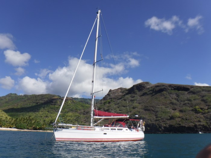
Capri in that lovely little bay
Here we’re anchored and if we look in towards the coast we see a bountiful coconut plantation and white beach. If we look out of the bay, westward, we are treated to the most colorful sundowns we can imagine. The word “sundowner” gets and entirely new meaning here.
According to the pilot books, it is important that we go ashore on the northern end of the beach where Steven has his primitive house/hut.
On the southern end of the beach lives another Polynesian who is not friendly towards sailors. He doesn’t want the sailors in the bay nor does he want them to land on his beach. Steven, on the other hand, is quite friendly unless he is drunk, in which case it is better to stay on the boat. Aside from that, we are welcome ashore, but he has a small sign up asking us to respect that this is his home and would we please stay on the beach. He also is not fond of sailors who go up from the beach and steal his crops. Which is very understandable. Apparently that has happened enough that he has felt himself forced to set up a barbed wire fence around his crops.
Sad that some sailors apparently can’t refrain from taking what isn’t theirs. We are welcome to gather coconuts from the beach, but since they do belong to him, it is polite to ask permission first.
The coconut is frequently called the “Nomad of the Pacific” da it can survive floating thousands of miles on the ocean currents before setting roots on whatever shore it washes up on. This is the reason there are palm trees on England’s southern coast. Coconuts fall in the ocean in the Caribbean and drift with the Gulfstream up along the coast of USA and across the Atlantic, coming ashore on Britain’s south coast. The coconut is extremely resilient and when it reach land, it shoots out a palm leaf through one of the “eyes” and the bottom of the husk and finally sets roots. Five to six years later, it is a fully grown tree. This resilience and its survivability, even through hurricanes has made it an invaluable part of the diet and the basic building material of the first islanders. It remains an important crop for the Polynesians.
The coconut has many uses:
- The tree trunk is used for building materials
- The leaves, previously woven and used as roofing material, are mainly used for decorative purposes.
- The fibers from the inside of the husk were used to weave rope and today are used as kindling.
- It takes almost a year for a flower to become a coconut
- Long before the nut is fully mature, it becomes usable. The green nut is full of coconut milk, the local substitute for cow’s milk. The milk is also sued in cooking and for medicinal purposes.
- As the nut matures, the meat begins to form on the inner side of the hard shell. This meat is soft (and tasty) and is used in desserts and cooking.
- As the nut fully matures, the meat becomes thicker and hard and the milk becomes watery. The watery milk is drinkable but doesn’t have the taste of the thicker, earlier milk.
- As the meat hardens, it becomes the “coconut” we know and is harvested and exported.
- Most coconut meat, however, is removed from the nut and laid out in the sun to dry, becoming Copra. When the Copra is ready, it is shipped to Tahiti where it is pressed and the resultant coconut oil is exported for use in cosmetics, cooking oil etc. Everywhere we se coconut plantations and drying coconut.
We enjoy this mini paradise for almost 10 days. There isn’t much to do here. You can walk on the beach or go swimming. We enjoy snorkeling and there is much to see under the surface. We can’t dive here since we don’t have a compressor and therefore can’t fill our air tanks, but the water is so clear that snorkeling is fine. There is no internet here, no telephone. This is as far away from civilization as you can get without going to extremes.
We’ve started a new morning routine. The first one up makes coffee and tea. We usually get up around 6 a.m. We drink our coffee in the cockpit, enjoying the sunrise and watching the world wake up. Thereafter we do some yoga for about 45 minutes to help keep us in shape. After that hard work, we step overboard and take a morning swim. The swim is usually just around the boat – after all, we do share this anchorage with some sharks.
Yes friends – all in all – a tough way to start the day.
I’ve never practiced yoga before but in my younger days I was a gymnast and actually a good one. I was on the Elite level team. But that was many, many years ago and Jesus, have I gotten stiff. I was shocked. I bought a book in Denmark, “Yoga for beginners” and we follow the program here. Fortunately, after only a week, I can already begin to feel the difference. Both Carsten and I have had persistent shoulder pains and limited range of motion in our shoulders, caused by the long passages we have sailed. We have found that after beginning with the yoga, the pain is lessened and our range of motion has increased.

nubile young sailor doing yoga on the front deck
In a couple of weeks we will start “strength training”. We have bought an elastic exerciser that we can mount on Capri’s mast.
We also try to train ourselves mentally. Every evening we play “Russian Double Solitaire”. Carsten, who learned this as a child and has been playing for 60 years is damned good. There is no mercy here, so I get spanked every evening and I have to admit, I’m a bad loser. I also admit that I’m not a good cardplayer since it is a hobby I’ve never really pursued. But it is damned humiliating when we play. We both sit and look at the same cards on the table and it is beyond irritating that I can’t see the same possibilities as him. When it is his turn, the cards simply fly around on the tale and voila – he’s gained 4 free spaces.

cards are ready and I’ve discovered that Vinni has a masochistic streak – losing every evening
Carsten’s daughter, Anne Sophie, has been playing (and losing) against him for over 30 years. They play every time they are together and she must be a masochist. It took her 30 years before she finally beat him one evening. I’m not that much of a masochist – I’ll give up before then, but since he is 7 years older than me, I can always hope that senility (his) will come to my rescue. He tries to comfort me by telling me that I get better every time, but the goal is still in front of me. I’m getting a nervous tic from playing. As I start to put a card down, he says, “Better think one more time before you play that”. I do win occasionally, but only if he helps me. All the while, Carsten entertains himself with the thought that he is playing against himself.
We’re planning to sail around in French Polynesia for the coming year and I have to admit that the French I learned in school has been stored in one of those inaccessible areas of my brain – in other words – I’ve forgotten most of it. So I’ve bought a “Learn French” for beginners and hope that after a while I can manage to communicate with the locals, few of whom speak English. Carsten has never taken any French and can only say, “Voulez Vous couche avec moi ce soir?” (might be spelled wrong but it means: “Do you want to go to bed with me tonight?”. He claims to have had great success with it when he was a young bachelor. But he needs to expand his vocabulary if he is going to communicate so we now have an hours French lessons every other day.

French lessons
Tahuata’s main village, Vaitahu is only 2 nm from here and that is where James Cook, on his second circumnavigation made landfall in 1774 to replenish his water barrels. Since Cook is an integral part of the south seas, here is a bit of history:
Captain Cook. Say the name and the South Seas, exploration and chartmaking immediately come to mind. Undoubtedly, one of the greatest sailors of all time, Cook almost single-handedly explored and charted the South Pacific.

Replica of Endeavor

Cooks voyages, 1st- red, 2nd – green, 3rd – blue
First voyage (1768–71)
On 25 May 1768, the Admiralty commissioned Cook to command a scientific voyage to the Pacific Ocean. The purpose of the voyage was to observe and record the 1769 transit of Venus across the Sun which, when combined with observations from other places, would help to determine the distance to the Sun.
The HMS Endeavor, departed England on 26 August 1768. Cook and his crew rounded Cape Horn and continued westward across the Pacific, arriving Tahiti on 13 April 1769, where the observations of the Venus transit were made. Once the observations were completed, Cook proceeded with the second set of orders from the Admiralty: to search the south Pacific for signs of the postulated rich southern continent Terra Australis. Cook then circumnavigated New Zealand, mapping the entire coastline. He proceeded westward, reaching the southeastern coast of Australia on 19 April 1770, becoming the first recorded Europeans to do so.
On 29 April, Cook made landfall on the mainland of the continent at a place now known as Botany Bay. Botany Bay became a terrible phrase in English, as banishment to Australia for life became a common punishment, even for petty crimes, in British courts. The bay that the banishment ships made landfall in was Botany Bay. To be sentenced to banishment in Australia was a horrible punishment. Today, however, many Australians note with pride that their ancestors came to Australia via Botany Bay.
Continuing north, HMS Endeavour ran aground on a shoal of the Great Barrier Reef and was “nursed into a river mouth on 18 June 1770”. The ship was badly damaged, repairs taking a full seven weeks. Cook claimed the entire coastline he had explored as a British possession. He returned to England via Indonesia, and rounded Cape Hope, arriving at Saint Helena in July 1771. Cook’s journals were published upon his return, and he became something of a hero among the scientific community.
Second voyage (1772–75)
In 1772, he was commissioned to lead another scientific expedition on behalf of the Royal Society, to search for the hypothetical Terra Australis. On his first voyage, Cook had demonstrated by circumnavigating New Zealand that it was not attached to a larger landmass to the south. Although he charted almost the entire eastern coastline of Australia, showing it to be continental in size, the Terra Australis was believed to lie further south.
Cook commanded HMS Resolution on this voyage, while Tobias Furneaux commanded its companion ship, HMS Adventure. Cook’s expedition circumnavigated the globe at an extreme southern latitude, becoming one of the first to cross the Antarctic Circle on 17 January 1773. In the Antarctic fog, Resolution and Adventure became separated. Furneaux made his way to New Zealand and eventually sailed back to Britain, while Cook continued to explore the Antarctic, reaching 71°10’S on 31 January 1774.
Cook almost encountered the mainland of Anartica but turned towards Tahiti to resupply his ship. He then resumed his southward course in a second fruitless attempt to find the supposed continent. Before returning to England, Cook made a final sweep across the South Atlantic from Cape Horn. He then turned north to South Africa and from there continued back to England. His reports upon his return home put to rest the popular myth of Terra Australis.
Cook made charts of the southern Pacific Ocean that are so remarkably accurate that copies of them are still in use in the mid-20th century.
Third voyage (1776–79)
On his last voyage, Cook again commanded HMS Resolution, while Captain Charles Clerke commanded HMS Discovery. The trip’s principal goal was to locate a Northwest Passage around the American continent. Cook rounded Cape Horn and sailed to Tahiti then travelled north and in 1778 became the first European to begin formal contact with the Hawaiian Islands. Cook named the archipelago the “Sandwich Islands” after the fourth Earl of Sandwich—Then First Lord of the Admiralty.
From the Sandwich Islands, Cook sailed north and then northeast to explore the west coast of North America north of the Spanish settlements. He made landfall on the Oregon coast at approximately 44°30′ north latitude, naming his landing point Cape Foulweather. Bad weather forced his ships south to about 43 degrees N before they could begin their exploration of the coast northward. After leaving Nootka Sound, Cook explored and mapped the coast all the way to the Bering Strait, on the way identifying Cook Inlet in Alaska. In a single visit, Cook charted the majority of the North American northwest coastline on world maps for the first time, determined the extent of Alaska, and closed the gaps in Russian (from the west) and Spanish (from the south) exploratory probes of the northern limits of the Pacific.
He headed northeast up the coast of Alaska until he was blocked by sea ice. His furthest north was 70 degrees 44 minutes. Cook then sailed west to the Siberian coast, and thereafter southeast down the Siberian coast back to the Bering Strait.
Return to Hawaii
Cook returned to Hawaii in 1779. After a month’s stay, Cook attempted to resume his exploration of the northern Pacific. Shortly after leaving Hawaii Island, however, the Resolution’s foremast broke, forcing the ships return to Kealakekua Bay for repairs.
Tensions rose, and a number of quarrels broke out between the Europeans and Hawaiians at Kealakekua Bay. An unknown group of Hawaiians took one of Cook’s small boats. The following day, 14 February 1779, Cook attempted to kidnap King Kalaniopu’u and hold him until the boat was returned. As they approached the beach, the King realized he was being kidnapped and a struggle ensued. During this struggle, Cook was killed. His men, outnumbered, retreated to the ship.
The myth that cannibals ate Cook is just that – a myth. The Hawaiians were cannibals but they didn’t eat Cook. They held him in high esteem as a revered visitor. The body was disemboweled, then baked to remove the flesh, and the bones were carefully cleaned for preservation. Some of Cook’s remains, thus preserved, were eventually returned to his crew for a formal burial at sea.
We have Cook’s journals on board Capri. When we read them, we are positively surprised by his humanity. Approximately 50 years before Cook made landfall on Tahiti, a Spanish Admiral arrived with his fleet. The locals met him with friendliness, holding a great feast for him and his crew. As a thank you for this hospitality, the Admiral had the chief and 22 of his followers shot. Thereafter they returned to their ship and sailed away, shooting at anyone who followed.
Cook was diametrically opposite. He ordered his crew to always treat the locals with honor and respect and he forbade anyone to trade with the locals except those he appointed. This to ensure that the locals never felt they had been cheated. Cook was well-known and respected throughout the South Pacific islands.
I worked for Weilbach, the world’s oldest sea chart store for a while after I retired. Imagine the feeling when I went through the stacks of charts and looking at some of the smaller islands, could see the legends at the bottom: Charted J. Cook. Some said: Charted W. Bligh (of Bounty fame) who sailed with Cook. I could feel the winds of history blowing around me. Cook and Bligh charted those islands and because their charts were unbelievably accurate, no one has been back to improve upon them.
The anchorage at Viatahu, further along the coast, is well-known to have a stony bottom and therefore is a difficult anchorage. Most recommend setting 2 anchors. Even worse, it is almost impossible to lay your dinghy alongside the concrete pier due to the heavy swells. So we chose to sail an additional 2 nm further south to anchor up in the bay by Hapatoni, a smaller village. This bay is supposedly less challenging to anchor in.
The trip along the cliffs is wonderfully wild and we enter a bay where I feel we are floating into a tropical paradise. The bay is very deep and we have to closer to the cliffs than I like to find water shallow enough for us to anchor. I am insatiable and can spend the entire day gazing at these dramatic cliffs, their light and shadow formations and the green nuances of the plants. Little did I realize that these cliffs would become a nightmare for us in just a few hours.
The tradewinds pick up, as usual around midday and fly across this volcanic island. Because the cliffs are very high (over 3000 feet) and steep, the winds fly up the windward side and across the tops, falling down the lee side as Katabatic winds with gale force. We have met Katabatic winds before, most recently at Fatu Hiva. But these are different. Normally Katabatic winds blow you out to sea. These, due to the steepness of the cliffs, blow over our heads and come down further out seaward. This ends up creating a vacuum and drawing the winds in towards the island, creating gale force winds that are blowing Capri towards a lee shore.
If there is one thing every sailor fears, rightfully, it is having gale force winds blowing your boat towards a lee shore. Capri was only 50 yards from shore. We had to get that close to find shallow waters.
The neighboring boat dinghied over to say hello. They are a couple that have been anchored here for a week or so and they tell us not to worry. It is like this every day at mid-day but it all calms down by nightfall.
That may have been true the other days they were there, but this day the winds continued throughout the night until 3 a.m. Neither Carsten nor I slept much that night. To top things off, a giant cockroach comes climbing along our wall. Unfortunately, we didn’t manage to catch and kill it – but now we know we have cockroaches, every sailors nightmare. During the night I hear Carsten say; “No fucking way we’re spending another night in this damned bay”.
Next morning, we upped anchor, without visiting either of the villages, and sailed back to Hana Moe Noa bay to get some sleep and prepare for our sail northward to Ua Pou.
The islands gave us a wonderful farewell gesture. We’d just anchored in Hana Moe Noa bay and the water was crystal clear. Shit, I thought. Now we won’t get to see any Mantas. They prefer waters filled with plankton. But just as I’m lowering our bathing ladder, I see a giant shadow glide in under Capri. And then another one. Two big Mantas, with 6-7 foot wingspans surface, just 3 feet from the boat and swim alongside her. Both of us are paralyzed by this sight and neither of us get the camera. I wish I had my snorkeling gear out so I could have slipped into the water and gone swimming with them.
Wow.
With this good-bye from the island, we ate a little lunch, took a nap and got ready to raise the hook for our night sail to Ua Pou.


