As Vinni has previously told, throughout our many years together, I’ve entertained her with tales of the many fantastic places there are in the western US that I would like to show her. One that I have particularly emphasized is the Black Canyon of the Gunnison.
Why the Black Canyon? Everyone else that visits the US carries on about the Grand Canyon. Ok, the Grand Canyon is awesome, unique and I’ll pile on more adjectives. Actually, it is difficult to think of enough superlatives to describe the Grand Canyon. Black Canyon is “only” a little over 2250 feet deep and it isn’t anywhere near as long as the Grand Canyon. Grand Canyon stretches over many, many miles. Black Canyon is only 14 miles long.
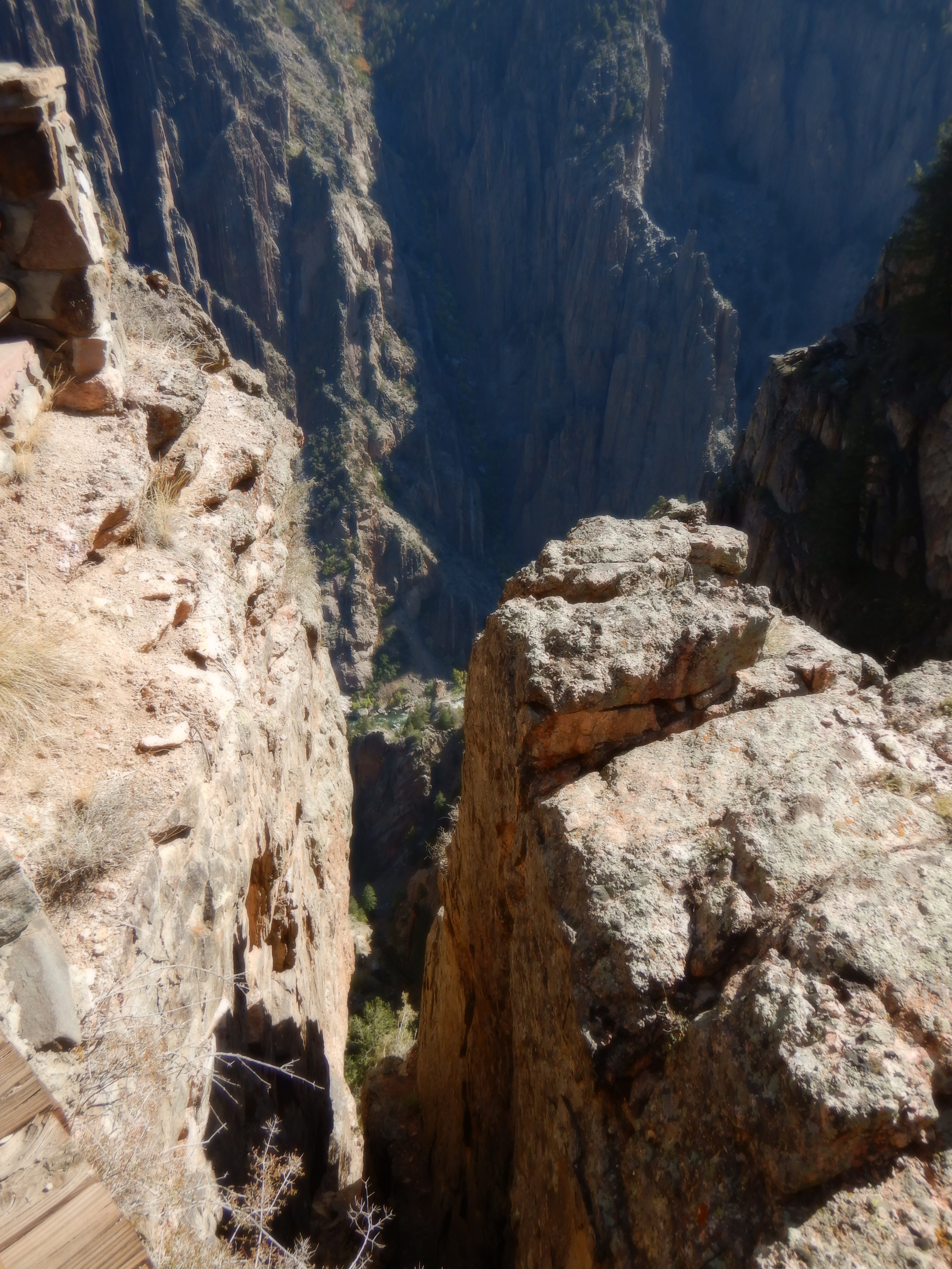
The great difference lies in the width of the Canyon. Grand Canyon is several miles across. Black Canyon looks like a place where God took an axe and slammed it into the ground. At its widest, Black Canyon is just over 350 feet wide. At its narrowest only 40 feet wide. Capri is 40 feet long. Imagine a canyon a couple of thousand feet deep and only 40 feet wide.
Unimaginable.
But, we had better begin at the beginning. We left Golden one fine morning after spending a couple of days at Pat and Jim’s marvelous condominium high up in the mountains. Since we want to savor our road trip, Vinni and I don’t drive on the interstate highways unless absolutely necessary. We took the old US route 285 that runs through the mountains. The next several hundred miles we drove through one National Forest after the other. Almost no one lives out here since the land is owned by the government. There are some small towns, there where the roads exit a national forest. We are driving almost directly south to visit a place called Great Sand Dunes National Park. In my hubris, I believed that I either knew the name of every National Park (there are, I believe 65 of them) or had at least heard of them. Great Sand Dunes was new to me.
Since it was almost on the way, and Vinni and I are not in a hurry, we decided to take a little detour and visit. We stopped for an overnight at Timberline National Forest Campground.

It was closed for the season and therefore camping was free. Ok, no reason to complain about the price. Actually, we can find no reason to complain about any of the prices for camping on federal lands. I’m officially an old man, meaning I get a 50% discount. So we end up paying anything from nothing to $15. Most nights we only pay $7.50.
Next night we find O’Haver Lake. Our map shows it lying only a mile or two from the main road and Vinni turns Caprise at the sign. The road immediately turns into a gravel road, albeit a wide one. What our map didn’t tell us was the couple of miles was closer to five miles and the road quickly narrowed. Not only did it narrow, it started climbing up the mountain.
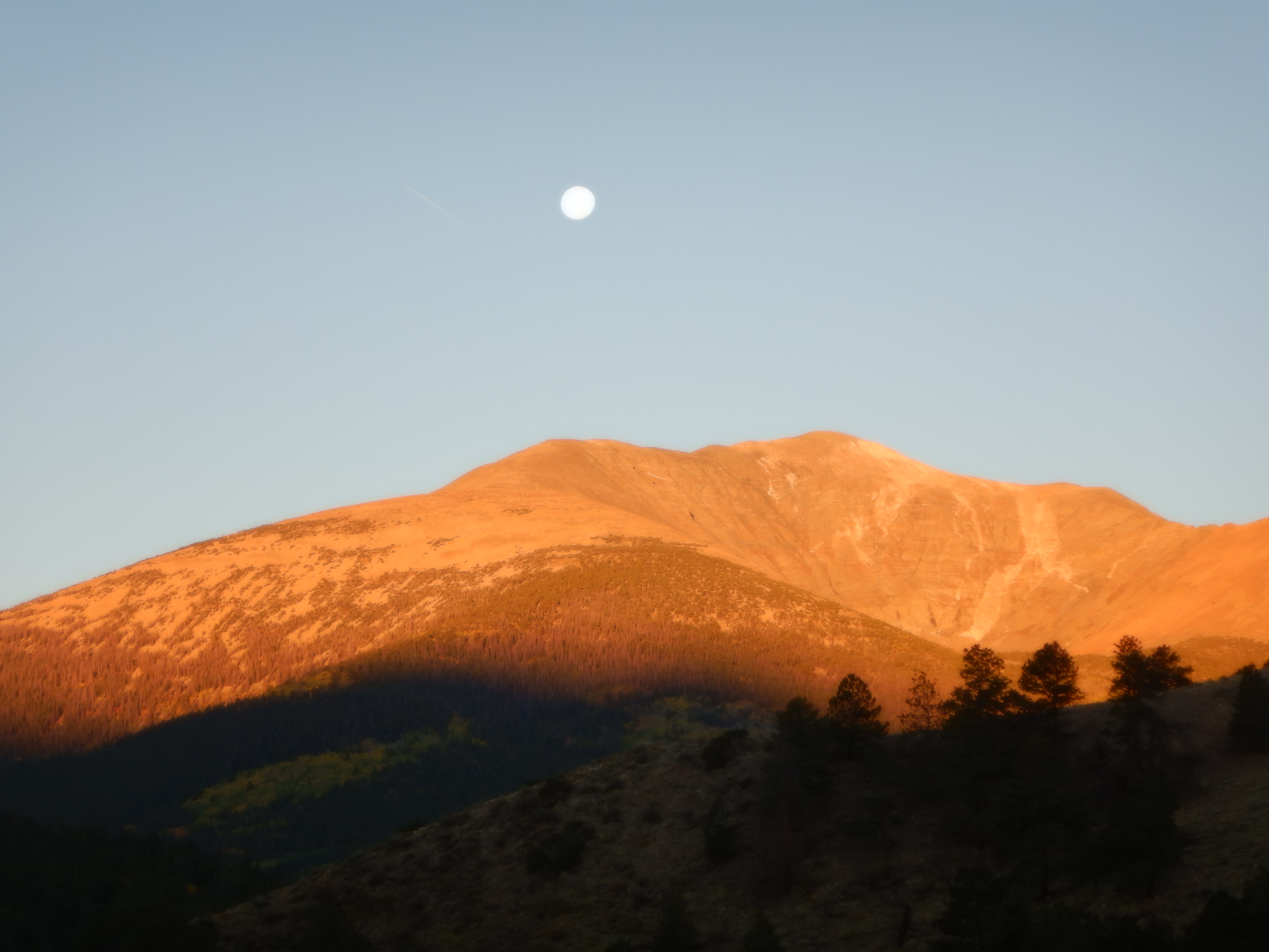
Yes dear friends, as you probably have guessed, it was several miles of climbing with one tight hairpin turn after the other. Vinni, who can curse in more than one language, swore in all the languages she knows (and that’s a few). I have to say O’Haver Lake was worth the strenuous drive (ok, that’s easy for me to say – all I did was sit alongside and enjoy the view). We parked the camper right by the lake and had a magnificent view, not the least in the morning when the sun lit up the mountainside across from us. It is so wonderful that we stayed two days.
We are bombarded with so many impressions that we are constantly sated by all the impressions that pound our senses. It needs to make a mighty impression on us before we say “aha”. Despite our being sated, we say “Aha” many times each day. We could write page up and page down about all that we see and show hundreds of pictures, but we will try to control ourselves.
The next morning we exited the mountains and come out onto the High Chaparral. These high valleys lie at over 7000 feet. The land is flat and faraway on the horizon you can spot the tops of the mountains that encircle this great valley. We reach a sign saying, Great Sand Dunes National Park with an arrow pointing left. Colorado Alligator Farm lies on the corner. Why is there an alligator farm in the middle of this semi-desert? Tourist apparently will pay good money to see alligators here. It is a smaller (much smaller) road, but paved, and a sign says 40 miles to the park. 40 miles of literally straight road. Like a line drawn against a ruler, the road disappears out across the desert. If we had been able to tie Caprise’s steering wheel, we could have set the cruise control, gone in back and taken a nap.
There is no traffic. When I write no traffic – we saw one car, coming against us in the entire distance.
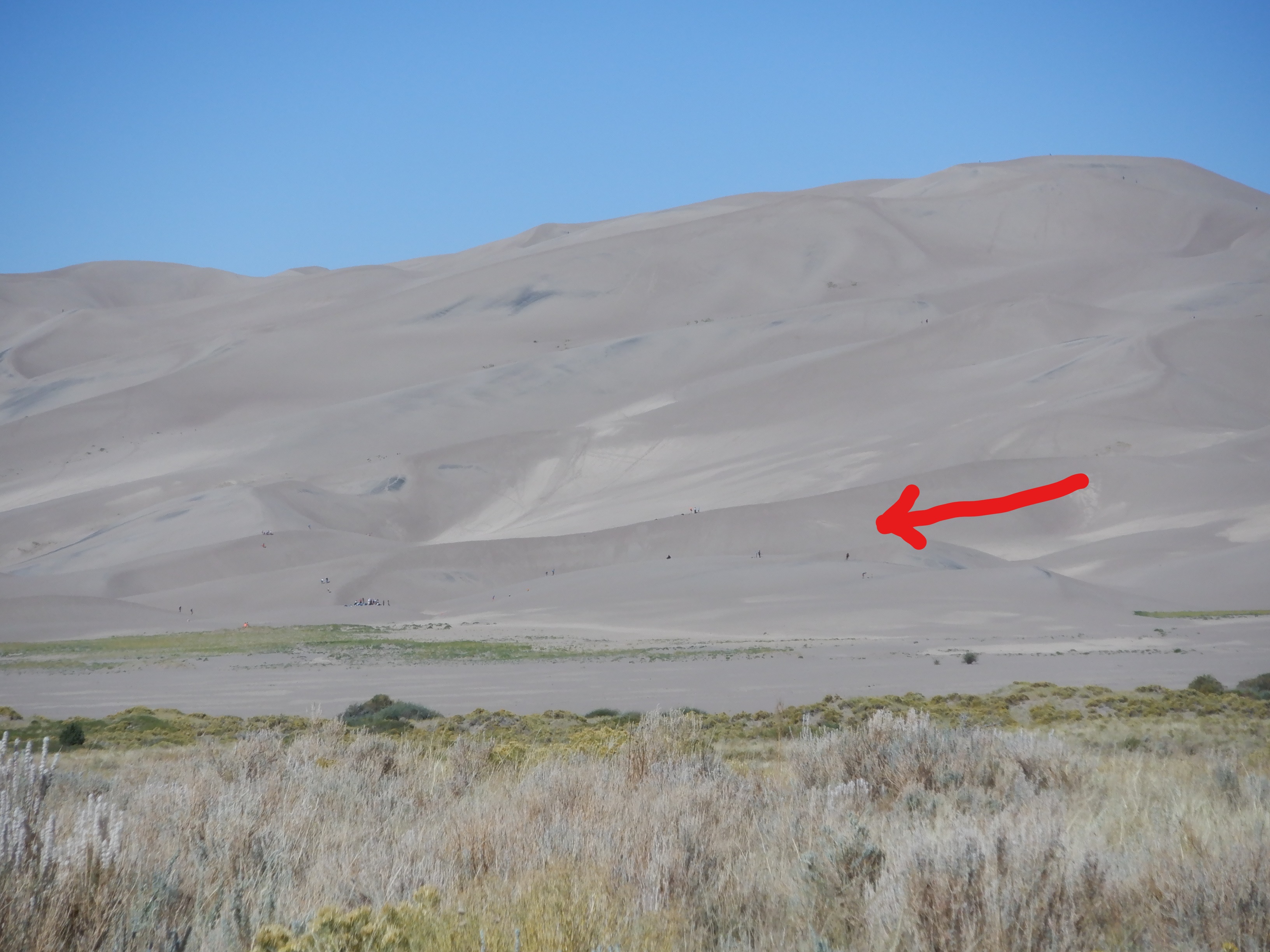
An hour later, we arrive at the park entrance. Once more, since I am an old man, entrance is free (being over 65 does have some advantages). Now we see the huge (it is difficult to describe just how big) sand dunes. They stretch for many miles and are up to 700 feet high. They have been formed over thousands of years as the westerly winds have raised up sand from the desert-like Chaparral and blown it towards the mountains. When the winds reach the mountains, they are unable to carry the sand over the top, depositing it at the base of the mountains.
Unfortunately, the campground is full, so we are forced to motor onwards.
We are on our way towards the Black Canyon and once again the road winds through one National Forest after the other. Our map has labelled this a “Scenic Highway”. This is no exaggeration. We have one “aha” moment after another as the road winds its way over the tops of the mountain passes. We are in Rio Grande National Forest and pull into Palisades Campground for the night. Once more, the price is appealing, free since the campground is officially closed for the season. We aren’t alone, there are more campers, but the sites are a good distance apart, so we don’t notice them. Most of the others are fly fishermen and they spend the day testing their lures in every little eddy they can find. While we do see some fish being caught, none of them are big.
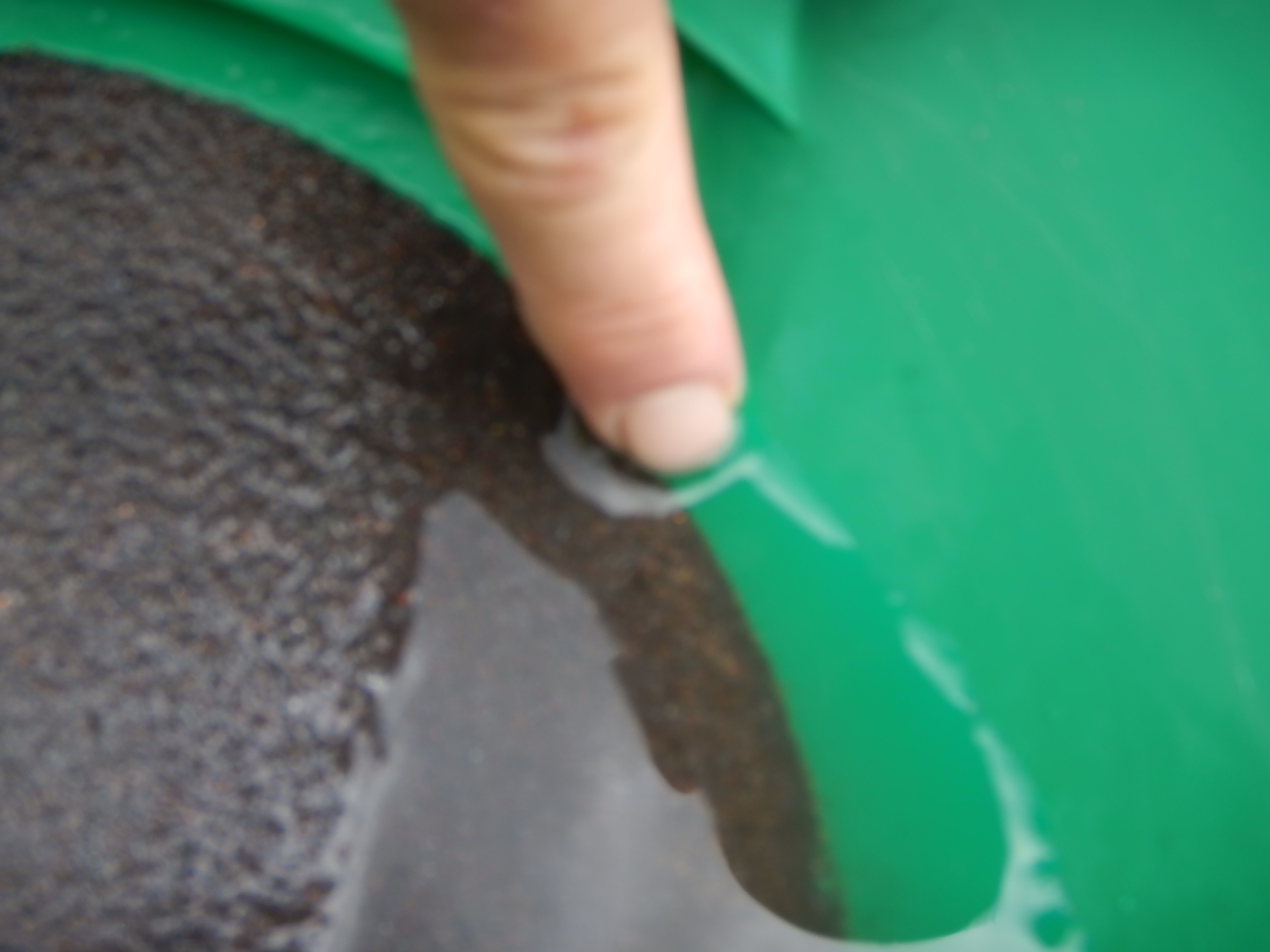
It is here, in this campground, that Vinni has one of life’s unforgettable moments. We see a fellow down by the river, bent over studying something. “What do you suppose he is doing?” she asks. “he’s not fishing”. I look and say, “I’d guess he’s panning for gold”. “What?!! Panning for gold? You’ve got to be kidding!!” Vinni grabs the camera and rushes down to the river. It turns out that the man IS panning for gold. The fish aren’t biting so he might as well do something useful. After all, a nugget might just show up in the pan. Vinni has never seen anyone pan for gold; she thought this was something that people did a couple of hundred years ago.
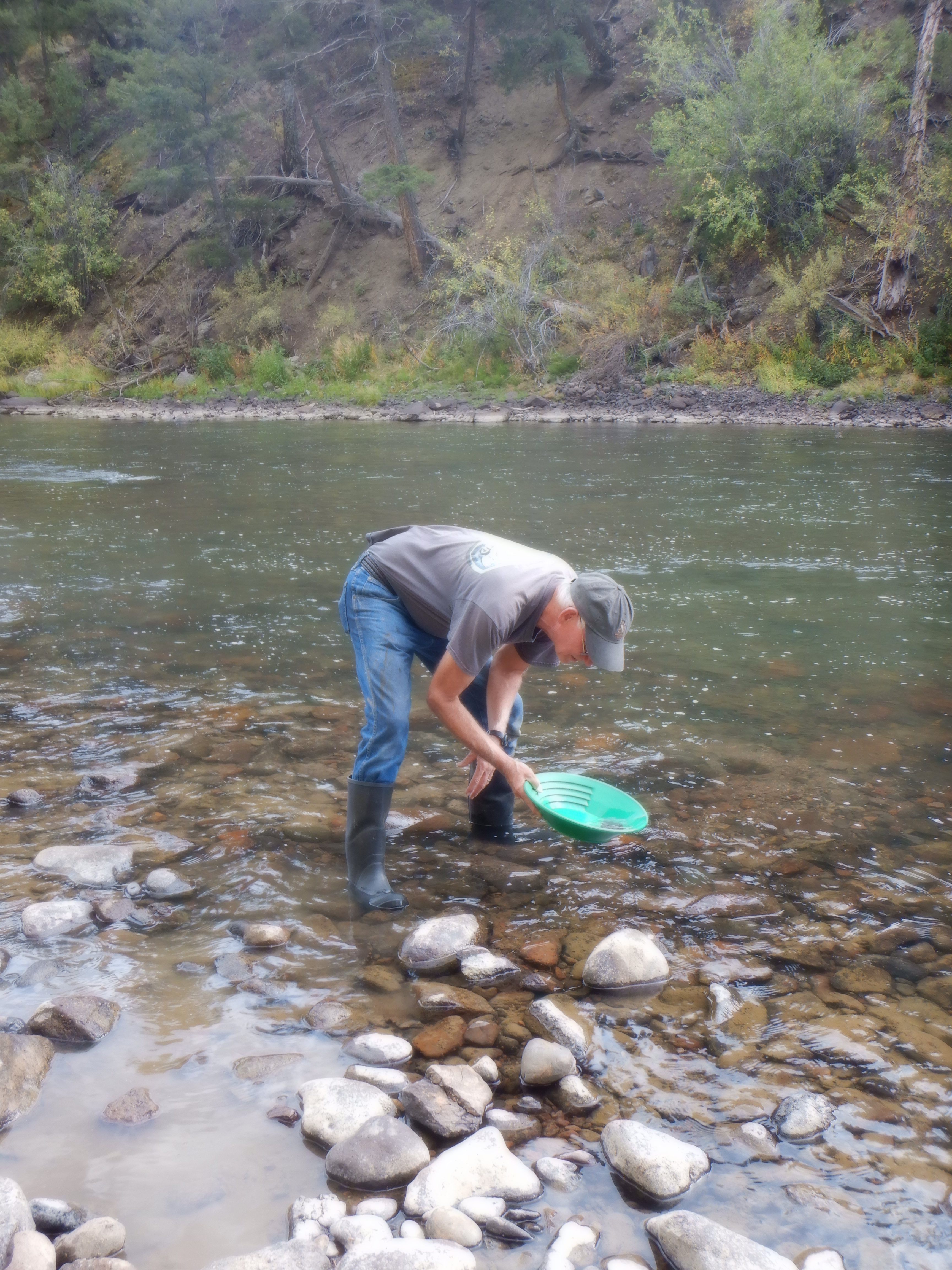
People still pan. There are still many places where one can pan and if you preserve long enough you might find a little gold. Our friend by the river did find a couple of flakes – a reward for his efforts. The flakes were small and worth nothing, but if you find enough of them, you can smelt them and have a small piece of jewelry made. A gift of a piece of jewelry made from gold you’ve panned will make any women smile from ear to ear.
As the reader will have noticed, our Great American Road Trip has been filled with adventure. We have seen and experienced much. And we haven’t even reached Black Canyon yet. There is a campground in Black Canyon park, but it is full. 25 miles east of the park is a National Forest containing Elk Creek Campground; that lies next to the Gunnison River, there where it has been dammed resulting in a big lake. Camping here is not free (more’s the pity), we have to dig down deep and haul out 10 whole dollars for a spot here. The site is a good site with a view over the lake towards sundown. We are almost completely alone. Small herds of deer wander through the campground in early morning and evening. There are signs everywhere warning that, despite the almost desert-like environment, bears abound here (as almost everywhere in the Rocky Mountains).
As I noted above, over the years I have entertained Vinni many times with stories about the Black Canyon and as we leave early the next morning for the 45-minute drive, I begin to get nervous. After all, it has been more than 50 years since I saw it. Will it live up to my (and Vinni’s) expectations? Have I “oversold” it? The narrow asphalt road winds its way up the mountainside to the park. Once again, it is free for old farts like me (Vinni is not an old fart) to enter and a kilometer from the park entrance we come to the first viewpoint. We park Caprise and wander towards the edge of the canyon and the viewpoint.
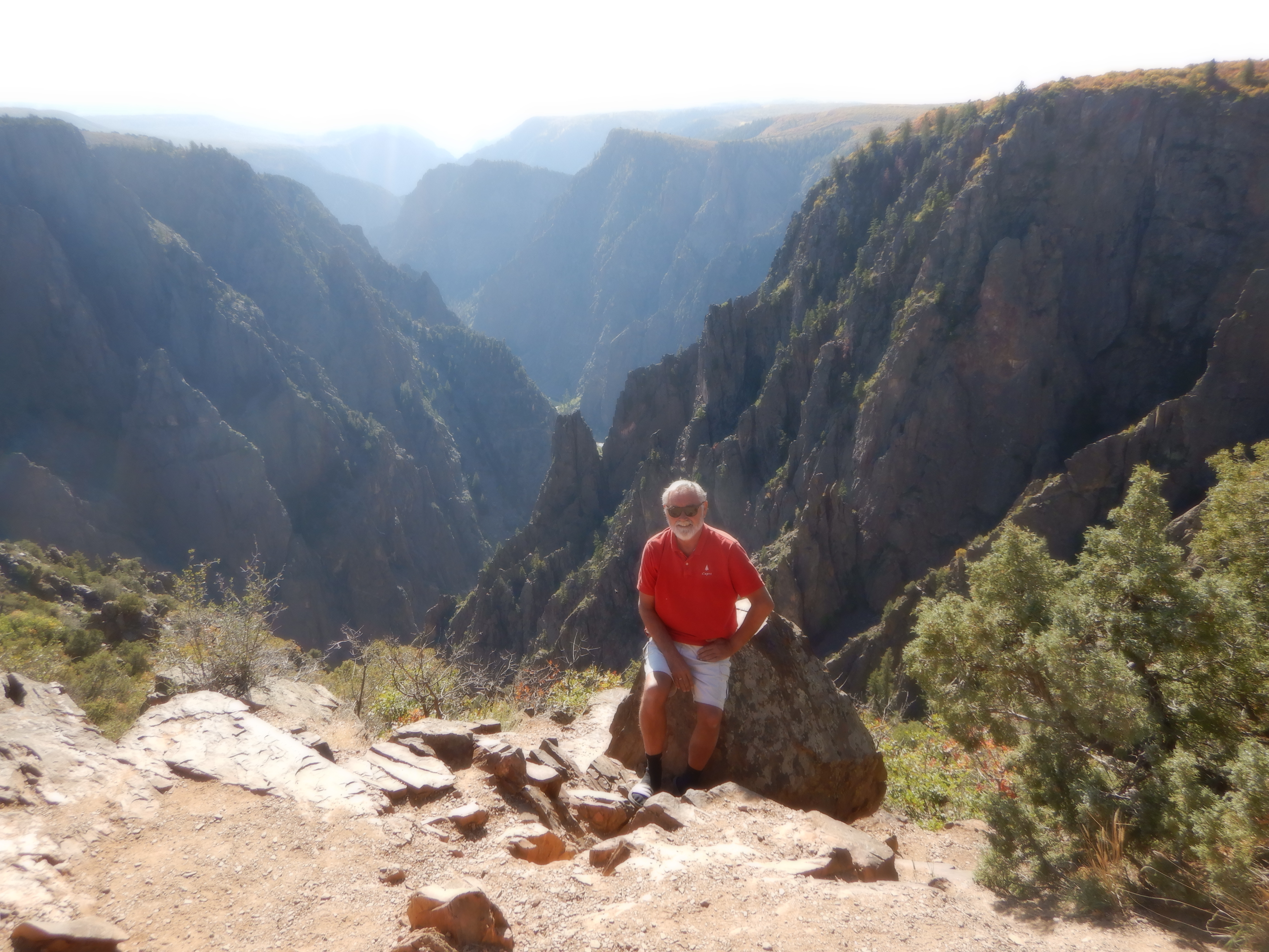
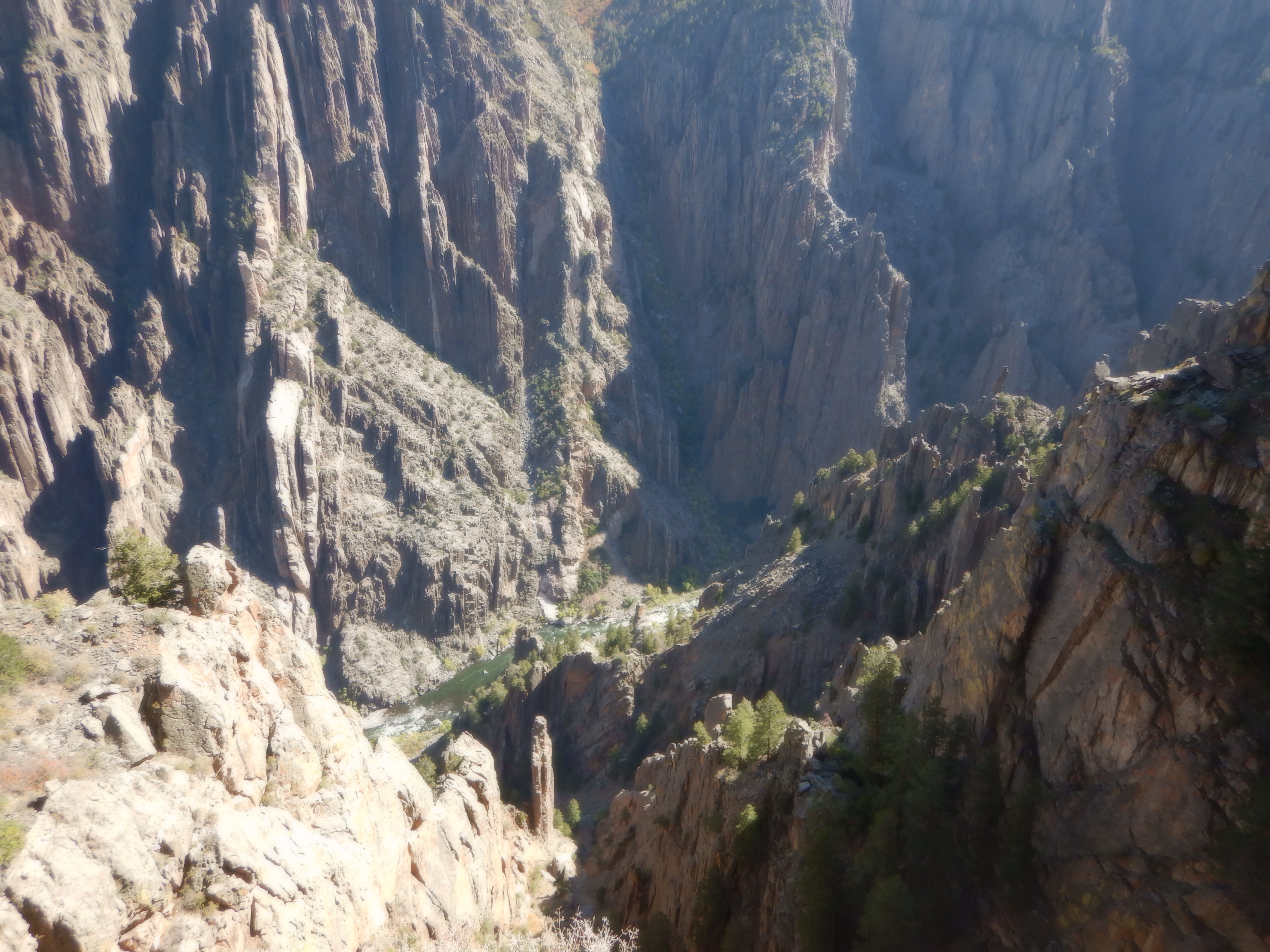
No, I haven’t oversold it. The view is almost more than we can comprehend. Awesome, unique, fantastic, unbelievable and I’ve run out of adjectives. It is as I remember. The ground has been cloven as if God slammed an axe into it. The river has worked its way down through the hard granite over several hundred thousand years. Later, a Ranger will tell us that it is just exactly here that there is granite. If the river had moved its course just a few miles in any direction, it would have carved a new Grand Canyon, not the cleft we are looking down into.
The first explorers that tried to pass through the canyon gave up. The 14 miles were simply impassable. Many tried to pass from one end of the canyon to the other and were either forced to give up or died en route. The Ute Indians, who populated the area were also unable to pass it and preferred to go around. The river was wild and untamed. The current was fierce and there were a number of spots where one simply could not pass the sheer rock walls. In 1873, a geological and cartographical expedition, led by Hayden, attempted to go through, but gave up. Hayden commented on his charts and in his notes that the canyon was simply impassable, by foot or water.
Many more tried and failed, until 1901 when Abraham Lincoln Fellows and William Torrence made the attempt. They had arranged for provisions to be laid out along the way, there where it was possible to climb down into the canyon. Even with the extra provisions and gear, it took them 10 days to make the 14 miles. One day they only managed forward progress of less than 300 yards. They each lost 15 pounds over the 10 days (what an effective diet) and both noted that the trip was virtually impossible to complete.
Today a passage of the canyon is possible, although still difficult and dangerous. It is not for wussies. The river has been dammed and is now relatively tame. A passage takes 2-3 days and requires a permit.
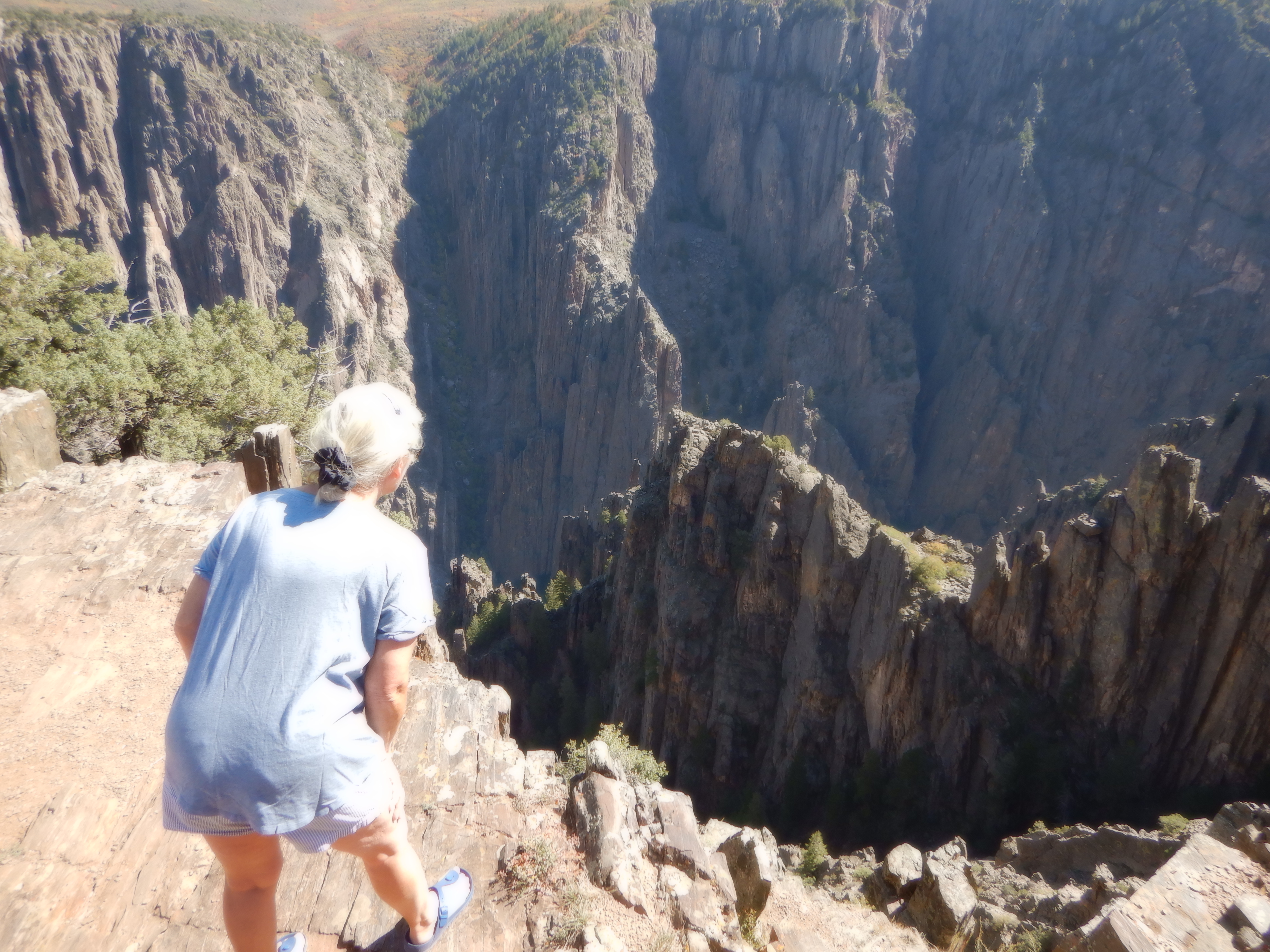
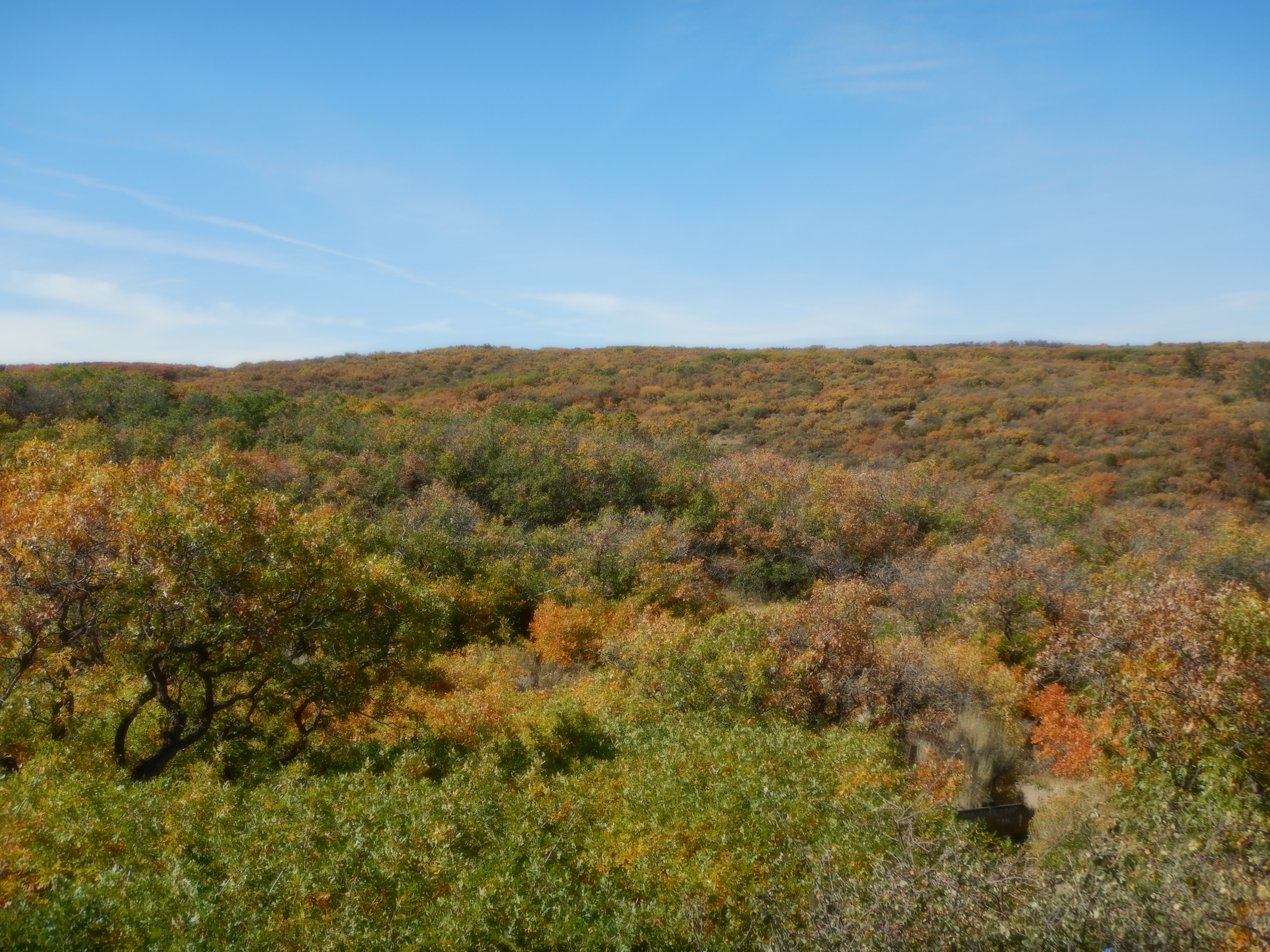
From the top of the cleft, you can hear the river roar at the bottom. It is a constant background noise. There are 11 viewpoints along the 15 mile “scenic road” that runs along the south rim. Each viewpoint is filled with “aha” experiences. If you suffer from vertigo or fear of heights, this is a bad place to go. There are a few safety fences here and there, but for the most part, you are simply standing on the rocks at the edge of the cliff. It is a loooong way down. Everywhere along the rim, the Gambel oak trees, only 3-4 feet high have clothed themselves in their autumn colors. The hills are an explosion of reds, greens, oranges and browns. Beautiful.
Vinni is impressed. She tells me that it is overwhelming and exceeds all her expectations. I haven’t “oversold” it – she says I’ve almost “undersold” it.
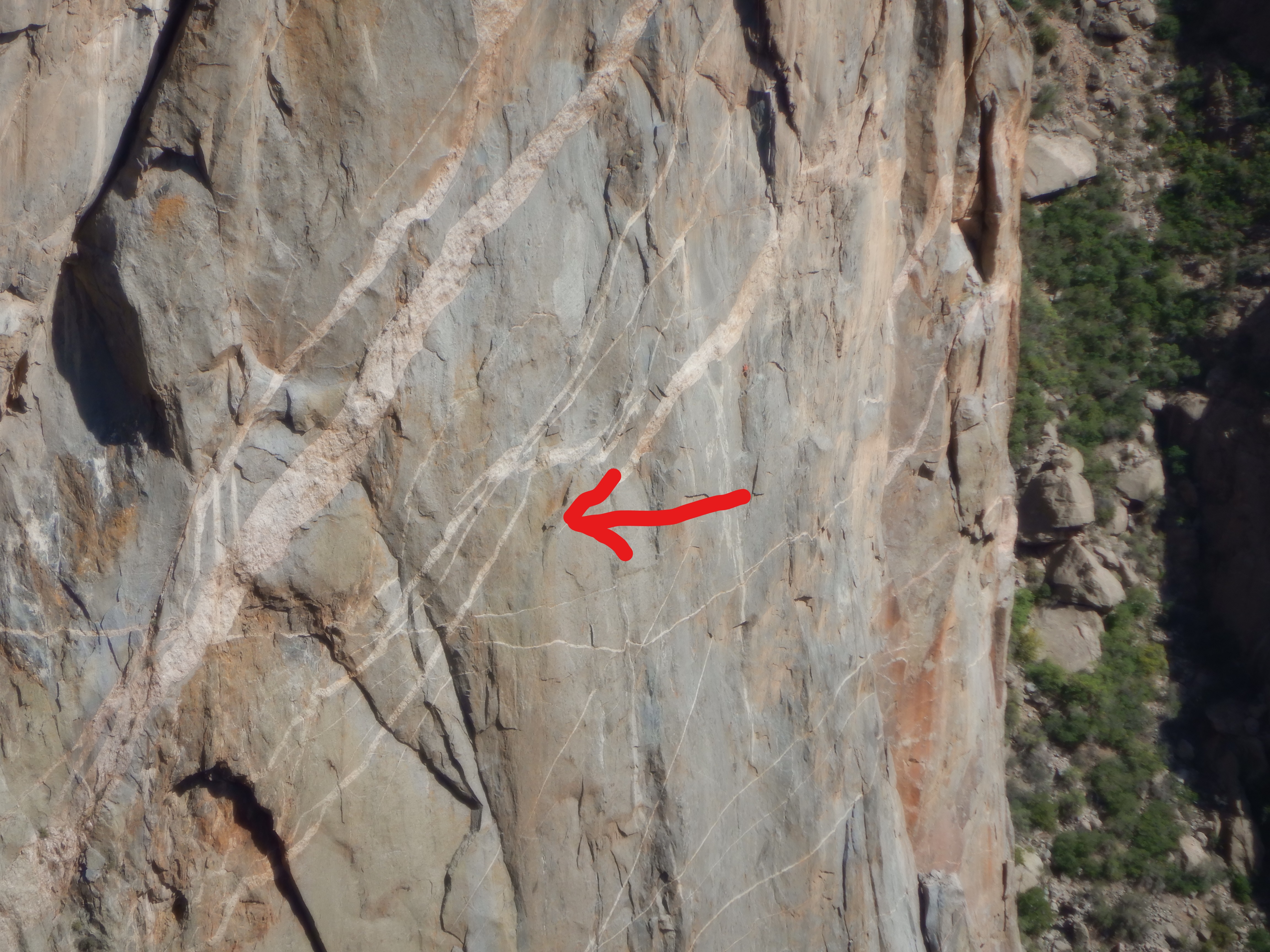
For those that have a death wish, it is possible to trek in through the canyon and then attempt to commit suicide by climbing the sheer rock walls (over 2000 feet). When I say suicide, I mean for me. For those with the proper training and equipment it is entirely possible to do this. Alas, I’m too old, too chicken and simply don’t have the physical condition to even think about trying this (not that I would think it anyway – the thought of climbing those walls scares me to death). At the one viewpoint, we look over at the vertical wall on the other side and see two small (very small) dots directly across from us. Two of these maniacs are climbing and I suddenly realize there is no way they are going to reach the top today, meaning they will have to spend the night tied into their hammocks that are attached to the sheer rock face.
I’m sure they are saying:
Are we having fun yet?
Damned right we’re having fun!
They are out of their minds. We would have liked to passage the canyon, but we do not have the equipment with us to do this. After a day where we once again became sated and more with impressions, we left to continue our odyssey.
Vinni and I have discussed how much we use and overuse adjectives to describe what we see and experience. The overuse makes them become trite, but we have no other words to describe all this. The American west is indescribable. There is so much of it and when driving through it your senses are assaulted by one extravagant view after the other. Our apologies for repeating ourselves.
We returned to Elk River and spent the night there preparing for the drive to Mesa Verde National Park (another park I have entertained Vinni with stories about through the years). Vinni will write about the Park, but I want to write a bit about our drive there since it was more than special.
The small (and it is small) road we will drive from Montrose to Durango stretches 109 miles through the Uncompahgre and San Juan National Forests. All 109 miles are mountain driving. There is a “shortcut” that is 20 miles shorter, but our map shows us that if we take that route, then we will have to go over several mountain passes that are more than 12,000 feet. Not only that, the map also shows it as a smaller road than the one we will take. I tell Vinni that we’ll take the “big” road. It will be easier. I’ve driven some of these small Colorado roads in the past and have no desire to try them with a motorhome – they are frightening enough in a car.
There are, of course, big roads and small roads, one has to remember where we are. This is Colorado. A “big” road here means it is paved. This road is a “big” road and therefore it is paved. We had driven towards the mountains for an hour or so when we pass a sign saying; “Dangerous mountain driving the next 50 miles. No guardrails, steep grades, no shoulder. Trucks and wide campers are advised to turn back. Tight hairpin turns and switchbacks next 50 miles”.
Aha. Hmmmmm. Are they trying to tell us something?
Ok, we’ve gotten this far and the other road isn’t any better (probably worse), so we might as well get on with it. Perhaps I should mention here that the sign was NOT exaggerating. The next 50 miles consisted of nothing but hairpin turns and blind switchbacks. One after the other. The road snaked its way over four mountains passes that all were over 10,000 feet (the air is thin up here). First all the way up, then all the way down to the valley floor (a bit more than 1000 feet down). Many places the speed limit was 15 mph (or less).
There were no guardrails and there was no shoulder. The white stripe at the right side of the road signaled the edge of the asphalt. Beyond the white stripe, there was nothing – just a sheer drop of 5-600 feet. This is not a road for the faint of heart to drive.
Caprise is wide. We fill our entire lane (and maybe a bit more – the lane is narrow here). A car coming from the other direction means a “close encounter”. A motorhome or camper means a much closer encounter (closer than you want). The hairpins turns are so tight that we can’t see around them. Despite my driving only 10mph and steering as precisely as I can, Vinni exclaims several times, “Carsten, turn – your going over the edge!” Actually, I’m not, but from where Vinni is sitting, she can only see empty air and the deep drop to the right – she can’t see the road. No wonder she is nervous.
At the worst place, she hangs on to her seat with both hands and sits with closed eyes. If you’re going to die going over a cliff, better not to know about it. Meanwhile my knuckles are turning white and I try to act like this is all a videogame – no danger here.
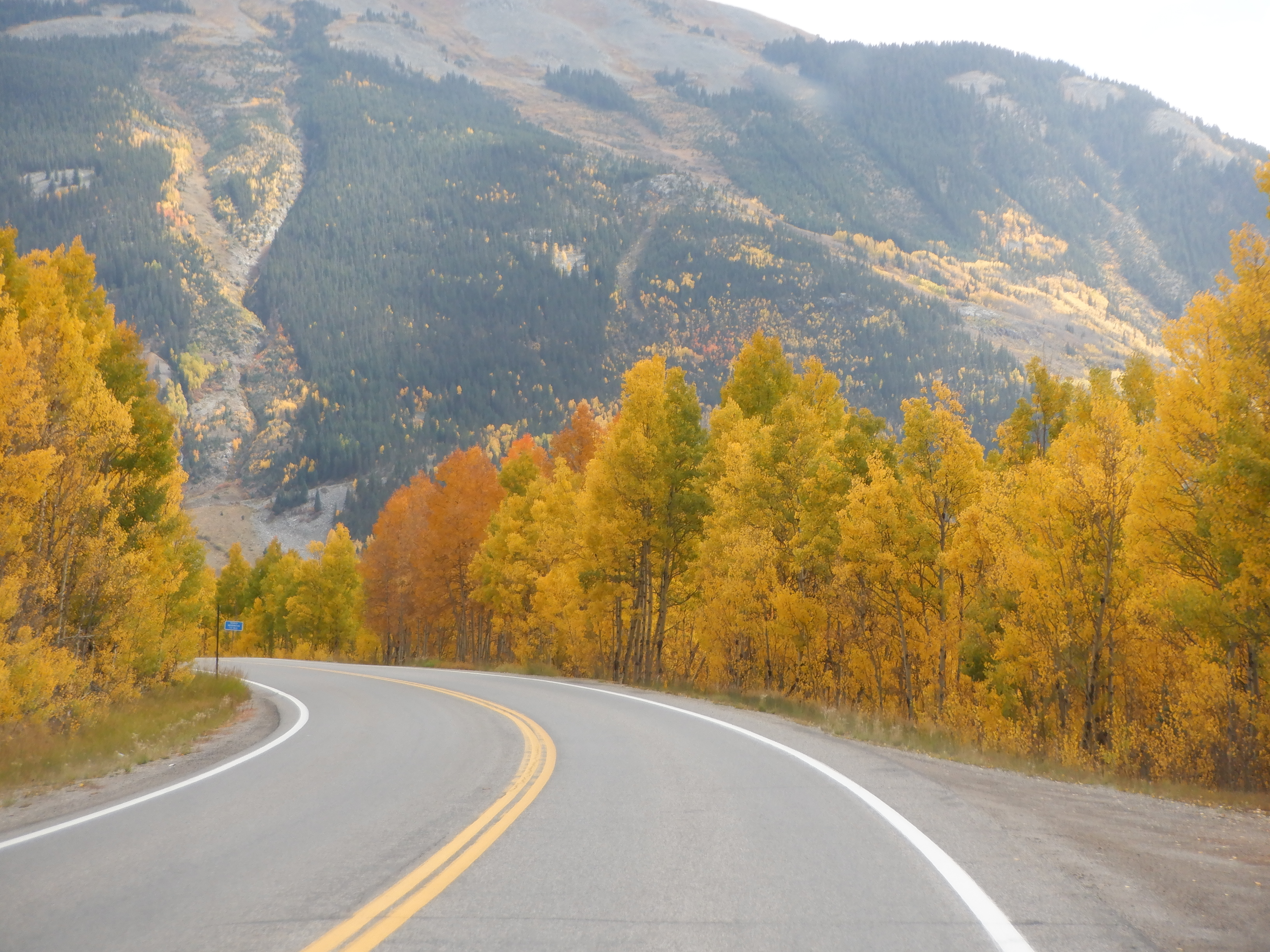
The trip, despite the bad weather (it was raining like mad) was unbelievably beautiful (there are those adjectives again). The Aspen trees were showing their gorgeous fall colors, brilliant yellows and reds. The mountainsides looked like they were aflame. The panoramas were indescribable. As we’ve said, we have run out of superlatives. There is an expression; “drop dead view” and that certainly best describes this. I doubt it is possible to find panoramas like this anywhere else.
We’ll let the pictures speak for themselves.

I was tired after the extremely exhausting driving and we were happy when we entered Durango. We shopped and then continued the 25 miles or so to Mesa Verde National Park, where we have a campsite reserved for the night.


I would have walked! Ray and I drove the Blue Ridge Mts in Virginia one time and I nearly wet myself many times and I said never ever again! You are WAY braver than I am!!!!