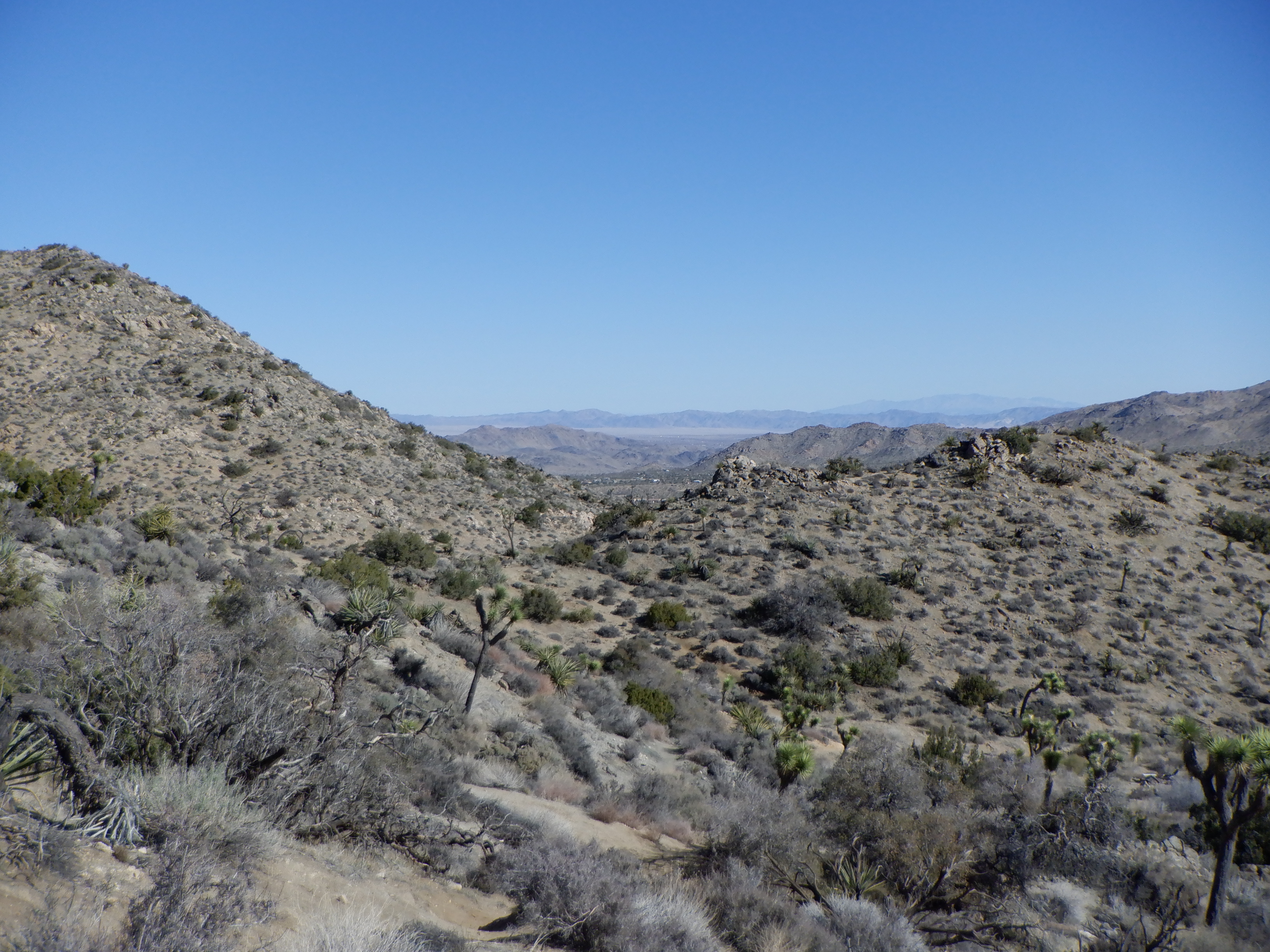
It is about 300 miles from Las Vegas to Joshua Tree National Park. A bigger difference in one’s surroundings is difficult to imagine. Las Vegas is one huge amusement park and Joshua Tree National Park lies in the middle of the Mojave Desert. The Mojave Desert, for those that have never been there is empty. Very empty. There is almost nothing green, only sand, stones, more sand and more stones and then even more stones and more sand.
Vinni drove most of the way since I was almost comatose from swallowing a host of painkillers. The desert, despite being empty, is ungodly beautiful. There are many colors and panorama landscapes, some so huge as to be unbelievable.
Joshua Tree National Park is close to the Mexican border (120 miles or so), so we thought we would finally be down where it was warm again. It was warm in the valley, but the park (campground) is at just over 4000 feet, so it was cool there during the daytime and downright chilly (freezing) at night.
Suffering builds character, or so they say, and I guess we have to suffer some to be able to have all the wonderful adventures we have. Our new duvet (which we bought while we were in New Mexico) is wonderfully warm and the furnace in Caprise keeps the interior toasty. The only problem with it is that the single house battery isn’t big enough to run the heater fan throughout the entire night so Caprise is cold when we rise.
Once we got here, we had some dinner and went early to bed. We were going trekking the next day through this marvelous sandscape (Vinni keeps saying it is good for us (read: me) but with a broken rib and a collapsed lung, I’m not entirely in agreement with her for some reason).
Nonetheless, after breakfast, we donned our boots and hats and set off. The weather forecast said warm weather, albeit a little wind. The sun was out, but the “little wind” was a lot of wind that funneled in between the mountains and blew right through our jackets.

We were up in over 4000 feet and the past few days in Las Vegas at lower altitudes meant we once again weren’t acclimated to heights. As a result, we huffed and puffed, gasping for oxygen the whole way. I was gasping more than Vinni since part of my one lung was collapsed – the broken rib wasn’t helping me any either. Vinni kept saying, “This is really good for us (read: me). We really need the exercise”.
There is no such thing as pity from a nurse, especially not when she is also your wife. Good thing I’m a staunch type of fellow.
As usual, we chose a route the trail guide said was “only” 6 kilometers but actually ws closer to 8. The guide also failed to mention that the trail consisted entirely of trails going up and down the steep sides of the hills. Of course, there was also some actual rock climbing.
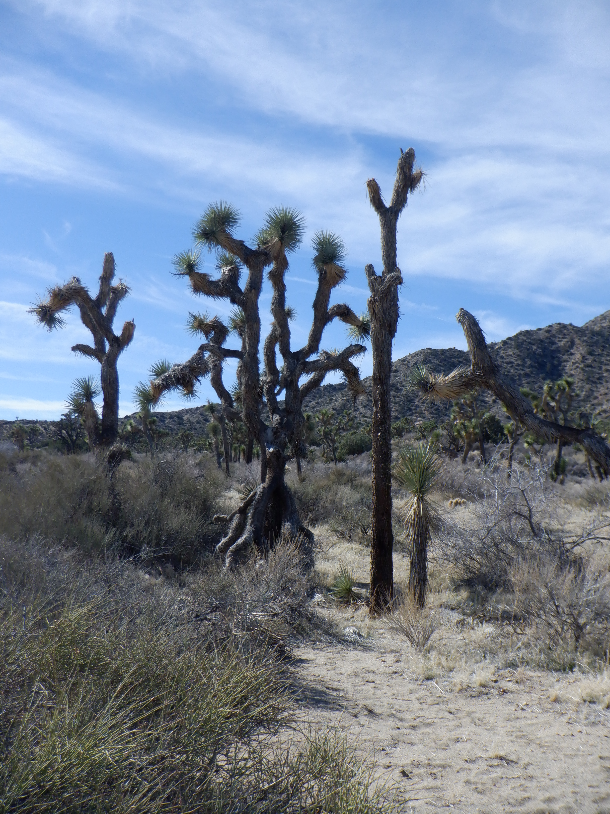
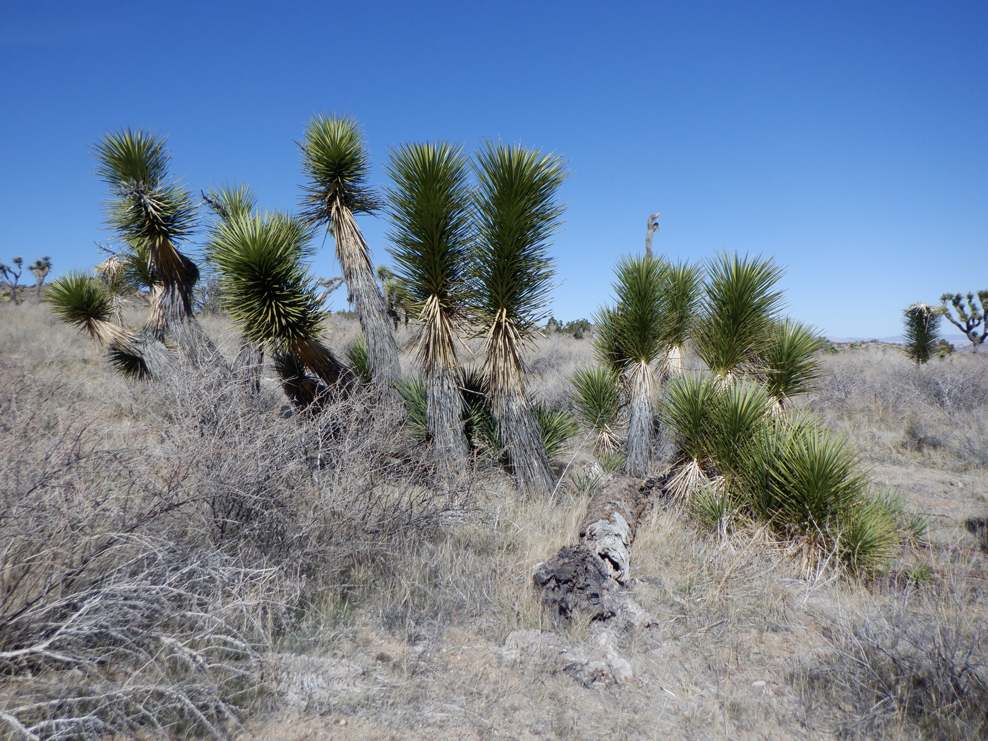
Joshua tree were named by Mormon pioneers that passed through here. The trees reminded them of the biblical figure, Joshua, who led the people chosen people over Jordan after Moses died. According to legend, at one point he raised his up I supplication and asked God for guidance. The outstretched limbs on the trees reminded the Mormons of this legend and therefore they named the trees, Joshua trees.
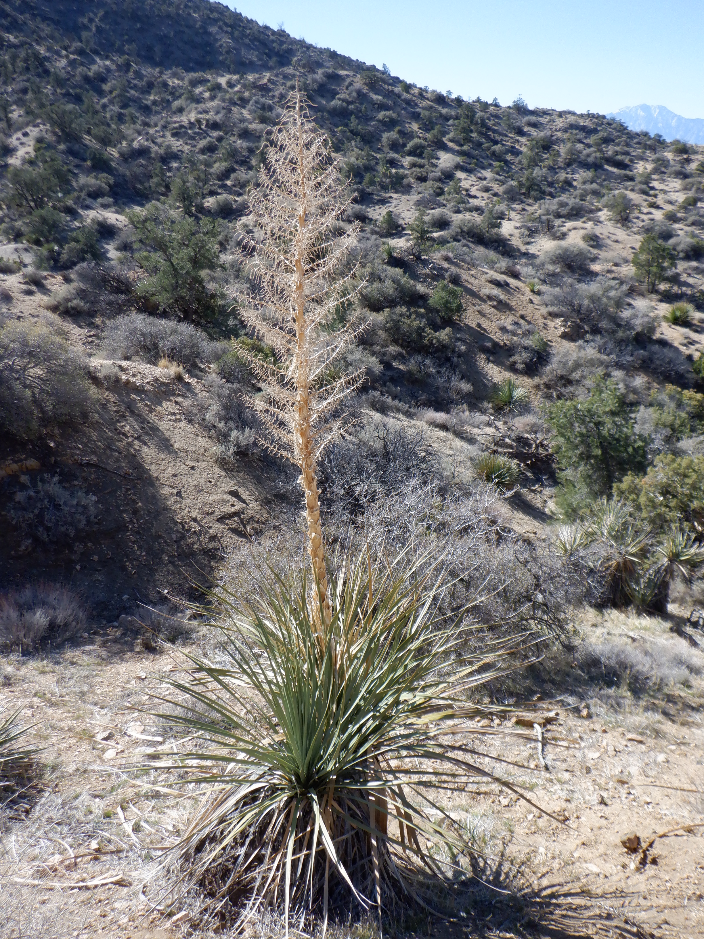
Of course, there is a minor issue here. Joshua trees aren’t really trees. They are cactus. They are related to the Yucca cactus and that means they actually are a cactus. That doesn’t really matter, they are beautiful and make the most fantastic figures as their arms curl and spread in every which direction. Joshua trees only grow here in the Mojave Desert. They are found nowhere else in the world.
Just look at these pictures.


We trekked around in the hills for a couple of days, albeit the one trek was rather short.

The park is huge and we were camped at the one end, so the next day we drove through the rest of the park. Joshua Tree is noted, aside from the trees, for its strange stone formations. The formations look more like gigantic bricks that have been stacked by a drunken bricklayer. Naturally, no drunken 8or sober) bricklayer has been at work here. The reason for these “brick” is once again, erosion. Water seeps into the porous stone and freezes. Then thaws. This cycle repeats every winter, thousands of times and eventually the rocks crack. Strangely, here they seem to all crack into squares.
Late in the afternoon we arrived at Chollo Cactus Garden. Our guidebook explained that here, there were many cacti. It didn’t tell us that there was an entire valley, stretching as far as the eye could see where the valley floor was filled with these delightful whitish cacti. A fantastic sight.
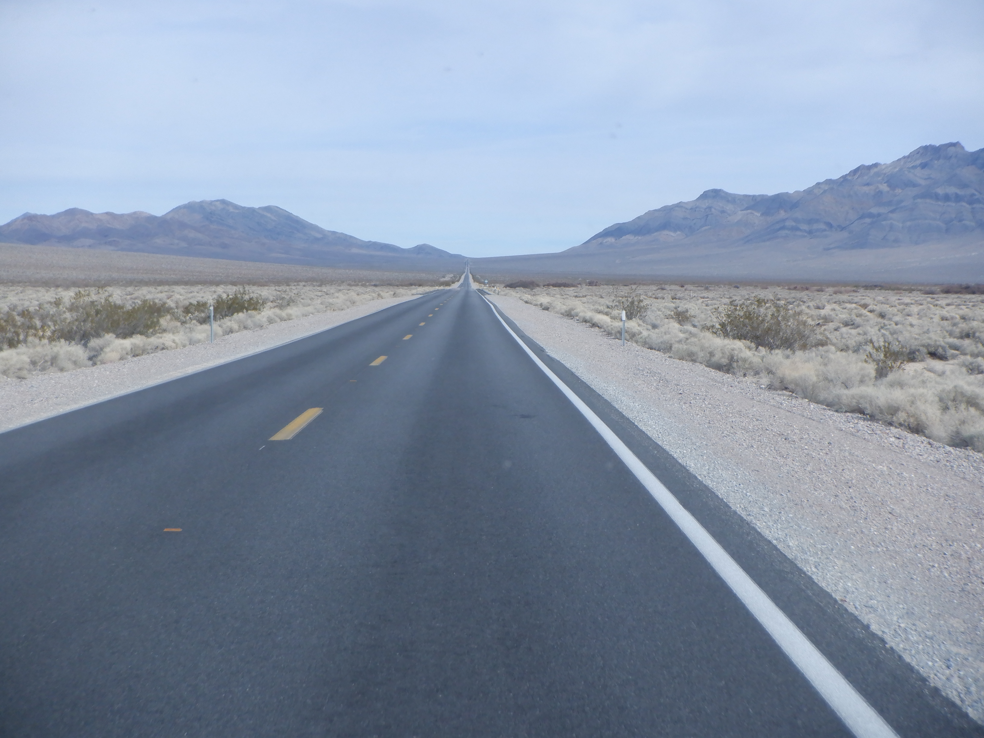
But, everything must have an end and we turned our course north toward Death Valley. I had told Vinni that I wasn’t terribly excited about driving through Death Valley, because I could remember driving through it 50 years ago. Then we arrived at the beginning of the summer and it was hot. Very hot. Damned hot. Unbearably hot. Did I mention it was hot?
Our car (back then) didn’t have air conditioning and even with all the windows wide open, it was unbearably hot inside the car. Back then, the Valley was almost empty, there was little help to be gotten if your car broke down or you had some other kind of emergency.
I wasn’t excited about trying that with Caprise, who as we all know, is an older gal with a number of minor problems.

But – like everything else in this world, Death Valley has changed radically over the past 50 years. There are now several places where one can get help (or have your car repaired). Today, there is also traffic – a lot of traffic. Ok, maybe not a lot, but a lot more than there was 50 years ago.
We meet many strange people on our travels. When we stopped for gas on the way to Death Valley, this rocket car was sitting alongside the pumps. The owner was there and we fell to talking. He had held the world’s speed record for that size rocket car 4 times. He didn’t have the record at the moment, but fully expected to win it back this coming summer. His fastest speed was just under 1100 kilometers per hour and he expected to better that. We also talked about how thirsty Caprise is, roughly 8 miles per gallon, but he wasn’t impressed. His rocket car blows off 160 gallons of aviation gas in under 9 seconds, so as he said, “You’ve nothing to complain about”.
Everything is relative I guess – but 18 gallons of fuel per second???

Aside from the rocket car, the town we stopped in had a strange claim to fame. They purported they had the world’s largest thermometer. A 134-foot high thermometer to be exact. Why 134 feet? Because the highest temperature ever measured in the continental United States was 134 degrees, measured in Death Valley. Every town has to have a claim to fame – the thermometer was the claim here.

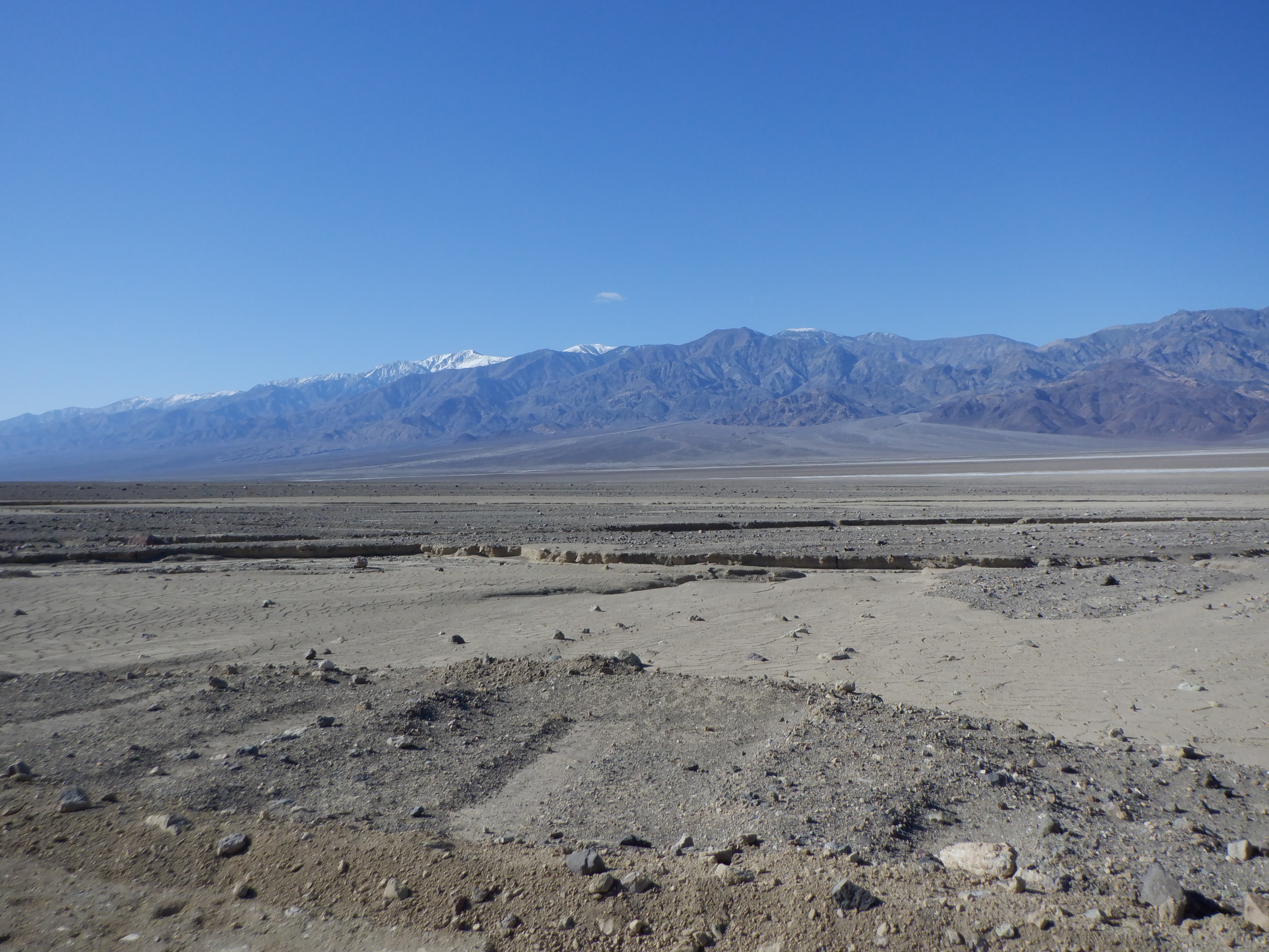
If you think the Mojave Desert is empty – then you haven’t seen Death Valley. In Death Valley, there is nothing. Only rock and sand. Death Valley lies between two mountain chains and stretches just over 200 kilometers from end to end. Now that doesn’t mean that there is green forest etc just outside of Death Valley – it just means that the areas are called something else. The lowest point in Death Valley is 282 feet UNDER sea level. This point lies at Badwater Basin, one of the few places where you can find water in Death Valley. As the name so poignantly expresses – the water is not potable.


Death Valley got it name when a wagon train of pioneers headed for the gold fields of California left Kansas too in the year to cross the Sierra Nevadas before the winter. Rather than wait, they decided to try to go south around the mountain chain as they had heard there was a trail. This was in 1849-1850. A few years before tis, a wagon train had been caught by early snows in the mountains and forced to spend the winter there. They ran out of food ended resorting to cannibalism in order to survive. That was the now famous Donner wagon train. The pass through the mountains is called Donner Pass in honor of them.
The wagon train making the attempt in 1849-50 knew about the Donner train and therefore had no urge to make the attempt late in the year. The southern route, however, ran right down through Death Valley and the wagon train was soon stuck there as they were confronted by the Panamint Mountains that rise like a sheer wall on the western side of the valley. The wagon train found the only fresh water that exists in the valley, Traverline Springs and were able to spend the winter there. They send two you men ahead to find a pass over the mountains and return with provisions. It took the young men just over four months to find a passage through the mountains, reach an outpost where they could get provisions and return. Legend has it that as the last wagon crossed over the pass, one of the young men turned, looked back and said, “Good-bye, Death Valley”.

Fortunately, Vinni and I aren’t trying to cross Death Valley in a prairie schooner, but we did have one major problem. There is a campground at the previously named Traverline Springs (known today as Furnace Creek), but it was full (according to the internet). The campground I’m referring to is the one the National Park Service runs (and is cheap). Since I’m officially an old man, we get to stay in an NPS campground for only $10 per night. The privately owned campground next door had empty spaces, but costs $70 per night.
$70 per night is expensive (we are, after all, poverty-stricken cruisers) and normally we would never pay that much, but there are few other possibilities out here. We drove past the NPS campground and miracles of all miracles, there was a cancellation and an empty slot. Only $10 so we immediately jumped on it and a few minutes later Caprise was parked and our lawn chairs were out in front.
Death Valley is a desert in the classical meaning of the word. Only stones, rocks and sand, absolutely nothing green – not even cacti grow here. The next morning we drove down (literally down) to Badwater Basin and the lowest point in the United States, 282 feet below sea level. Here is a video from there, but I have to warn the reader that there is a lot of wind noise on the first part. Our camera simply aren’t good enough to filter the wind out and it was blowing like mad that day.
As you can see, the ground is white here – it isn’t snow – it’s salt (you can see snow on the mountains behind the desert). Lots of salt.
Throughout the years, people have dug for gold and silver here (there is gold and silver here but very little) and borax.
Borax? Like 20 Mule Team Borax? Yep exactly like that. As a matter of fact the trademark picture on the front of those 20 Mule Team Borax boxes is from Death Valley (my daughter claims that I am a walking encyclopedia filled with totally useless knowledge – sigh). Borax has been used for many years in soap. In the past it was used for tanning hides and preserving meat. Today, it is still used in cleansers but also cosmetics, fiberglass and many other industries. In other words, mining borax is big business.
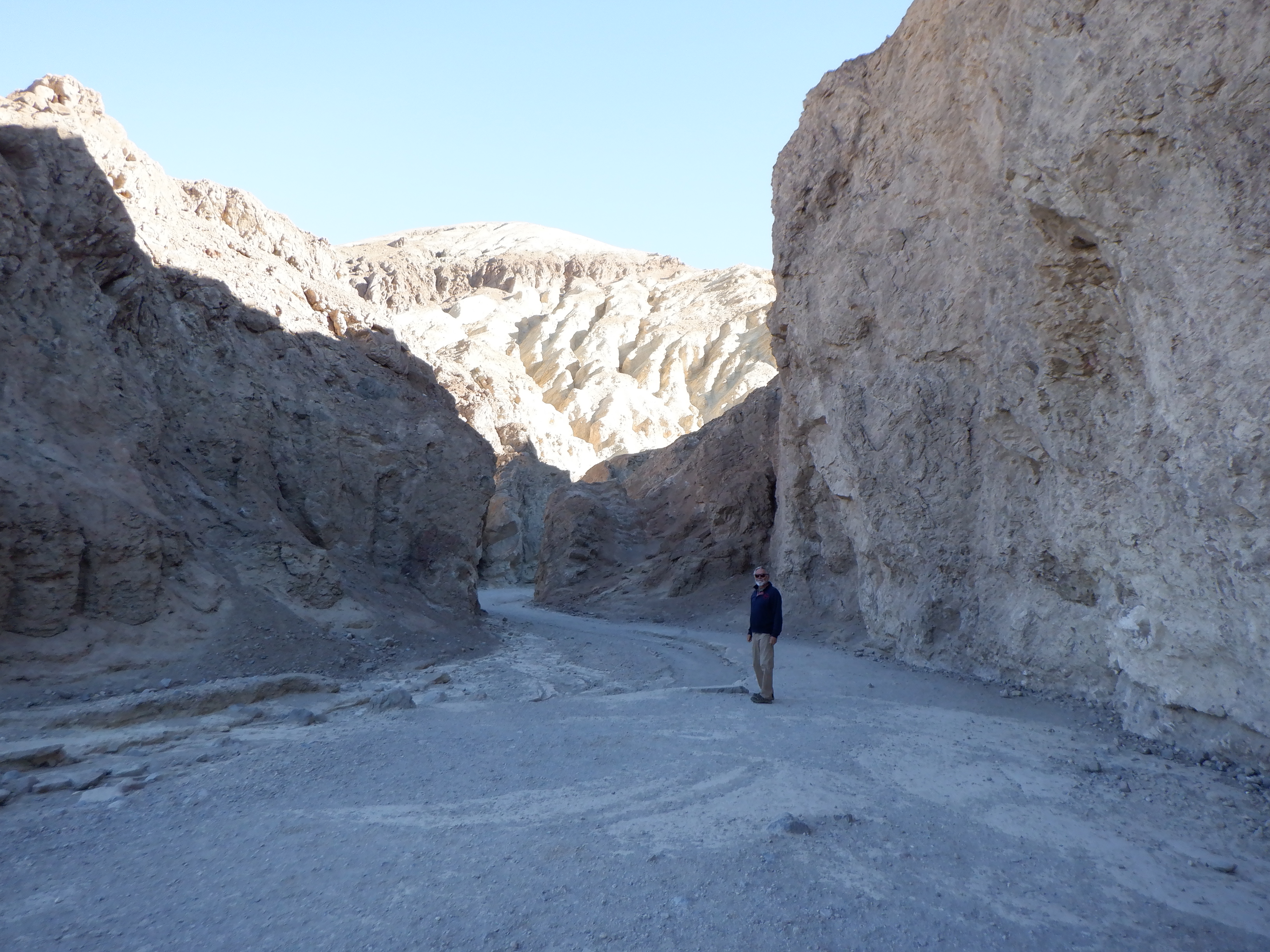
Back to our little adventures. Vinni, who thinks we are constantly in need of exercise (read: I’m in constant need of exercise), has decided that we will only trek a “short” trail into Golden Canyon. The trail guide claims this is easy walking and only 4-5 kilometers. “We’ll walk that one,” she says, “It isn’t very long, so we can easily do it tomorrow”.
One would think that now that I have reached the advanced age of 70 and been married to Vinni for over 30 years that I would be suspicious anytime Vinni declares a trek ”short and easy”. Of course, I’m still blinded by my love for her, so I can use that as an excuse. This day would prove not to be an exception.
The first part of the trek proved to be easy. The trail was well-marked and although it had a slight upwards incline, was easy walking. We enjoyed the early morning and as the trail wound its way through the ravines and hills, it came out into the sun and we were warmed by its rays.
Of course, this idyllic walk couldn’t last and as we neared the end of the canyon, the going got tougher. The last stretch in to the Red Cathedral (a sheer canyon wall of deep red rocks), the trail ceased to have a slight incline. It also stopped being wide. Instead we were now climbing over, and under, rocks, through narrow clefts and up vertical rock faces.
I’m not one to complain (far be it from me to criticize my beloved), but the reader may have some pity left over for me (remember the broken rib and collapsed lung). But, if I know our friends well (and I do) then they probably also have the opinion that a little exercise is good for me (sigh).
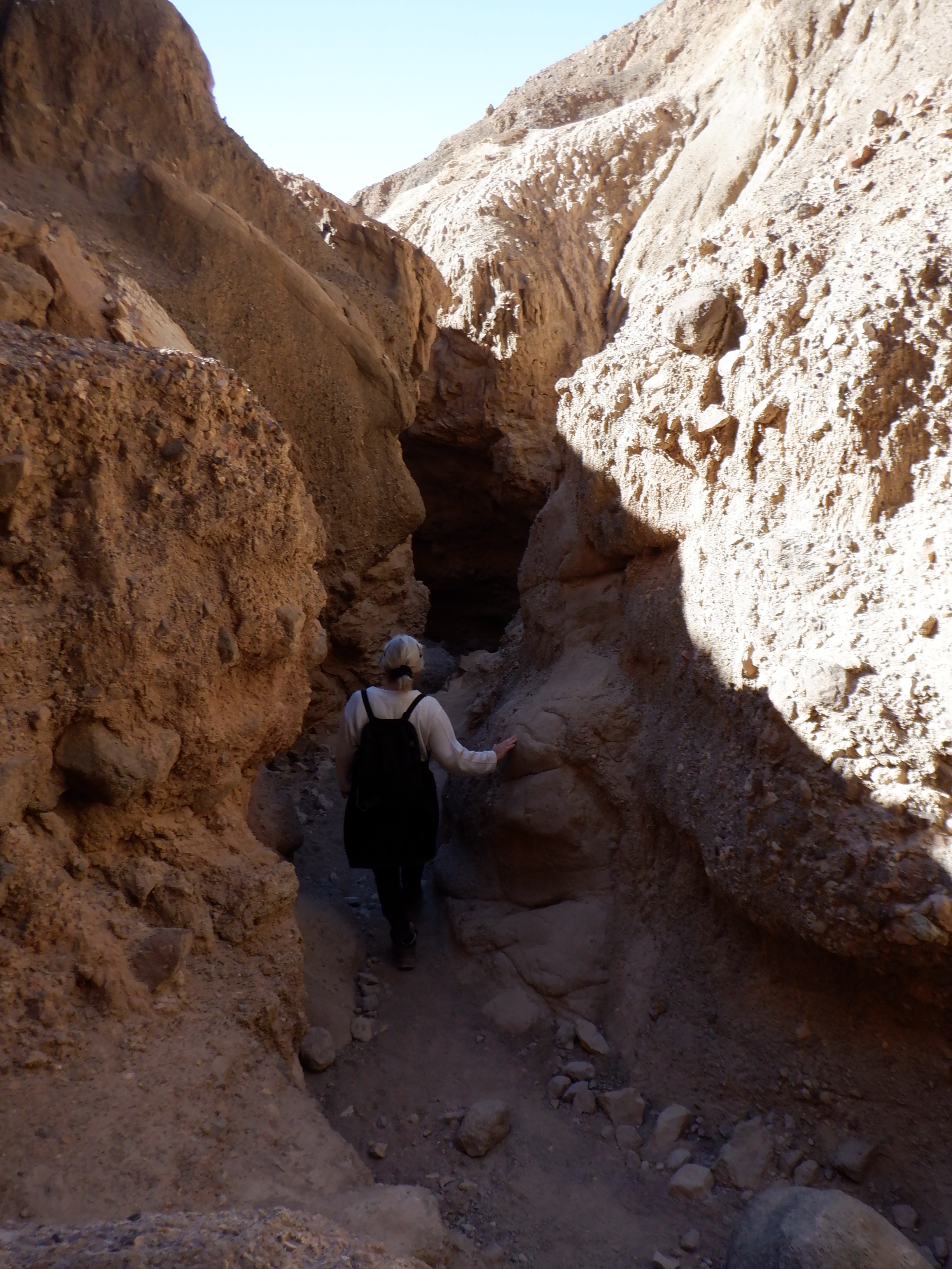
When we finally were on our way back out of the canyon, Vinni decided we could just take the “long way back”. A side trail the wandered through the hills would only add 7-8 kilometers. No sooner said than done – we turned left and were now climbing up over the hills and deep into the desert canyons.

My brother Carl told us, when he heard we were visiting Death Valley, that he visited here once and trekked around. He remembered coming out of one canyon on a trail that ended at the top of a dry waterfall. No way down, he had to edge his way along a cliff for 20 meters of so before the trail began again.
Death Valley is so huge that there couldn’t be more than a remote chance in hell that we would be on the same trail – but we were. After climbing around the canyons and ravines for a couple of hours, where were we?
Standing on top of a dried out river bed waterfall. 30-40 down and the only way to get further was to edge our way along a cliff for 20 meters or so to where the trail began again (sigh).
On our little sojourn, we passed several old gold mines. The NPS had wisely closed off the entrances with heavy bars. They don’t want to have to spend their time rescuing silly tourists that otherwise would insist on climbing down into these mines.

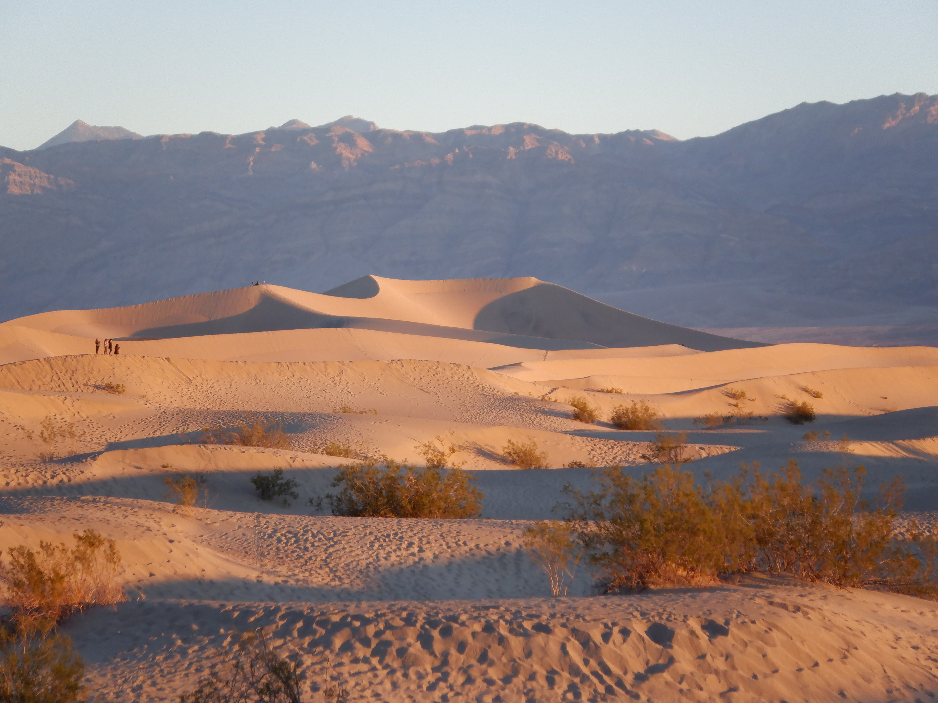
Our time in Death Valley was now approaching its end. In the northern end of the valley is an area known as Mesquite Flats Sand Dunes. It is, as the name implies, an enormous area where the sand blown from across the valley settles. What’s a desert without huge sand dunes? Sunrise, is supposed to be a grand experience, as the morning sun causes long shadows to be raised across the dunes. Ansel Adams, the famous American landscape photographer, took one of his famous pictures here. My picture is, of course, not as good as Ansel Adams’s, but I think it shows just how fantastic this scenery was.

After sunrise, we began the long drive out over the Panamint Mountains and out of Death Valley. We ended the day in Bakersfield. My broken rib had gotten worse and I could barely sleep at night, even juiced up with all the painkillers we have on board. I’ve have more than several broken ribs during my lifetime so I know there is nothing to be done exception suck up the pain and wait for a few weeks – it will go away. But the pain I was in was more than from just a broken rib so we went to a clinic to have an X-ray taken. Yep the rib was broken but the bottom part of my left lung was also collapsed. That was probably the reason for the exasperated pain.
We didn’t until then that I had a collapsed lung ( I now I mentioned it further up in this blog a few times, but that was just so the reader would have a tiny bit of sympathy for me – we only found out in Bakersfield that it was collapsed).
There is no treatment for a collapsed lung other than blowing up a balloon 8-10 per day in an effort to fill the collapsed part with air. So now I’m blowing up balloons and taking some really powerful painkillers. My breakfast looks like I’ve been robbing a drugstore with 3-4 different pills.
I writing about this so you, dear reader, will sorry for me.
We left Bakersfield and started northward towards Sequoia National Park – home of the giant Redwoods and Yosemite National Park.
Vinni will write about that.


I feel your pain! I’ve had a severe case of vertigo for the last 8 weeks and living on a boat, that make things equally uncomfortable. I don’t use the pain-killers but I do sleep a lot. I love the part of the country you are in at the moment. 4-corners (Mesa Verdi) has some of the strongest spiritual energy I’ve ever experienced. For me, the desert accentuated how quiet the earth can be. My great grandfather surveyed the boundaries of Death Valley and my father the boundaries of Denali Park. I assume you’ve found the benefits of BLM land. Love the updates and thank you for sharing. You aren’t missing anything here in the NW but cold, rain and snow.