When we left Canyonlands National Park, it was our intention to drive to Moab, a town that lies just between the entrances to Canyonlands North and Arches National Parks (this part of Utah has many National Parks). We arrive in Moab and found a fine campground in a National Forest just outside. Moab, on the other hand, turned out to be a sort of hell. The town itself was not charming at all, but worse, it apparently is a mecca for Off Road Vehicles. These ORV’s are allowed to drive all over in the semi-desert and they do, thousands of them. People come from all over the country to rent these and barrel out over the countryside. They are noisy as hell and destroy the land. The Ranger in Canyonlands told us that there are so many ORV’s in the Moab area and they have been driving there for so long that they have destroyed the natural watershed that the spring run-off uses, altering the areas both fauna and flora. They are a pestilence as far as we are concerned and should be forbidden, but I guess everyman has his own idea of what the words “enjoyable sport” mean.
The next morning we discovered our pressure regulator on our (20 gallon) propane tank was leaking. A propane leak is dangerous, so we drove into Moab where we found an RV mechanic who replaced it – $200 including the spare part – so it could have been worse. We then filled the propane tank (it had been almost empty) and shortly thereafter the gauge on the tank began leaking. This was much more serious. The regulator is mounted after a shut-off vale, meaning it was possible to stop the leak by simply turning off the valve. The gauge is mounted directly on the tank – no shut-off valve.
A propane leak is dangerous. The slightest spark can set off an explosion. For example – you don’t dare drive when it is leaking – engines are hot and sometimes give off sparks. The local repairman could do nothing – you need to be certified to work on the tank itself and once you have done work, the tank needs to be pressure tested. Unfortunately, we had just filled the tank with 20 gallons of propane and it all needed to come out before we could drive anywhere.
You can’t just exhaust that much propane in the middle of a town –there might be sparks everywhere. We took a deep breath and drove to an empty lot where we opened the small exhaust valve. It took over 5 hours to exhaust all that gas and since propane smells, the propane smell quickly spread throughout the neighborhood. Several people stopped by to see what was going on and if we were a danger to the town.
Five hours later, the propane stopped and only air came out. We decided to risk driving and set off towards St. George, a mere 6-hour drive. There was a certified repair shop in St. George and we had called them to ensure they could fix it the next morning. We set off at 9 pm and drove through the night until 2 am. We found a truck stop where we could grab a couple hours sleep (parked in between 25-30 big semi’s), got again at 4 am and finished the drive.
At 8 am, when they opened, we were parked directly in front of their service bay. They went to work immediately and fortunately, they only had to replace the seal and mount a new pressure gauge. The tank itself wasn’t damaged. Another $200.
This “little episode” meant that we missed seeing Canyonlands North, Arches and Capitol Reef National Parks. Did we miss anything? Hard to say since we didn’t see them, but it is difficult to imagine that anything can beat our indescribable experience in Canyonlands South that Vinni has written about. That adventure is undoubtedly the high point of our Great American Road Trip so far.
All this means that we went directly to visiting Zion and Bryce National Parks (I noted earlier that this part of Utah is filled with National Parks).
Why is it called Zion? The area was named by the Mormons who found it so peaceful and heavenly that it deserved a biblical name – hence Zion. Zion receives over 3 million visitors per year and the Park is, in reality, closed to vehicles. If you come early enough, you can park inside the Park, otherwise you have to park in the town outside (they know exactly how much to charge for a parking space – believe me). Once parked, you take the free shuttle bus that runs throughout the park.
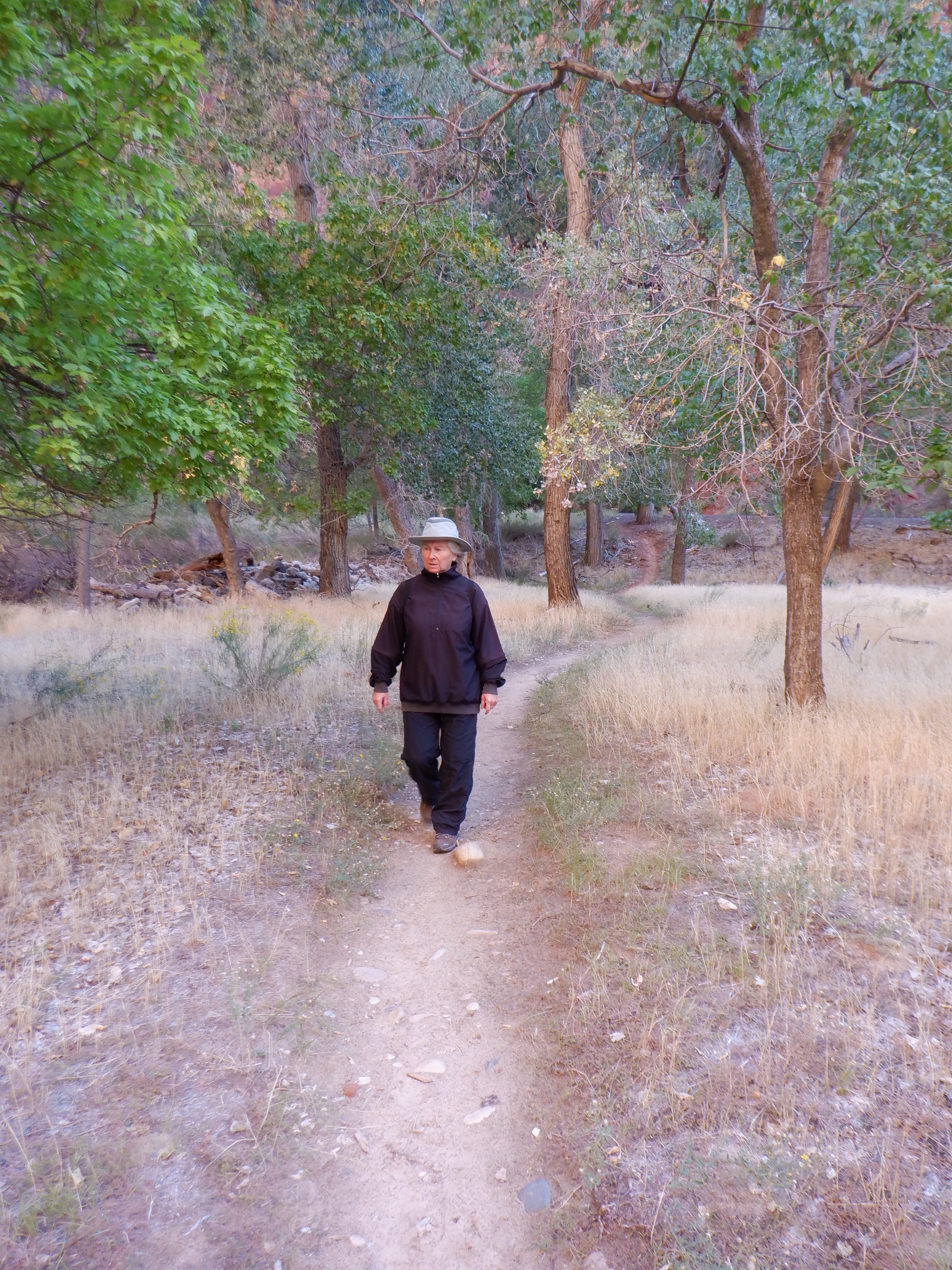
We got up very early and arrived just in time to get one of the last parking spaces inside the Park. We immediately got on the shuttle bus that runs to the other end of the “scenic drive”. The bus, even this early in the morning, was filled with people dressed in hiking clothes and carrying walking sticks. Everyone, apparently, was going hiking. As the bus wound its way along the drive, we could see the various trails branching out across the terrain. The trails were already filled with hikers. When I write filled, I mean just that. There were so many that someone probably needed to be there to direct the walking traffic to avoid traffic jams (no – I’m not exaggerating). Obviously, we would not have a peaceful trek all to ourselves as we had in Canyonlands.
We decided to take the bus all the way to the end and walk back alongside the river. We could see a small trail running alongside it. This trail was not on any trail amp and there were no people on it.
There were many cactus along the trail, some of them were budding despite it being autumn.

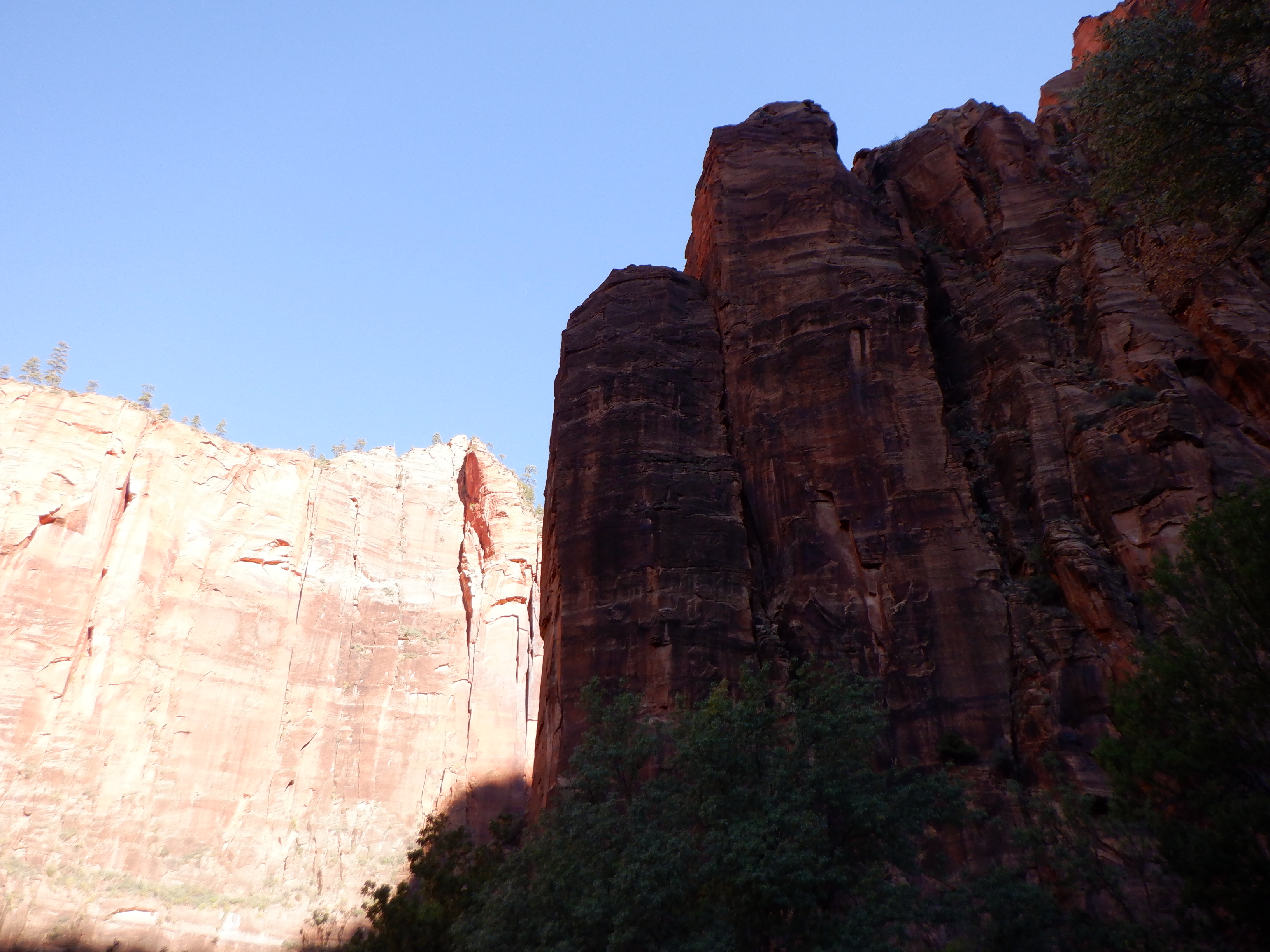
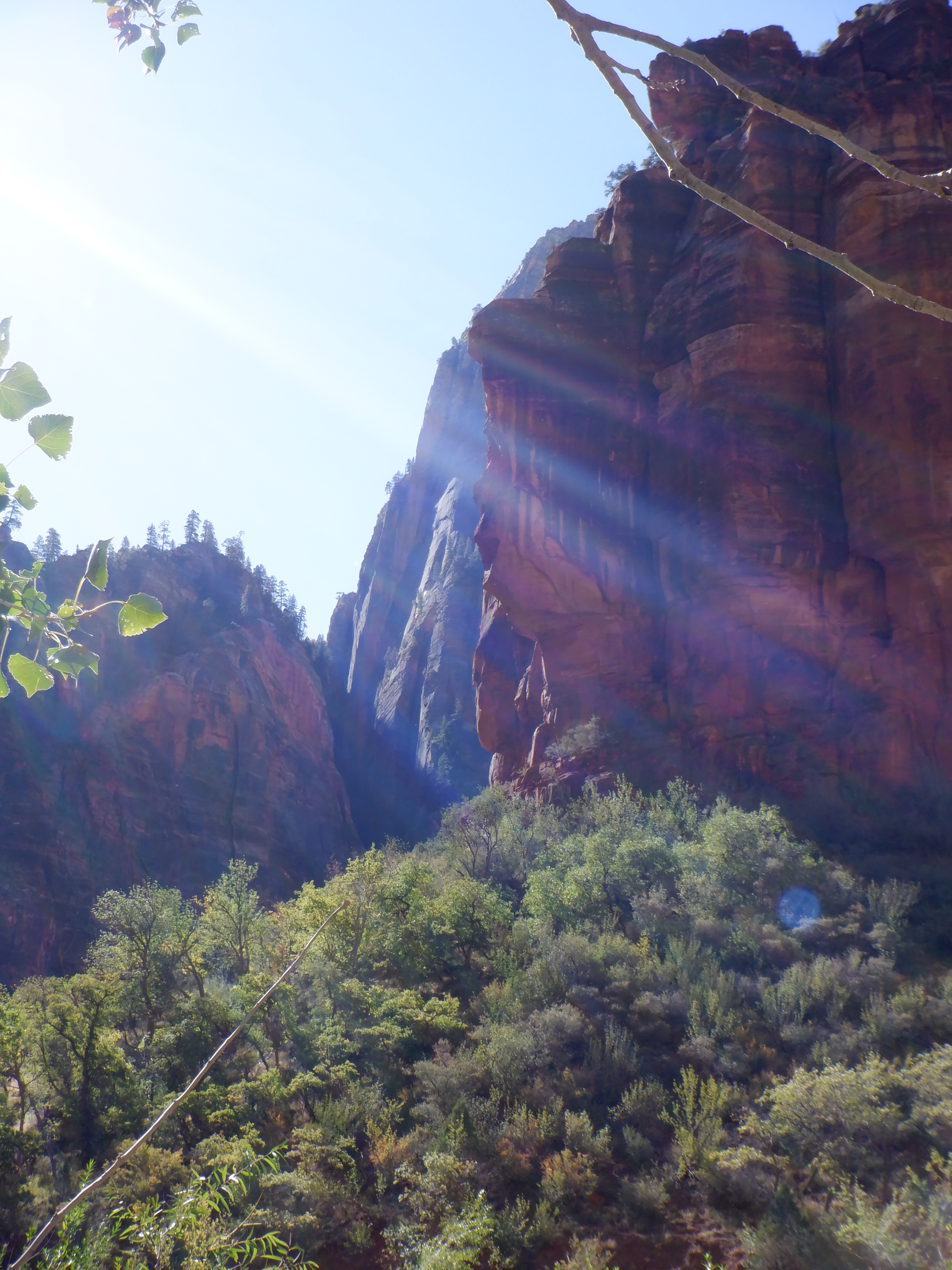
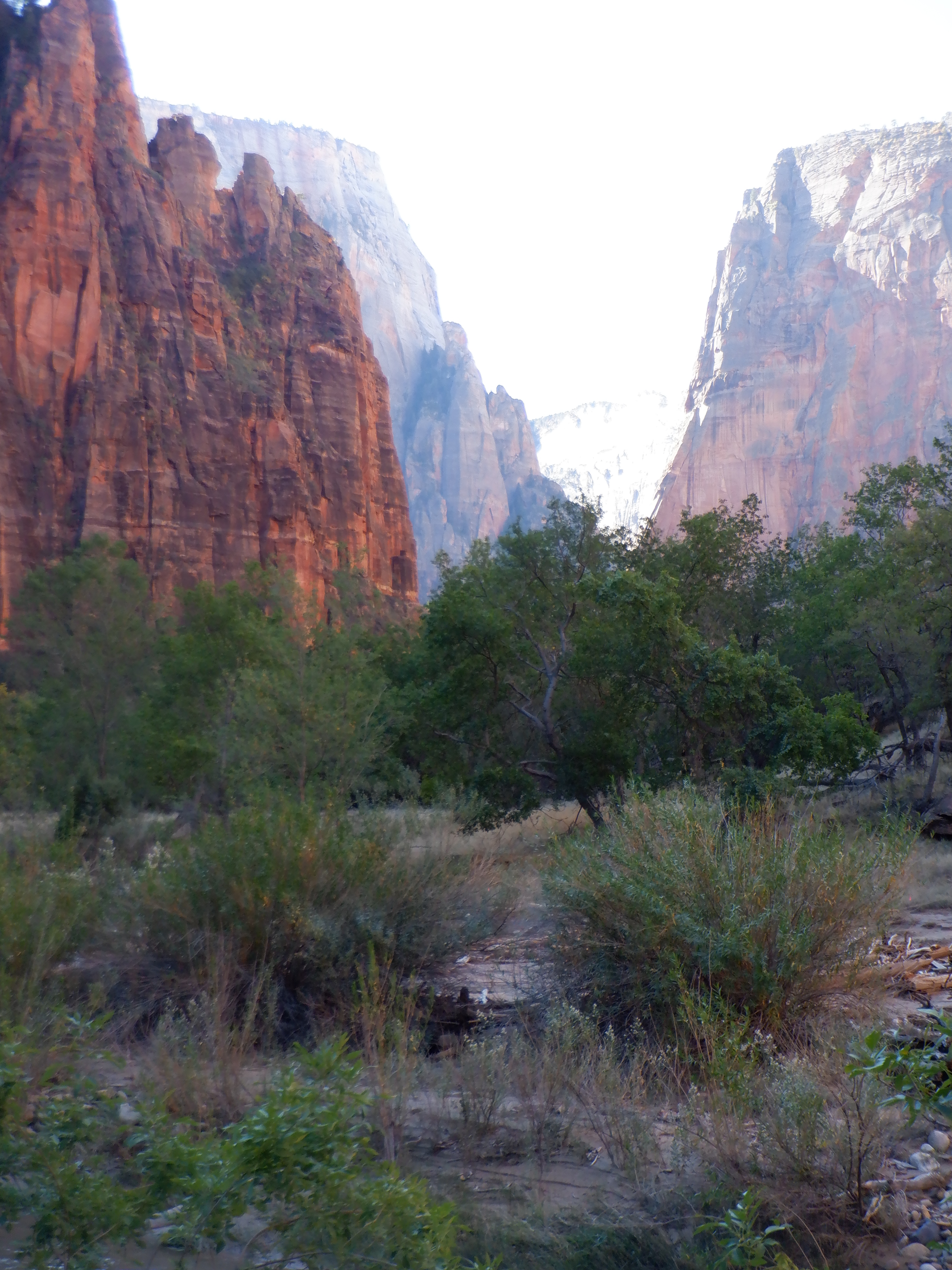
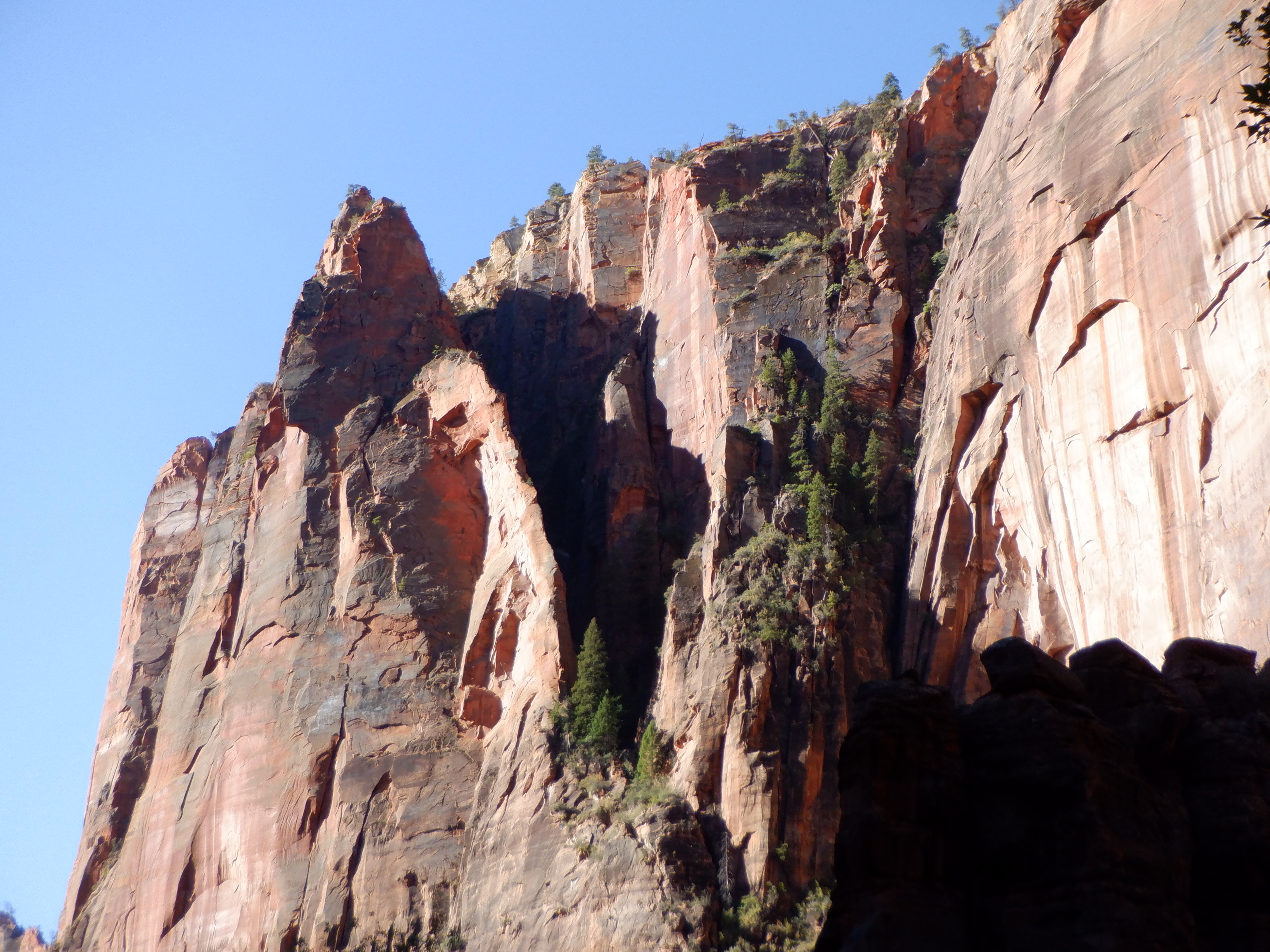
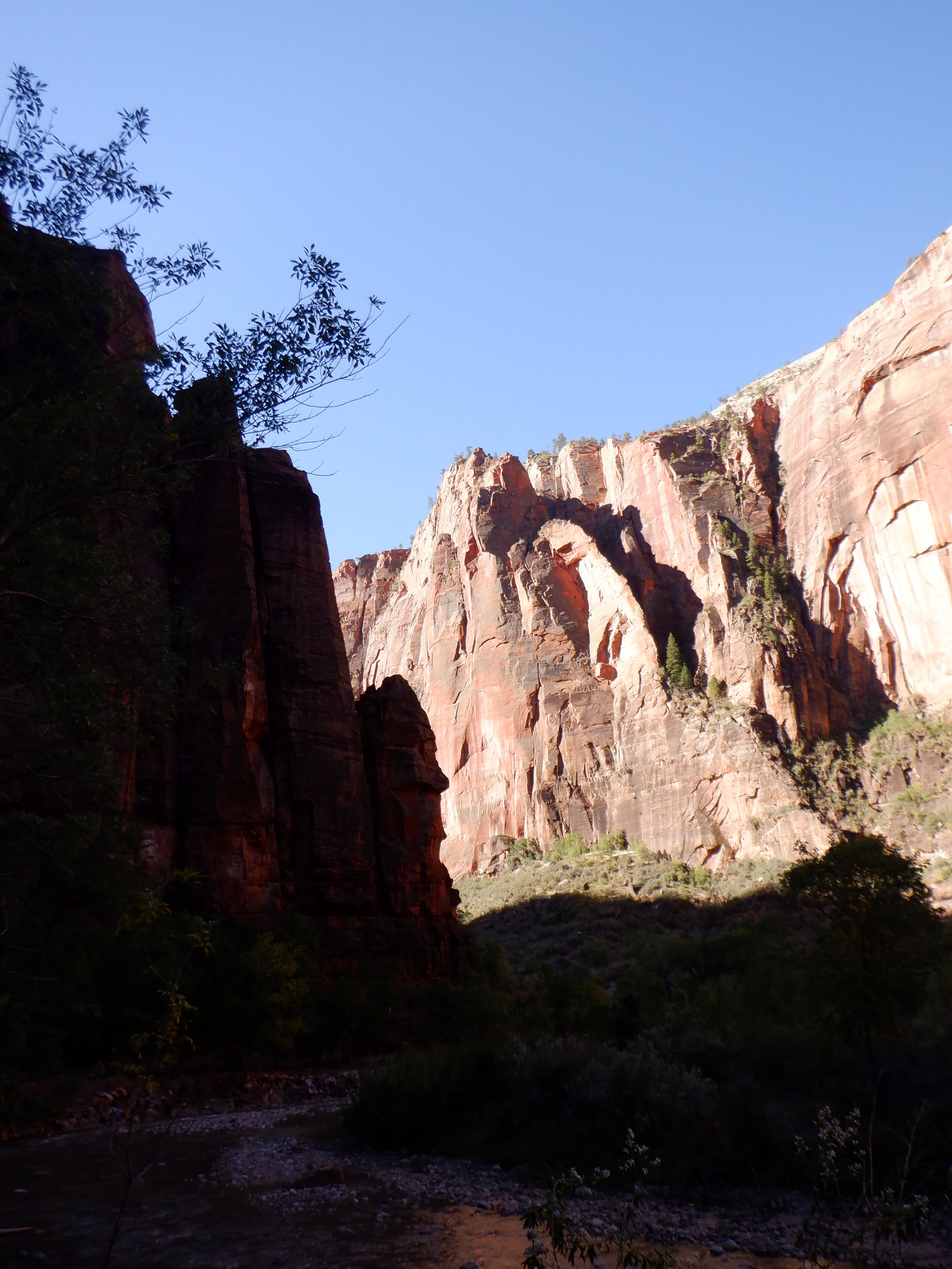
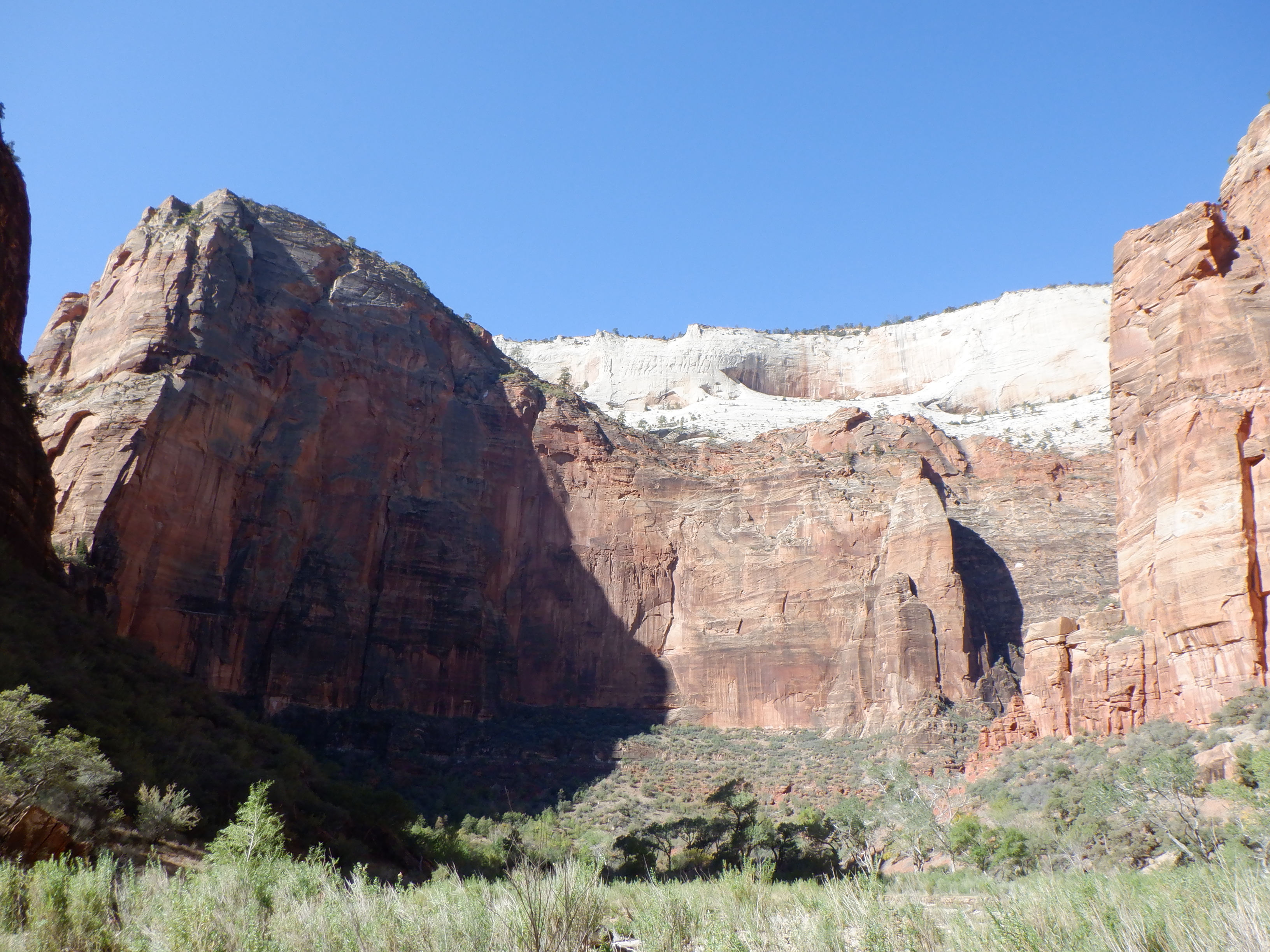
Once away from the bus stop, we had the world to ourselves. The canyon here is narrow and the cliffs vertical. The rocks are a fantastic red color and rise several hundred meters above our heads. Water in the river gurgles over small rocks alongside us. Small reptiles scurry under the bushes, hiding from us as we come tramping. Chipmunks are everywhere, running about in their eternal search for food.
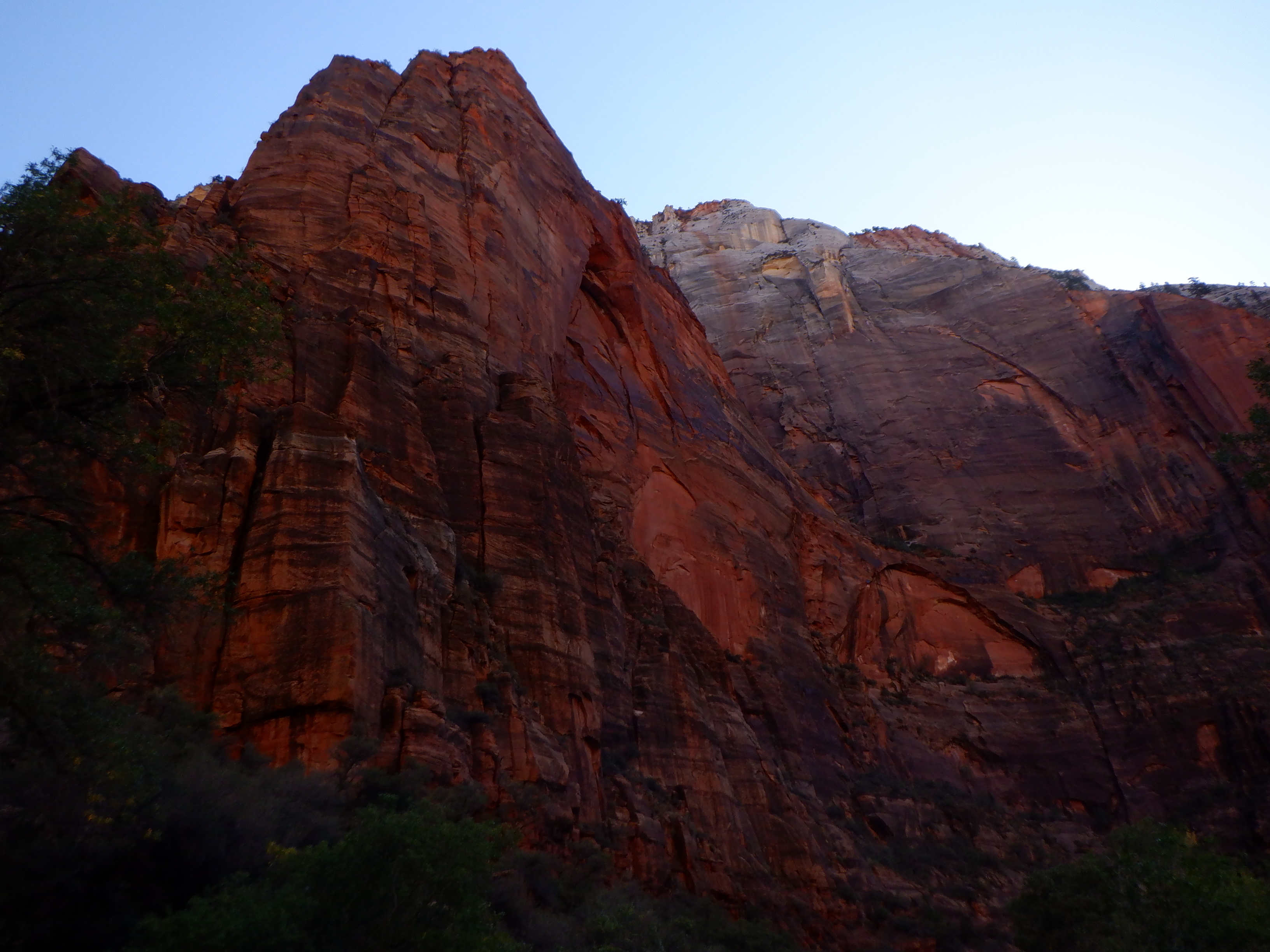
It is cold. We are at over 7000 feet and the sun comes late into the bottom of the canyon. You feel very, very small when you walk here. IT feels like walking in a cathedral. The silence is only broken by the gurgle of the water. We pass several small waterfalls where tiny brooks wind their way the cliffs. When a bus passes up on the road, it feels like we are being invaded.

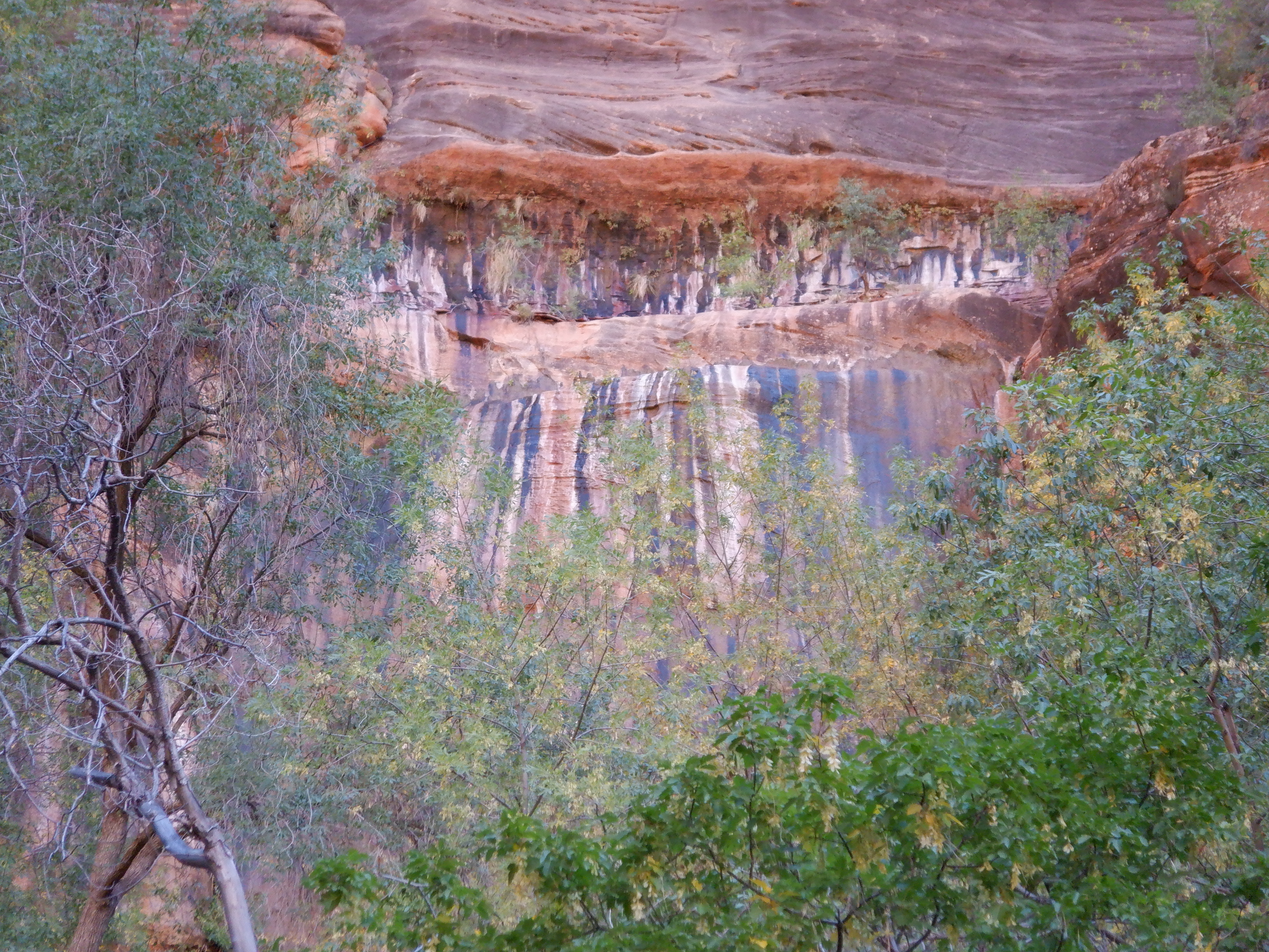
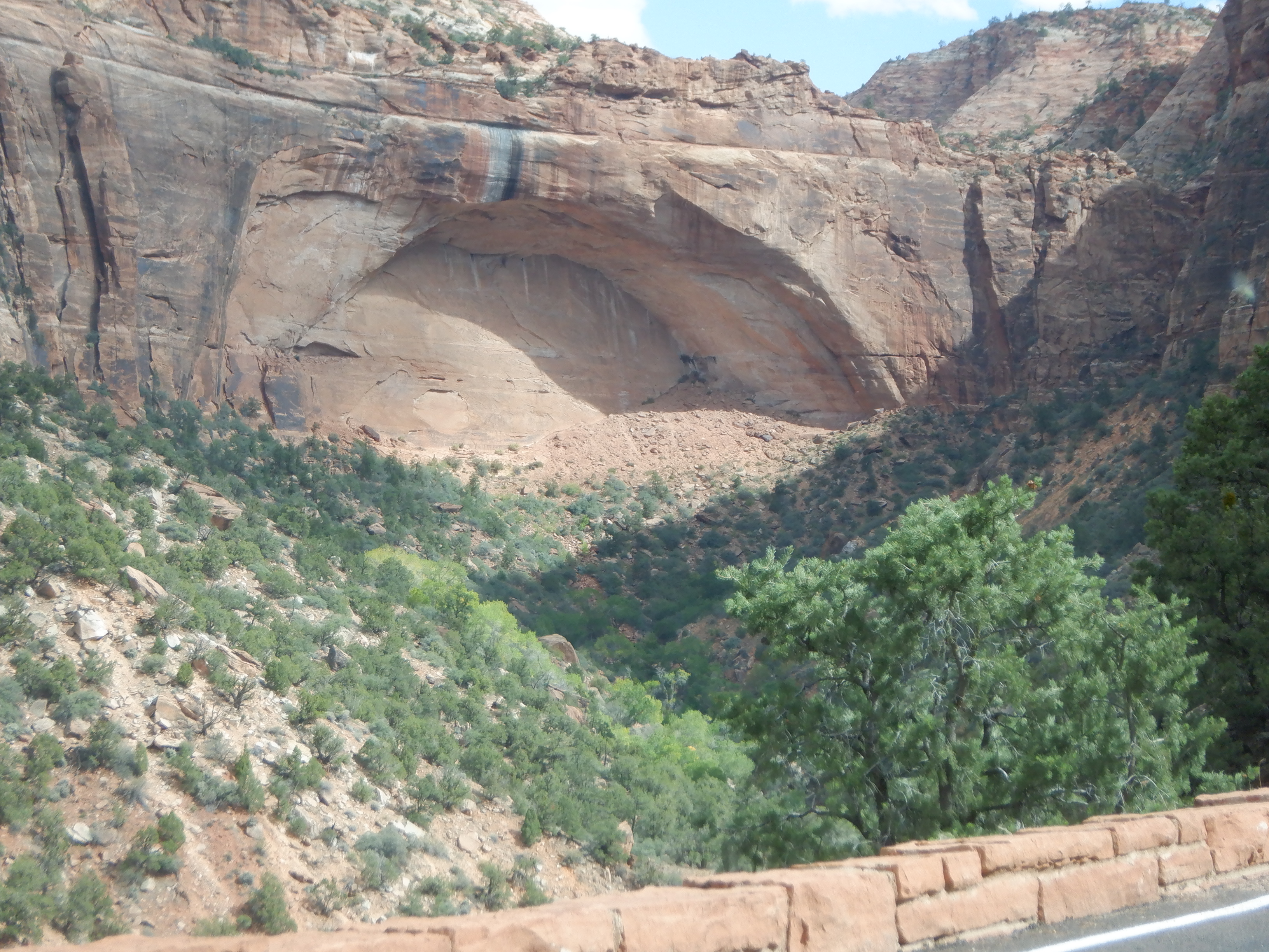
We see one of the well-known “weeping springs”, there where water is seeping out through a crack in the cliff. This one has colored the cliff in a many-hued fan of stripes. Wonderful.
The sun begins to reach down and spread warmth here where we walk. It feels wonderful on our shoulders. We look forward and can see the narrow canyon widening further on.
We arrive at the point known as “Big Bend”. Almost the entire area is closed off since a flock of California Condors (world’s largest buzzard) live on a cliff edge up above. The California Condor is on the list of endangered species and totally protected. The National Park Service is serious about protecting them – huge fines await those that disturb them or enter the closed off area. We don’t see any in flight – they must have been sleeping.
Shortly thereafter, as we are walking close by the river, I get one of my heart episodes. These have normally been short-lived (lasting only a minute or two), but this one continues. I lie down, to no avail. After a half hour of lying down, Vinni and I decide that it is better if we take the bus the last couple of kilometers back to Caprise.
Safely back at our home, I lie down on the sofa and the spell quickly passes.
The one and only campground her in the Park is, of course, filled to capacity and everything has been reserved months ahead of time. Before we drove up here, we found a campground lying outside the park on the eastern side where we could reserve a space. It is on the way to Bryce Canyon.
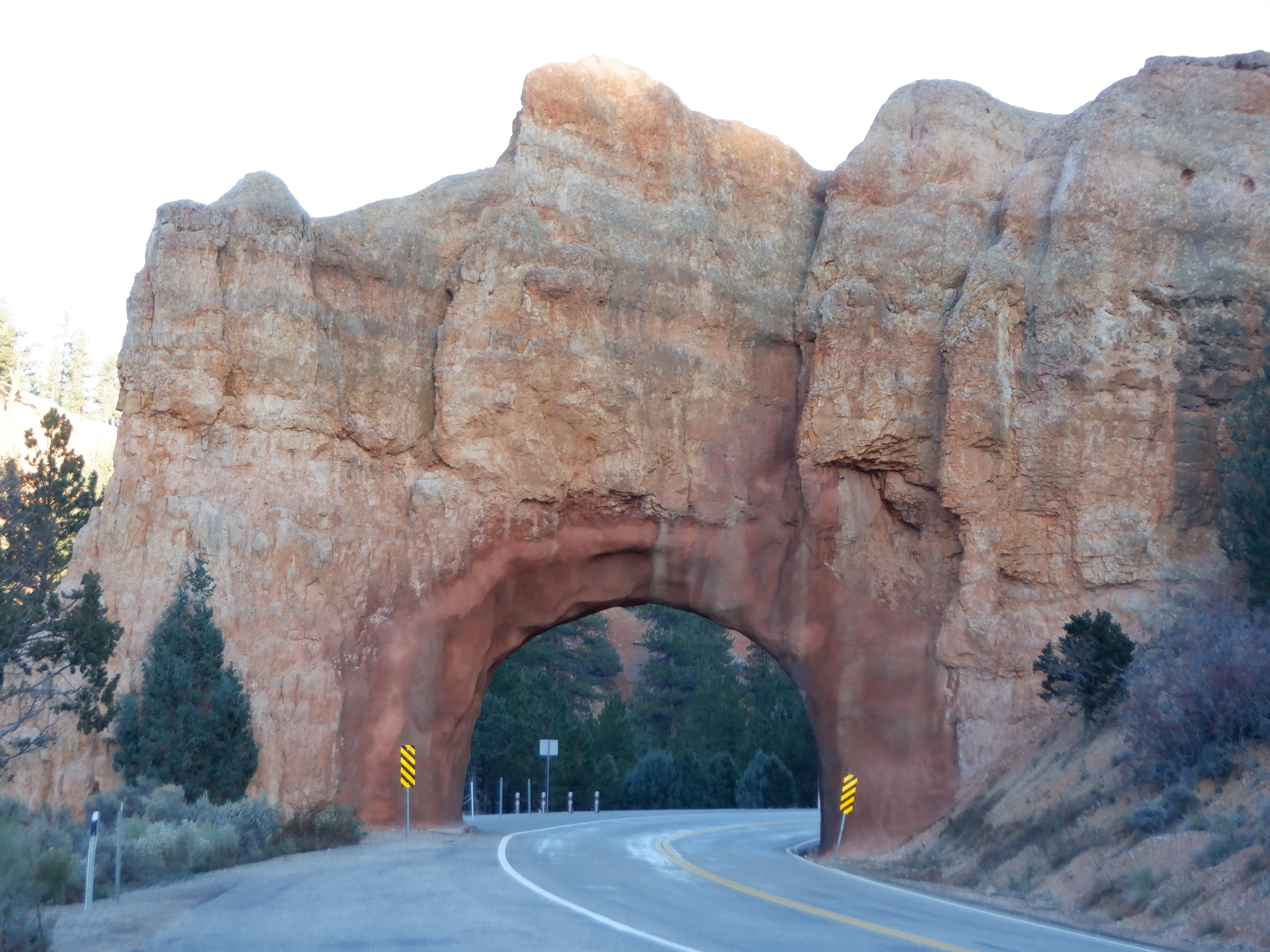
We need to exit Zion by driving out the east side of the Park; however, there is one small problem. The road east climbs over top of the mountains and at one place, through a 1 ½ mile long tunnel. The tunnel was built in the 1930’s and cars weren’t very big back then. Neither were buses. No one had ever thought that something like a motorhome was going to try to pass.
The tunnel is only 13 feet 4 inches high and 10 feet wide. Caprise is 12 feet 6 inches (I’ve measured her more than once and while 12’6” is conservative – I’d hate to try anything lower). So we have about 10 inches to spare. The width is not a problem; Caprise is a wide lady, but not that wide.
They take no chances here – if you say you are going east, they measure you before you enter the park. We drive up the mountain, and drive further up the mountain – the road gets narrower and narrower, lots of traffic – we’re not the only ones who want to exit through the eastern side. The panoramas are magnificent; we utter one “Aha” after the other. Suddenly the traffic stops and we are in a que. There is a que every time a vehicle like Caprise comes along – then the tunnel becomes one-way until they have passed through. We wait and finally it is our turn. There is a Ranger standing alongside the road, who stops us and says, “Stay in the middle, do not try to drive in one lane or the other”. Since we have no wish to rip the roof off Caprise, we drive with the middle yellow lines firmly planted in the middle of Caprise. Meanwhile, the traffic coming the other way waits patiently.
Naturally, nothing happened, but it was enough to get the adrenalin flowing a bit faster. Once out, we could spend the next 40 miles driving hairpin turns and enjoying the mountains scenery.
Late that afternoon, we rolled into our campground where we have reserved 3 days and hooked Caprise up to sewer, water and electricity. There was also a fast internet connection (we don’t want to cheat you, dear reader of our continuing escapades).
We’ve come up in elevation and the weather forecast calls for cold and snow (we’re at 5000 feet) We do get cold and snow so we are happy we have a good furnace that heats Caprise up to a toasty 70+ degrees.
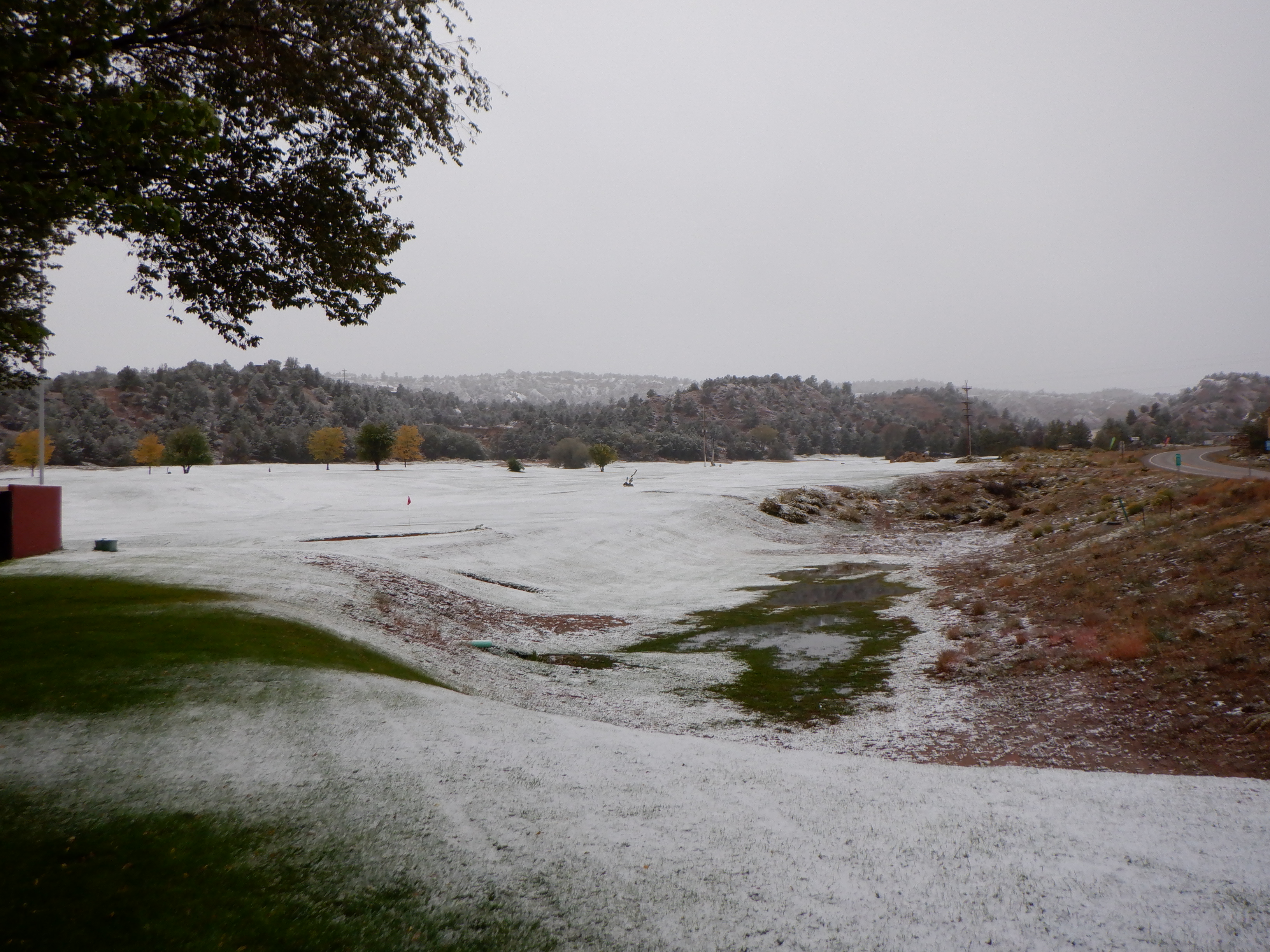
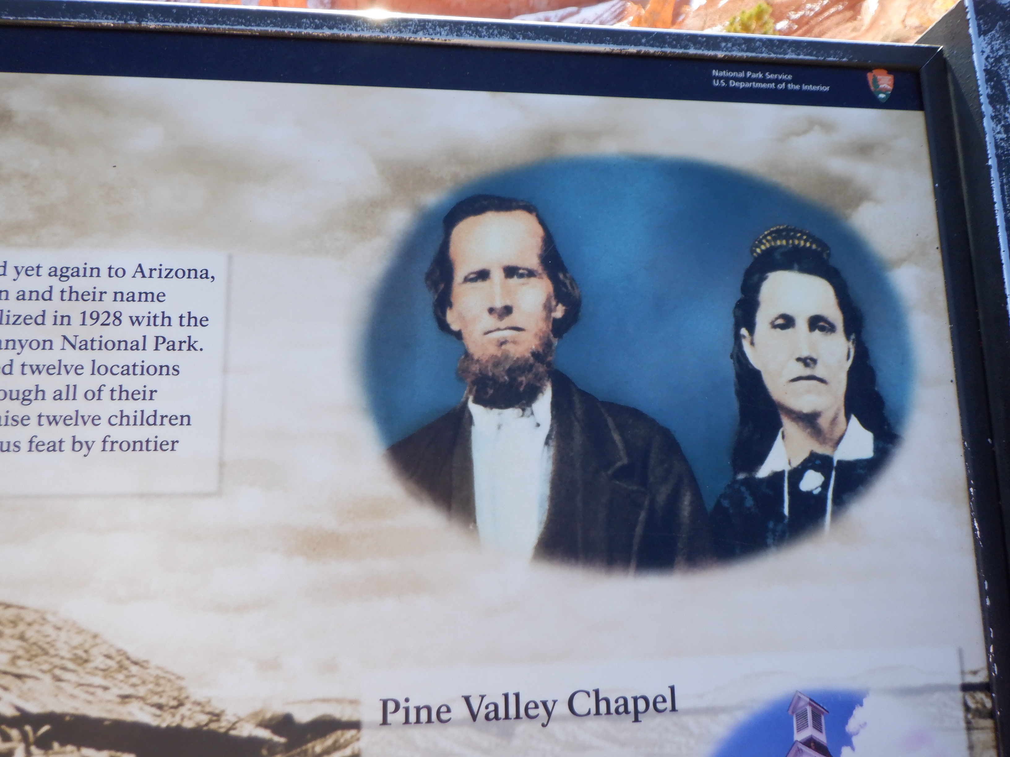
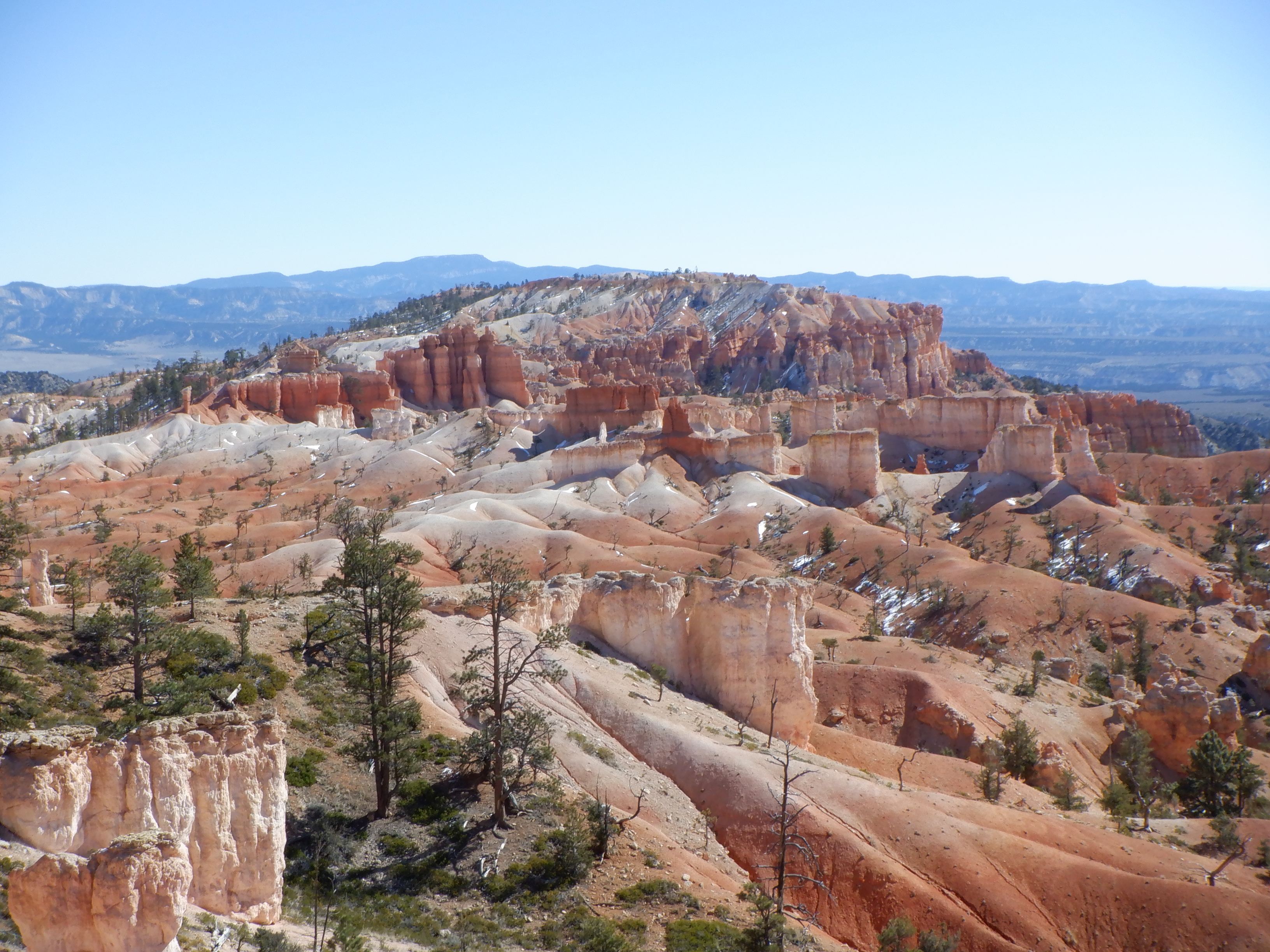
After 3 days, the weather begins to warm and the snow starts melting. We rise very early and drive the 60 miles or so to Bryce Canyon National Park. Bryce is named after a pair of Mormon homesteaders, Ebenezer and Mary Bryce that settled here.
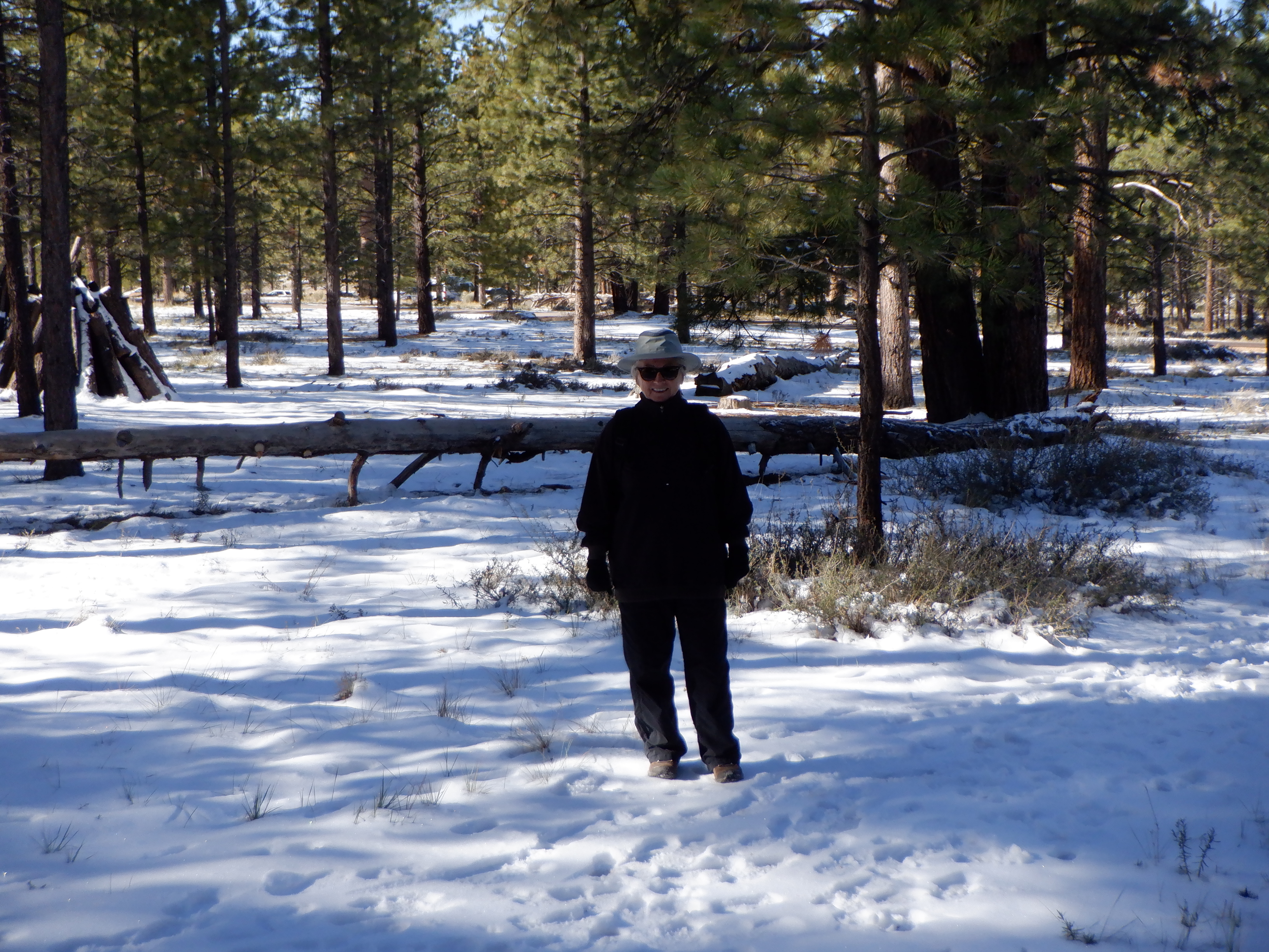
Bryce lies at 8-9000 feet (almost 3 kilometers). The air is thin up here and we can feel it as soon as we do anything other than sit still. It is also cold, there is still snow here and the temperature at night will fall to minus 8-10F. Daytime temperatures are in the low 50’s – although this is in the sun. We barely have the right clothes for this kind of weather.
The good news is that the campground is “first come – first served”. You can’t reserve a spot. This late in the season, there are empty spots so we drive around a little and find a comfortable spot for Caprise.
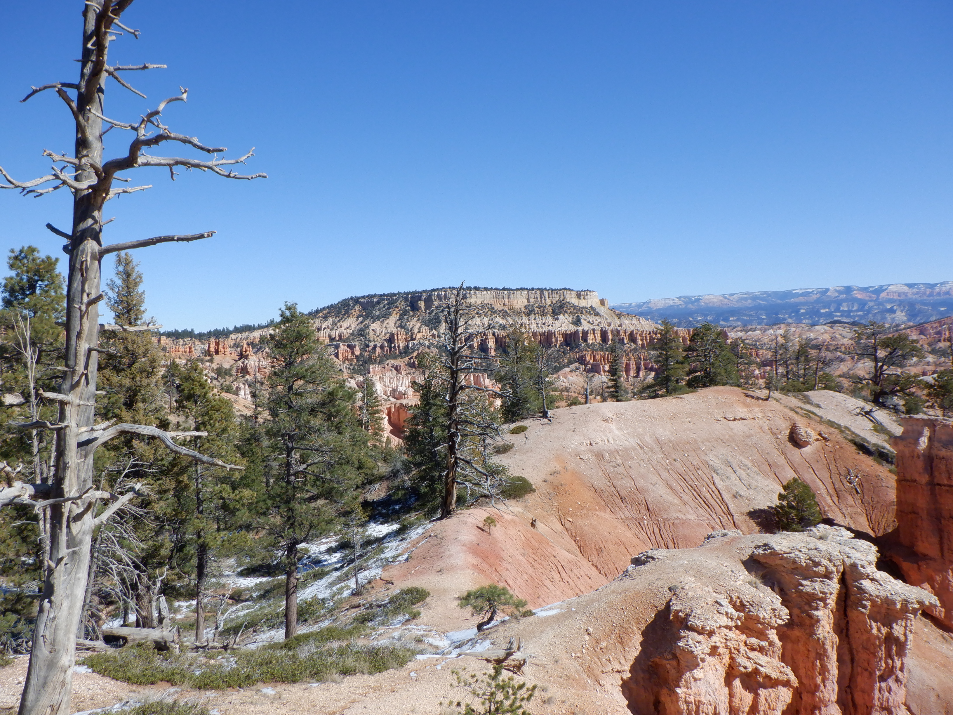
Bryce has the same problem as Zion – too many visitors. Over 3 million visit Bryce each year, the number has more than doubled in the past 10 years. If you are an early bird – you get to park inside the Park. If not, you’ll end up parking outside (at Ruby’s, who owns everything in the small town at the entrance, the hotels, campground, restaurants etc.), and riding the free shuttle. The tremendous influx of visitors has chased the bear and wolves who used to be a part of the fixed inventory in the park, away. There are still bear and wolves in Dixon National Forest, which surrounds the Park, but they are rarely seen inside. There are still prairie dogs, chipmunks, rattlesnakes and mountain lion, not to mention eagles and, of course, coyotes.
We arrive early – there is snow everywhere.
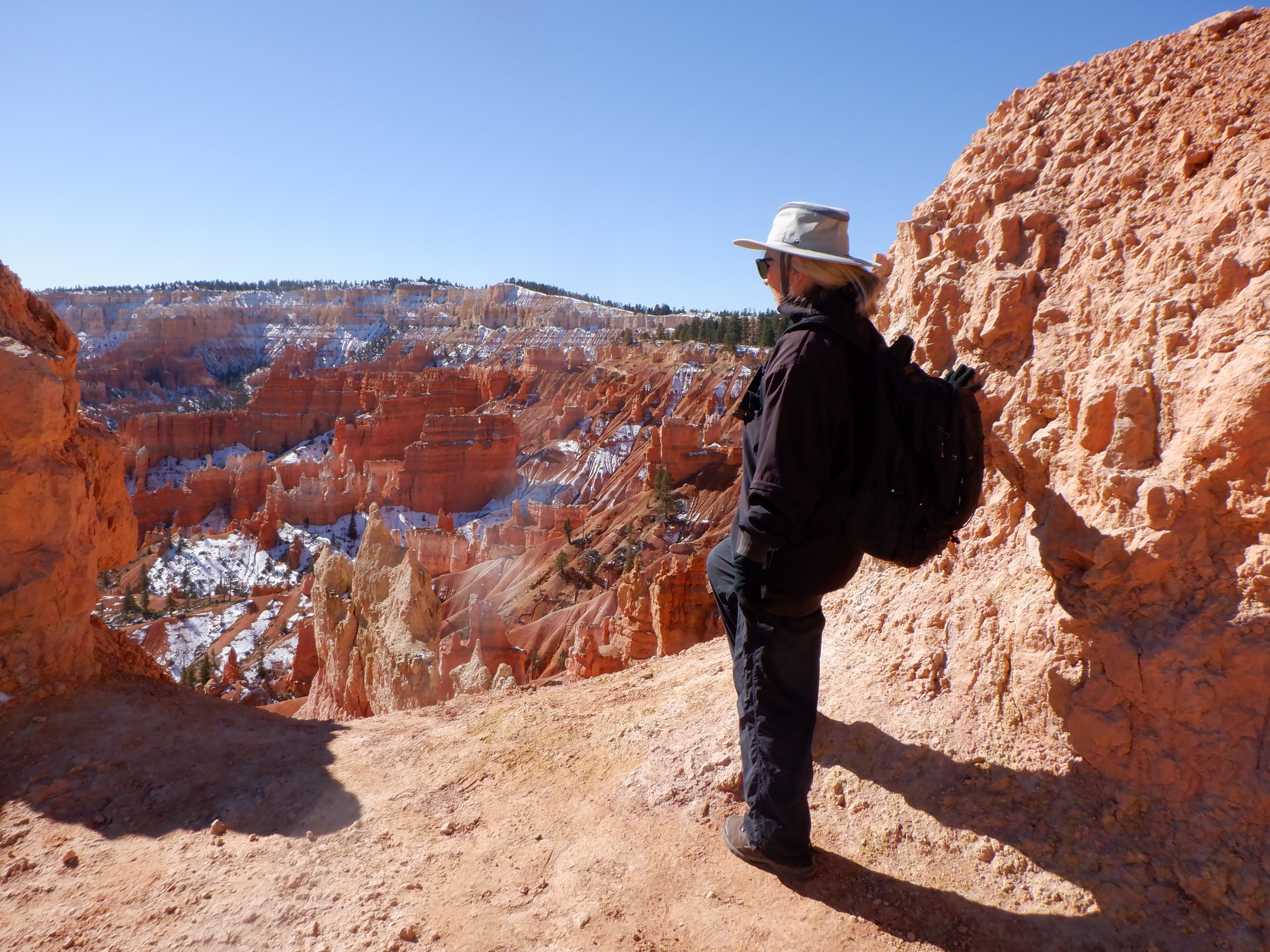
After parking Caprise, we grab the shuttle and get off at Sunrise Point. One of the trails, Queen’s Garden has its trailhead here. We stand and gawk at the scenery. We visited Bryce many years ago with my bother Carl – but memories fade and we have forgotten how unique this really is.
I’ve said a number of times that adjectives aren’t descriptive enough – but I don’t know how to explain the emotions you feel when confronted with these landscapes. Vinni and my vocabulary don’t have terms to describe this and it doesn’t get any easier the more panoramas we see. Indescribable is perhaps appropriate.

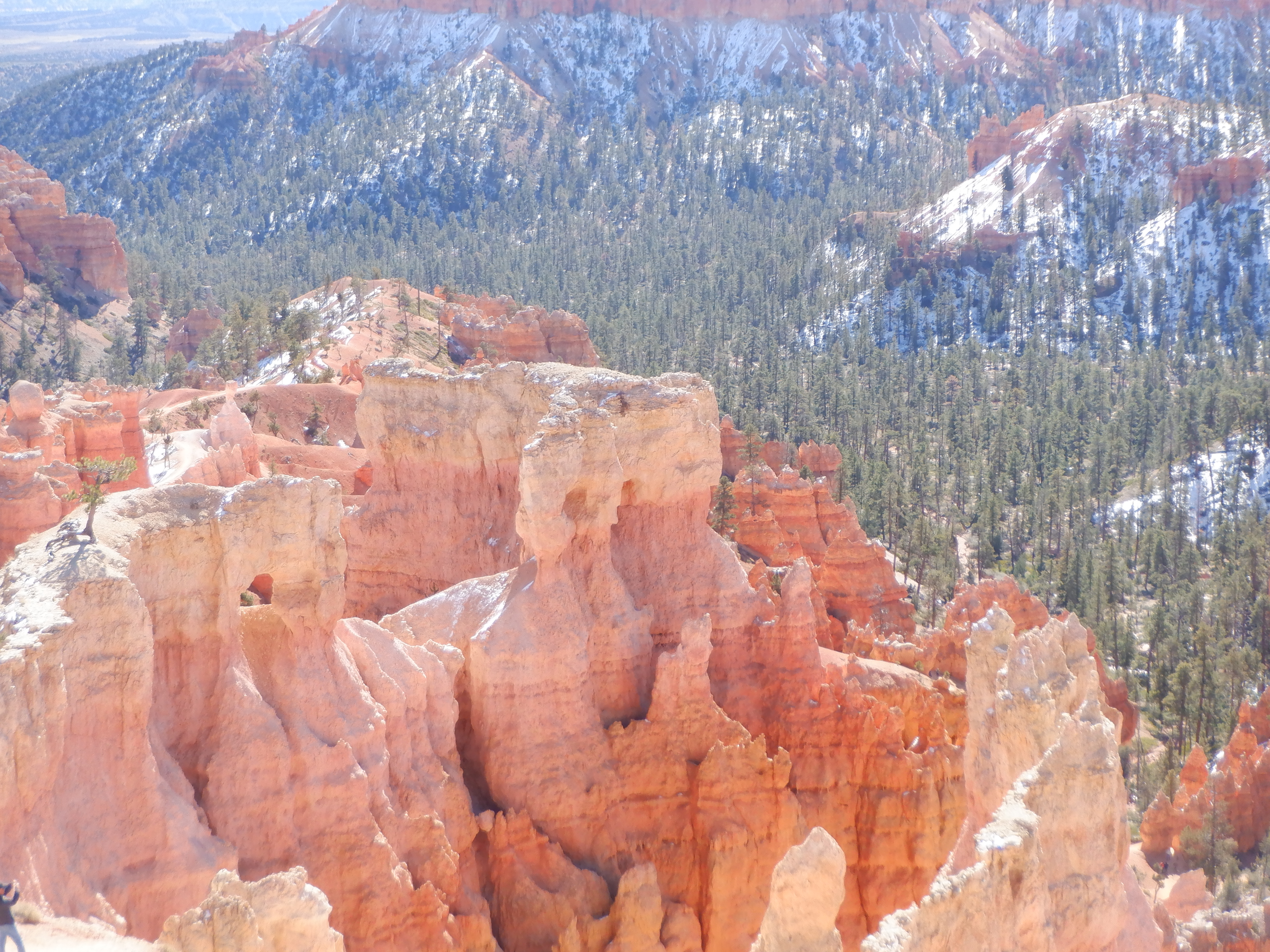

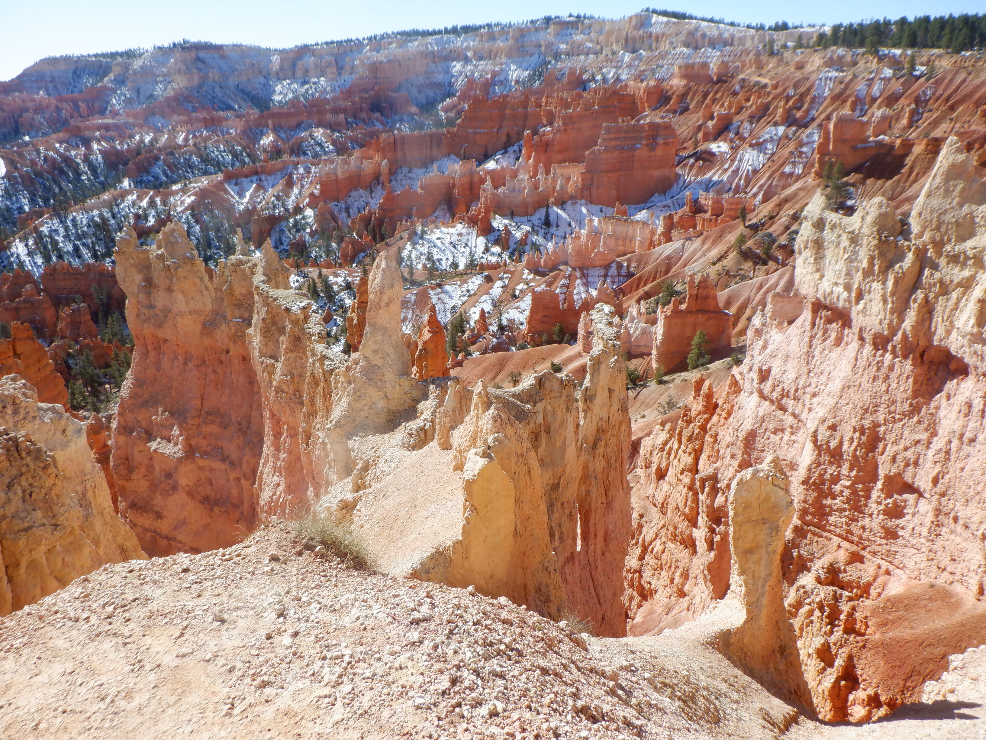
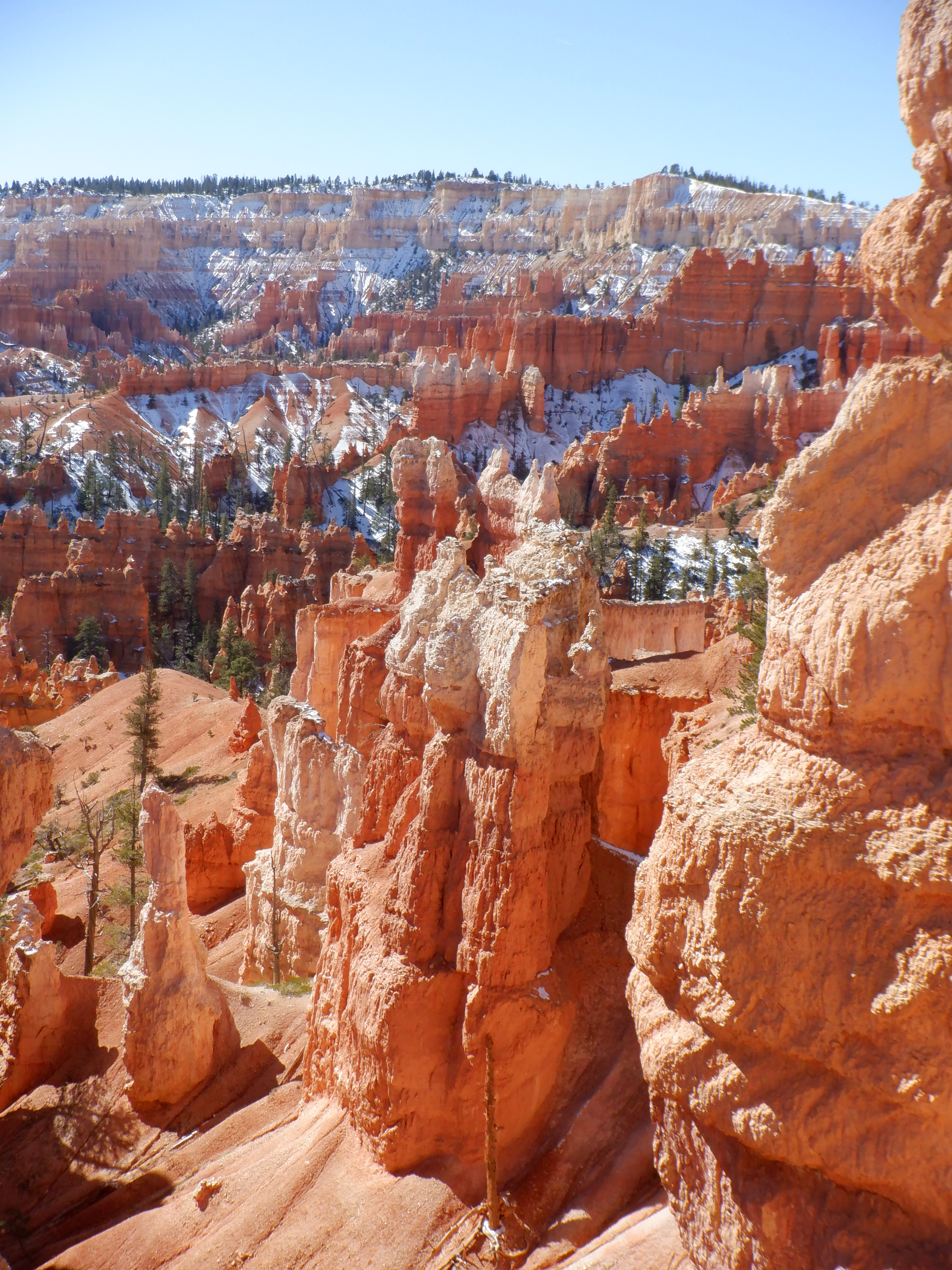
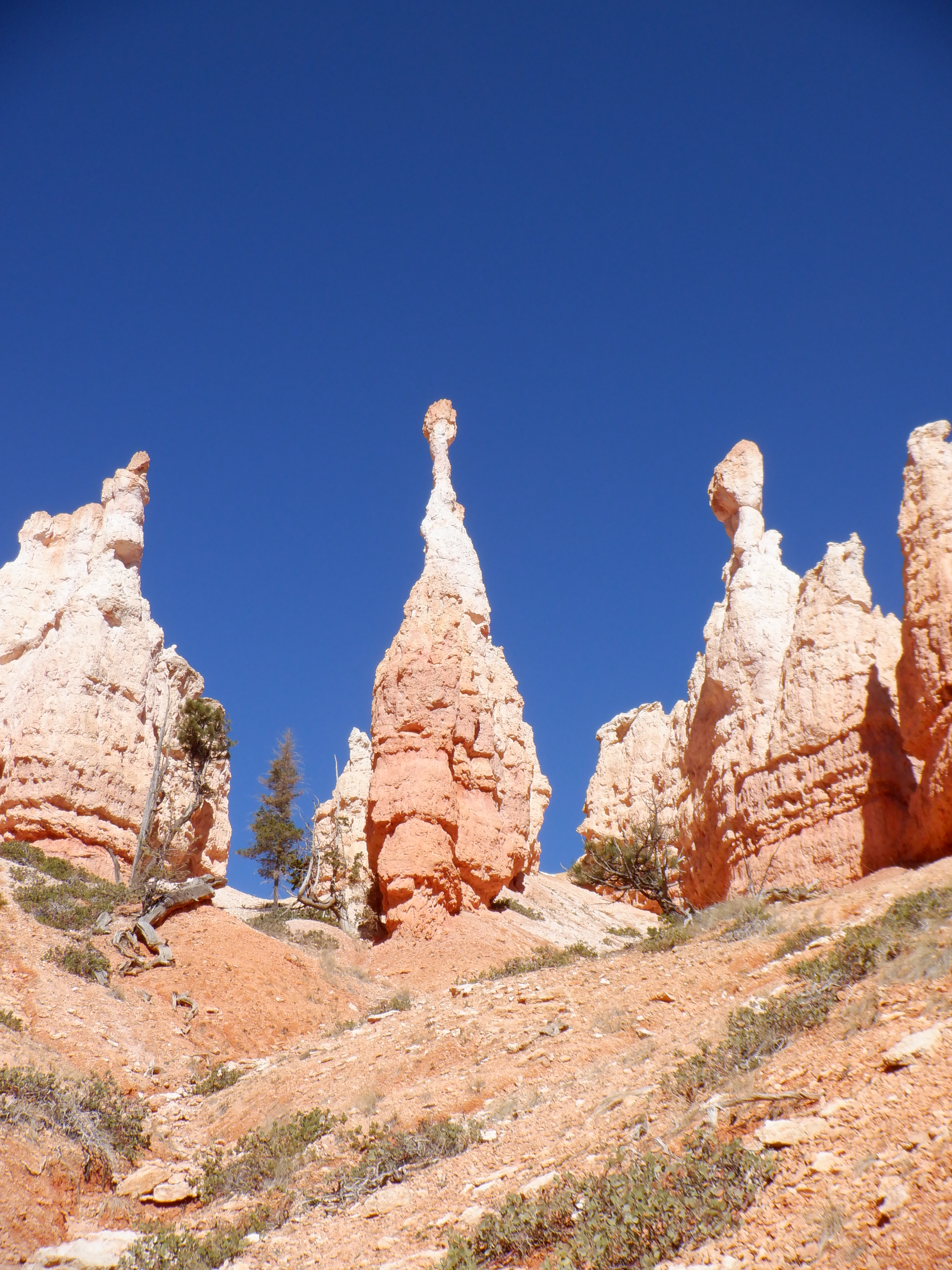
Bryce Canyon, despite its name, is not a true canyon in the scientific sense. A canyon is formed by a river eroding its way down through the ground and creating a deep cleft in the earth (Grand Canyon, Black Canyon et.al.). Bryce has been formed by rainwater and snow run-off seeping down into the porous rock. When the water then freezes, it expands and literally blows some of the rock away. Bryce ahs close to 200 nights per year where the temperature drops to below freezing. The waters have been seeping and freezing here for hundreds of thousands of years, finally creating that which we see today.
Unique, incomparable, indescribable – choose your own adjective.
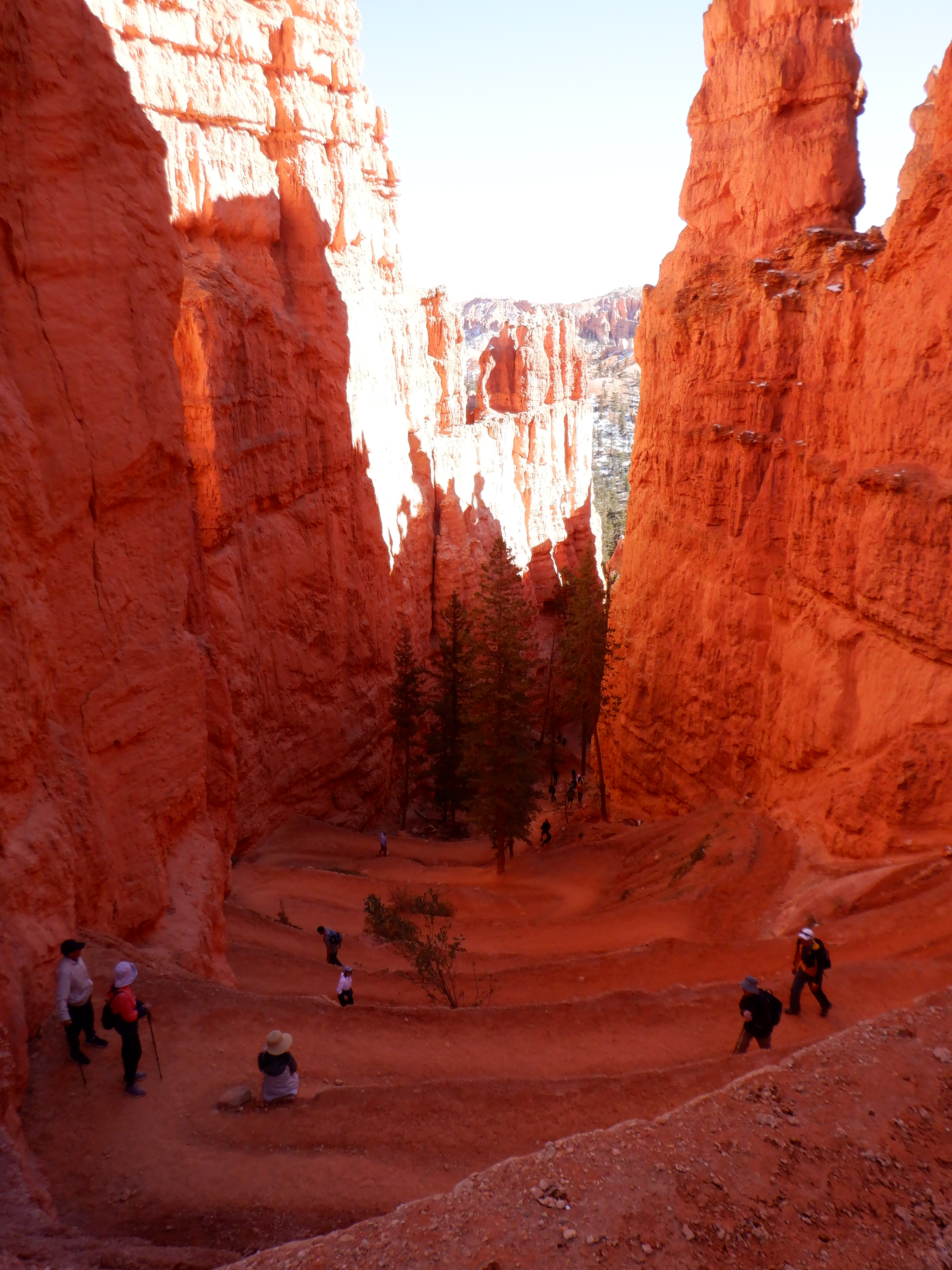
Vinni and I start down Queen’s Garden trail. A round trip is 2-3 miles. At the bottom, the trail meets Navajo Loop Trail and one can use that to come back up. The trip down is fine – we get a bit breathless on the way, since the trail goes both down and up – but the up portions are small and not too steep. The stone formations and the view is, as noted, indescribable. We stop saying “aha”. It ceases to matter. Despite our being very early, the trail is filled with hikers. We don’t have the same peaceful wandering we had in the Canyonlands.
When we reach bottom, we a sign pointing to another trail, “Peek-a-boo”. Taking Peek-a-boo is ony a short detour of 4-5 miles. As we stand looking at our map, a middle-aged couple comes up to us and asks if we are looking for the way to Peek-a-boo. We’re not, we say, we’re discussing if want to trek it. Is the trip worth is I ask. Absolutely, is the immediate answer. Definitely worth it.
Ok – that’s decided then. The couple tells us that it is best to take the loop counterclockwise. It is steep and best to get the steepest parts out of the way first.
Ok – but we’ve climbed and wandered almost 15 miles in the Canyonlands, including climbing up sheer rock walls and very steep paths, so this little “loop” doesn’t frighten us.
We’ll get smarter as the trail unfolds in front of us.
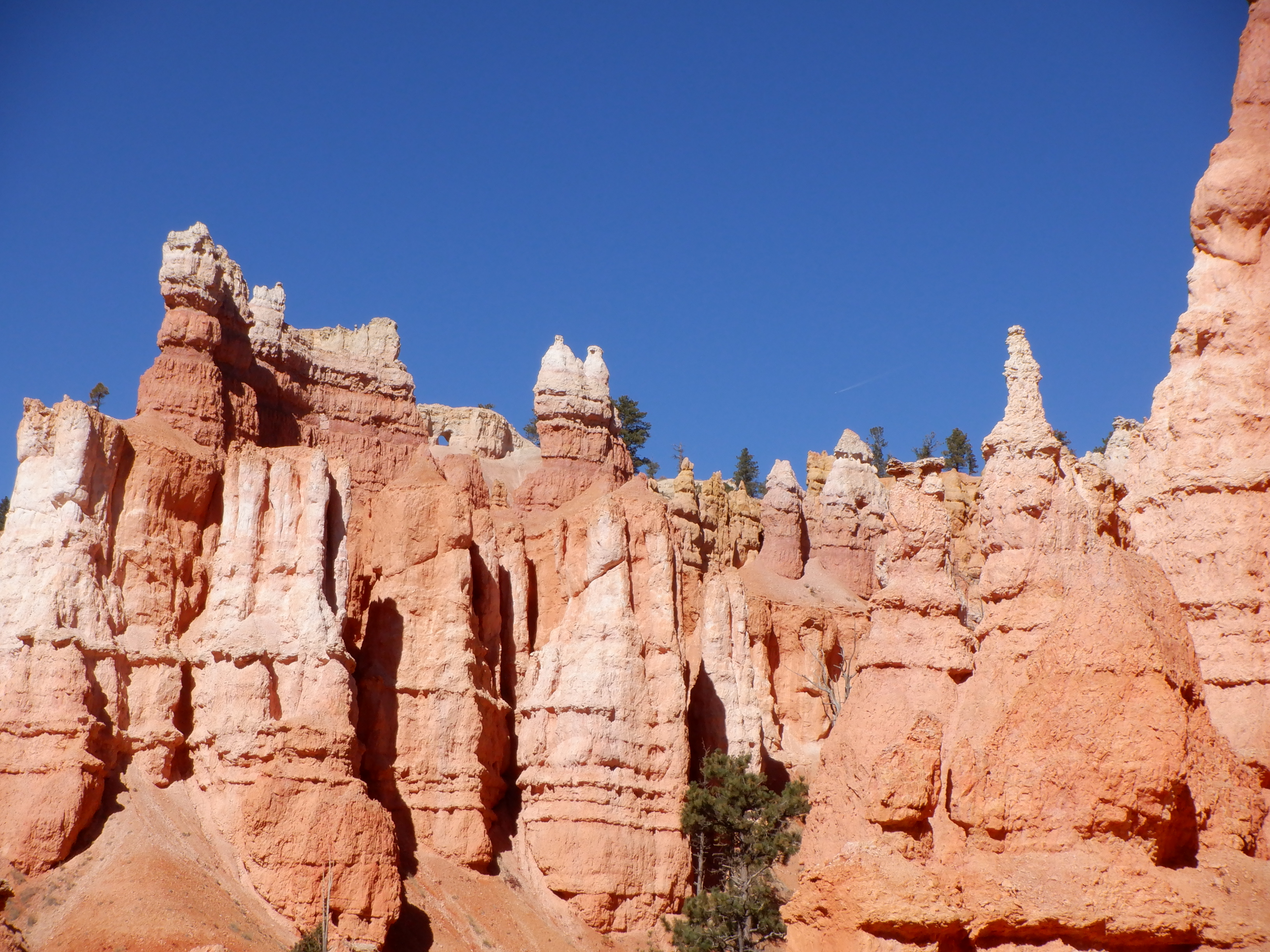

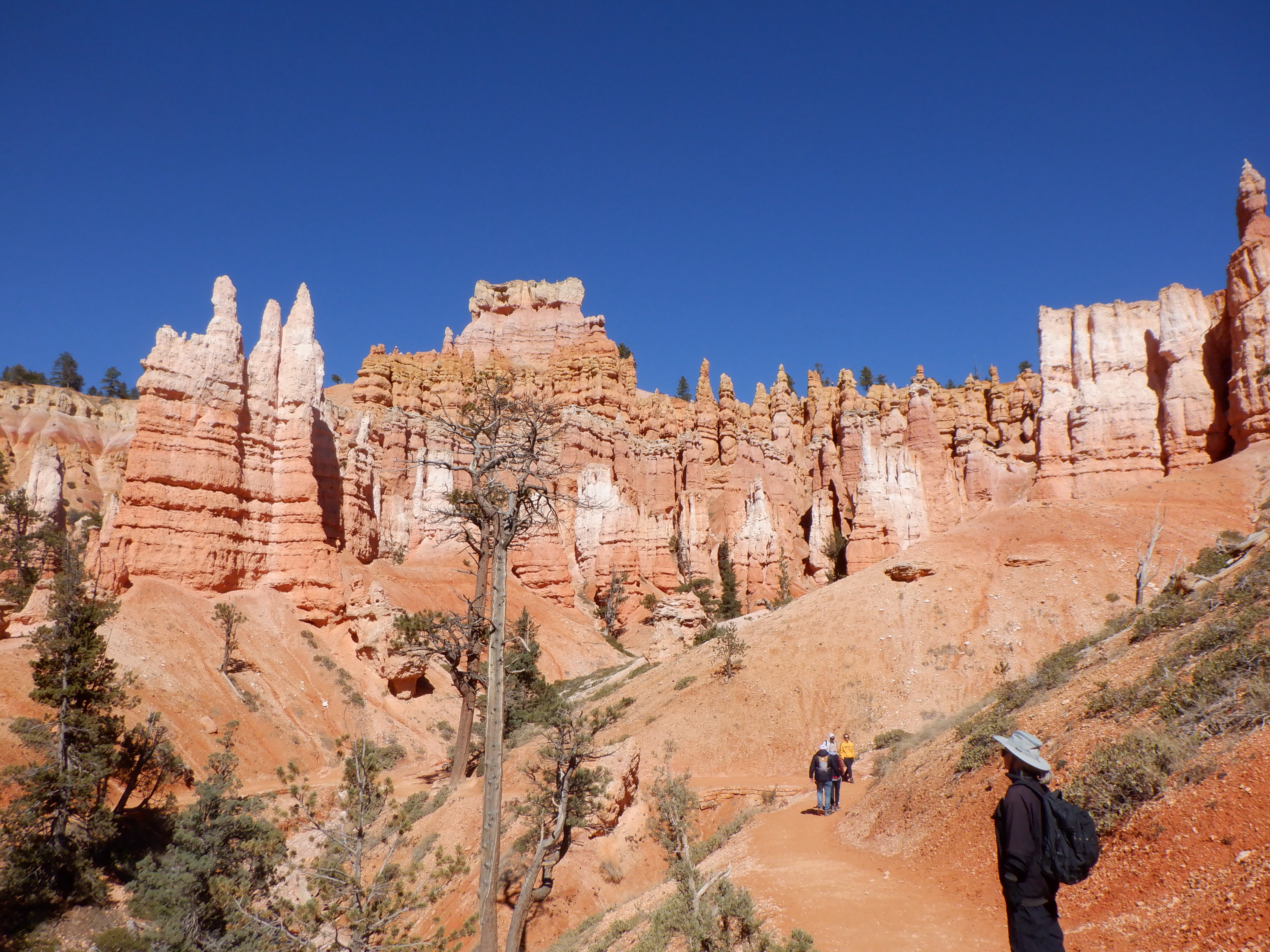
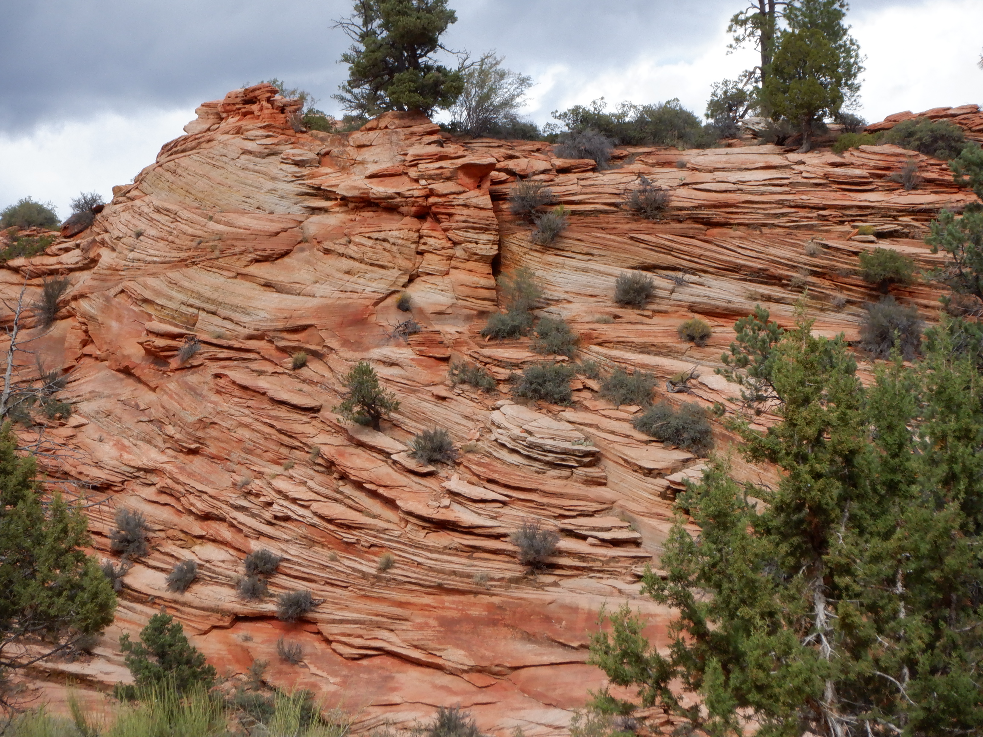
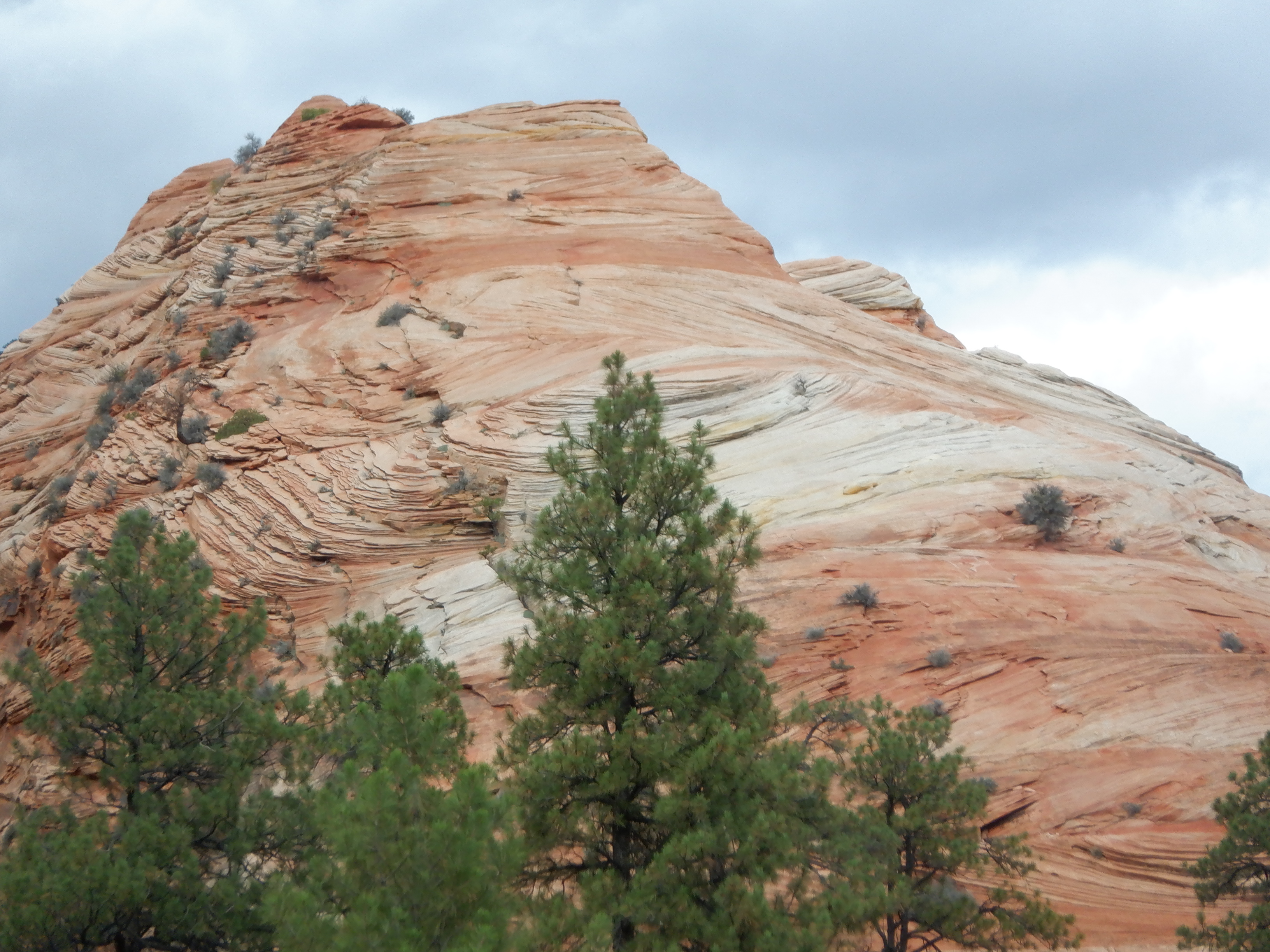
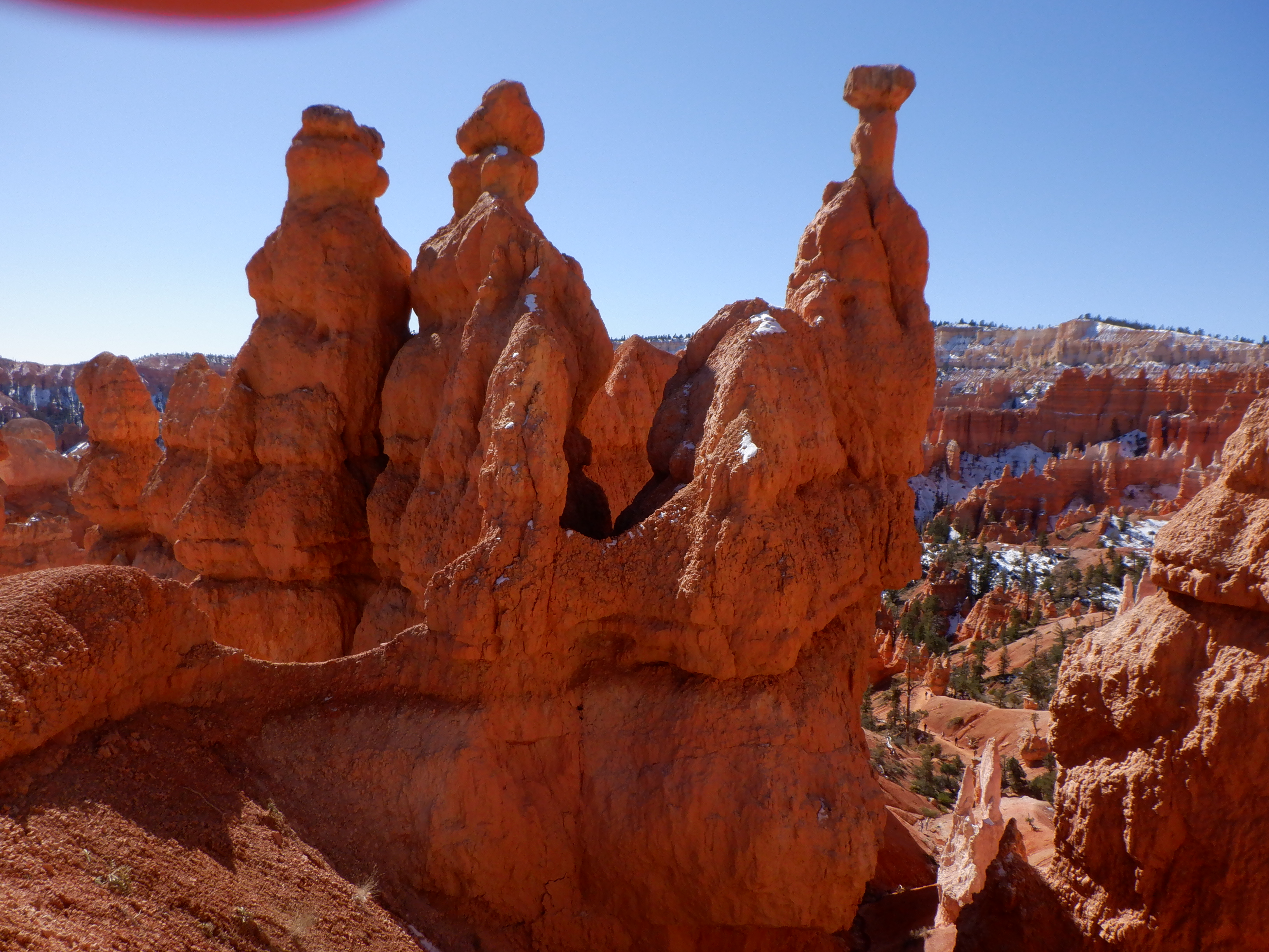
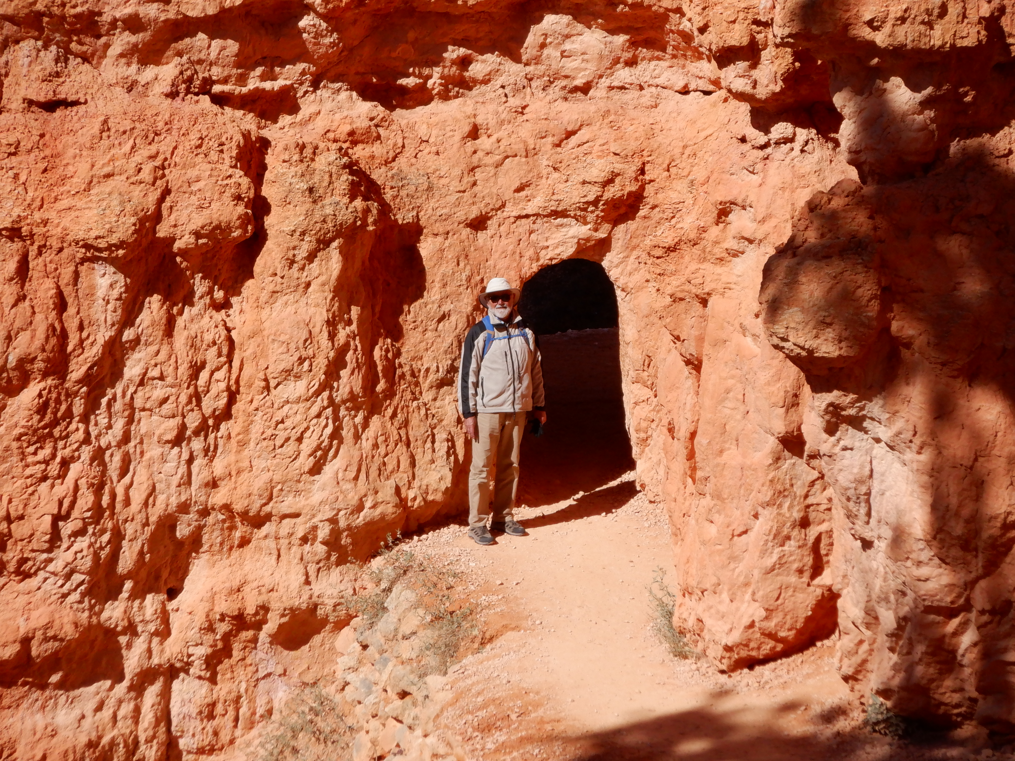
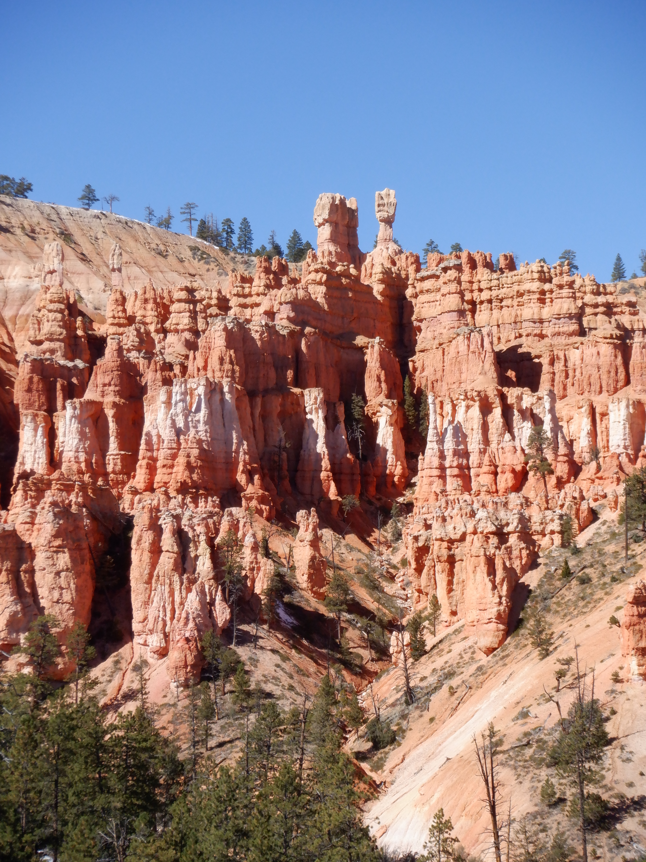
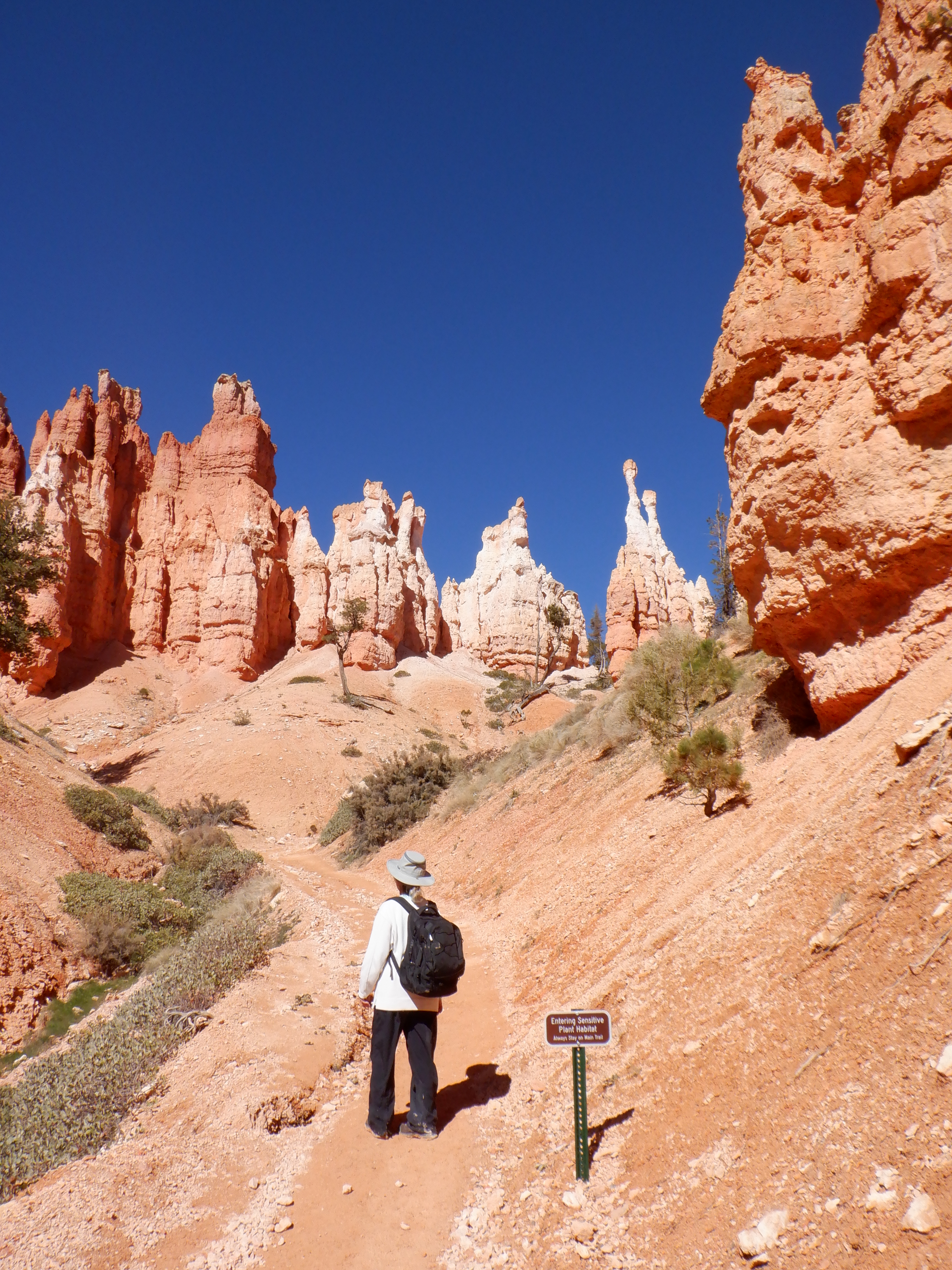
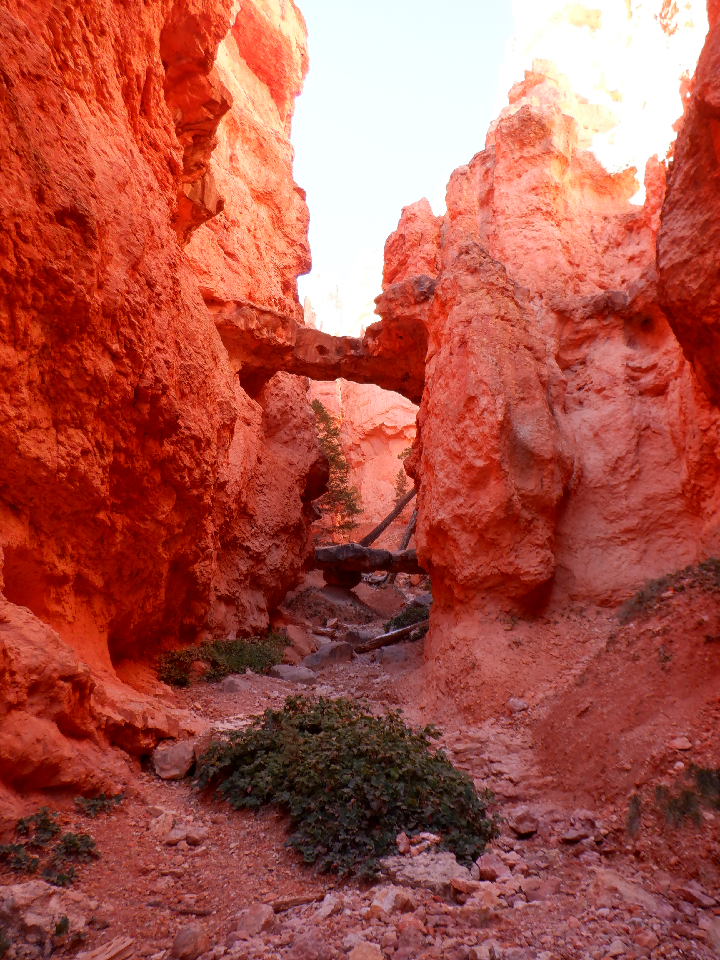
The first few hundred meters is a quiet walk through the pine forests at the base of the canyon, then the trail splits. Here we turned right to start the counterclockwise trek. The trail immediately became steep, wound its way around rock formations and became steeper. Then even more steep. All around us the Hoodoos rise. Hoodoos are the name for these unbelievable spire-like rock formations. The trial is truly steep now. It is narrow and there are many places where the sun doesn’t reach. The trail is covered in snow and ice, the hairpin turns are dangerous to negotiate. It is a looong way down. We pant and try to get air. We are over 8000 feet and the air is thin up here – very thin. We are not used to this thin air – especially not used to exerting ourselves in something like this. We take frequent pauses. Even with the frequent pauses we quickly begin to feel it in our leg muscles. Our lack of oxygen is reaching our muscles. We pant and blow some more. I’m more affected than Vinni – but she also feels it. We meet no one (no one else is crazy enough to be doing this). The very few we meet are having just as hard of a time as we are.
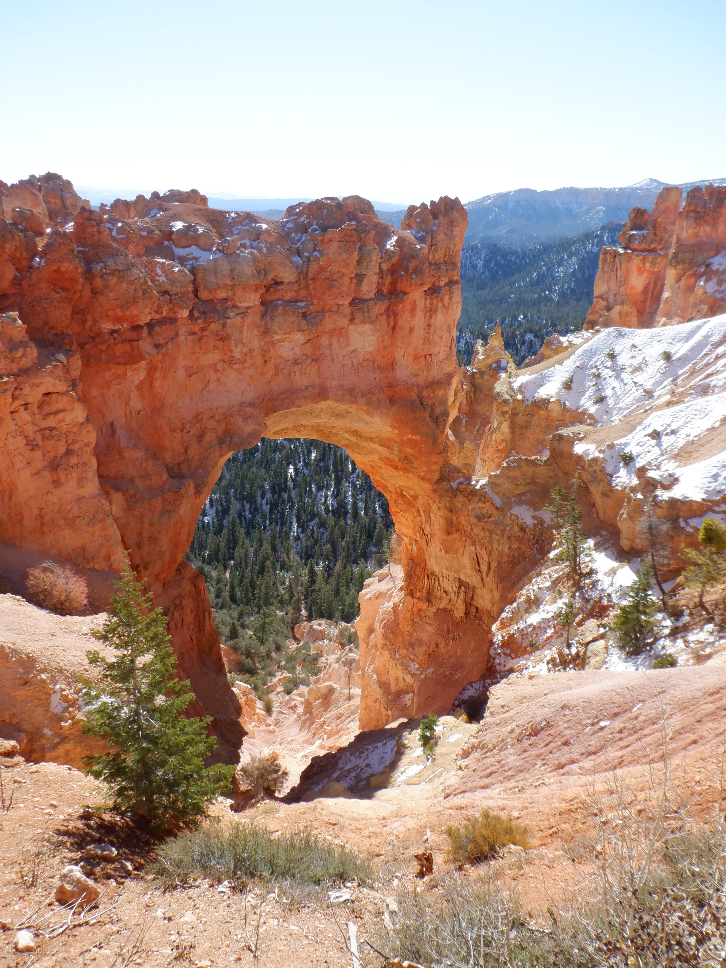
But, my God, the view! What can we say? We ended up climbing over 4 mountain tops, many places the rangers have cut a “door” in the cliff so you don’t have to climb on hands and knees over the last few meters.
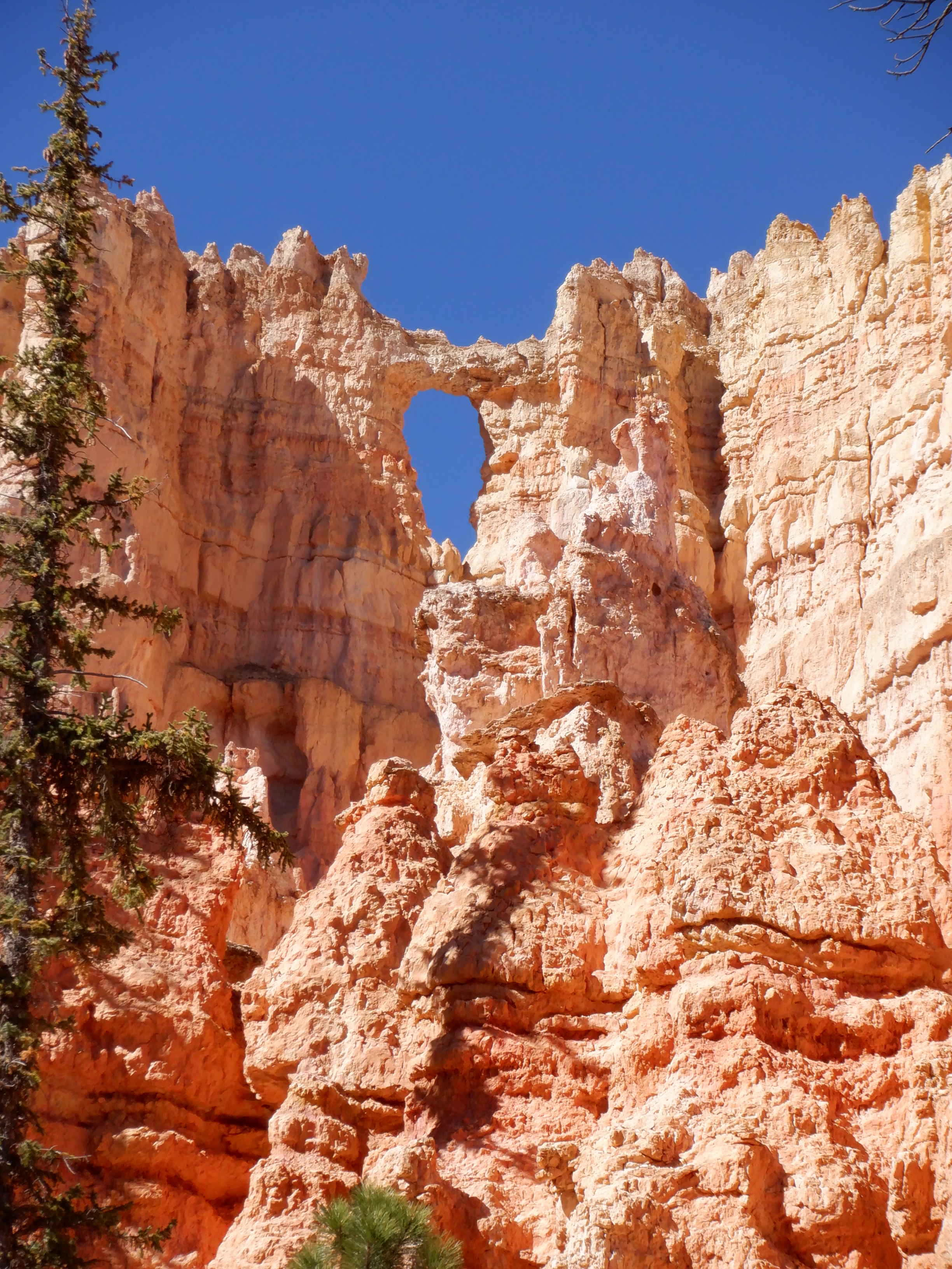
Each mountaintop we climb over exposes a new panorama. We take pictures and videos right and left. They say a picture is worth a thousand words. I hope so. I wish we were poets so we could do justice to this. Hoodoos tower up around us. We look across the valley at the wall opposite. The Hoodoos there look like a gigantic pipe organ. Colors fade from deep red over to pink to white. We can’t internalize all this. Our senses are overly sated and can’t digest more. We end up just standing, panting and staring at these wonders in silence.
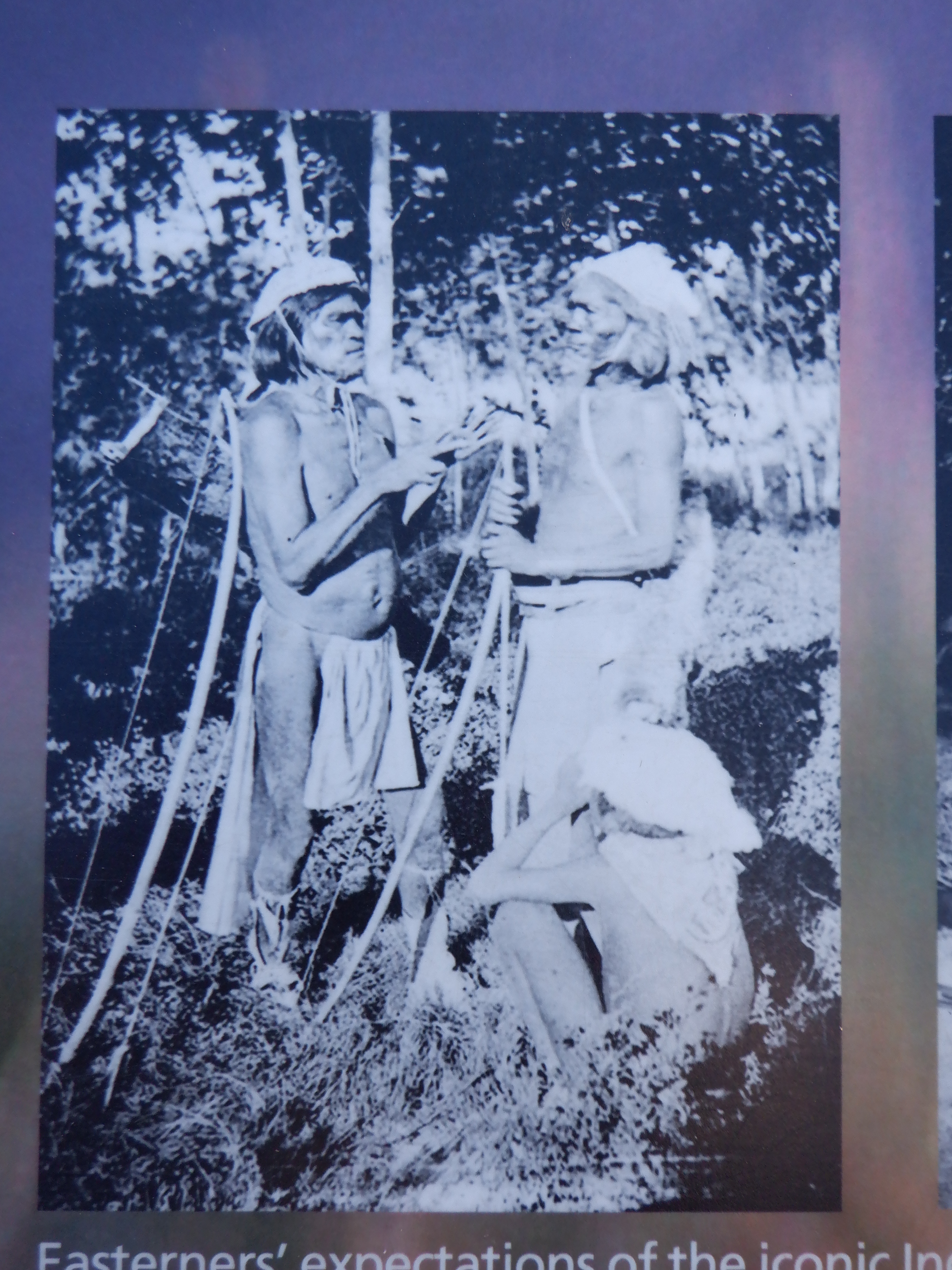
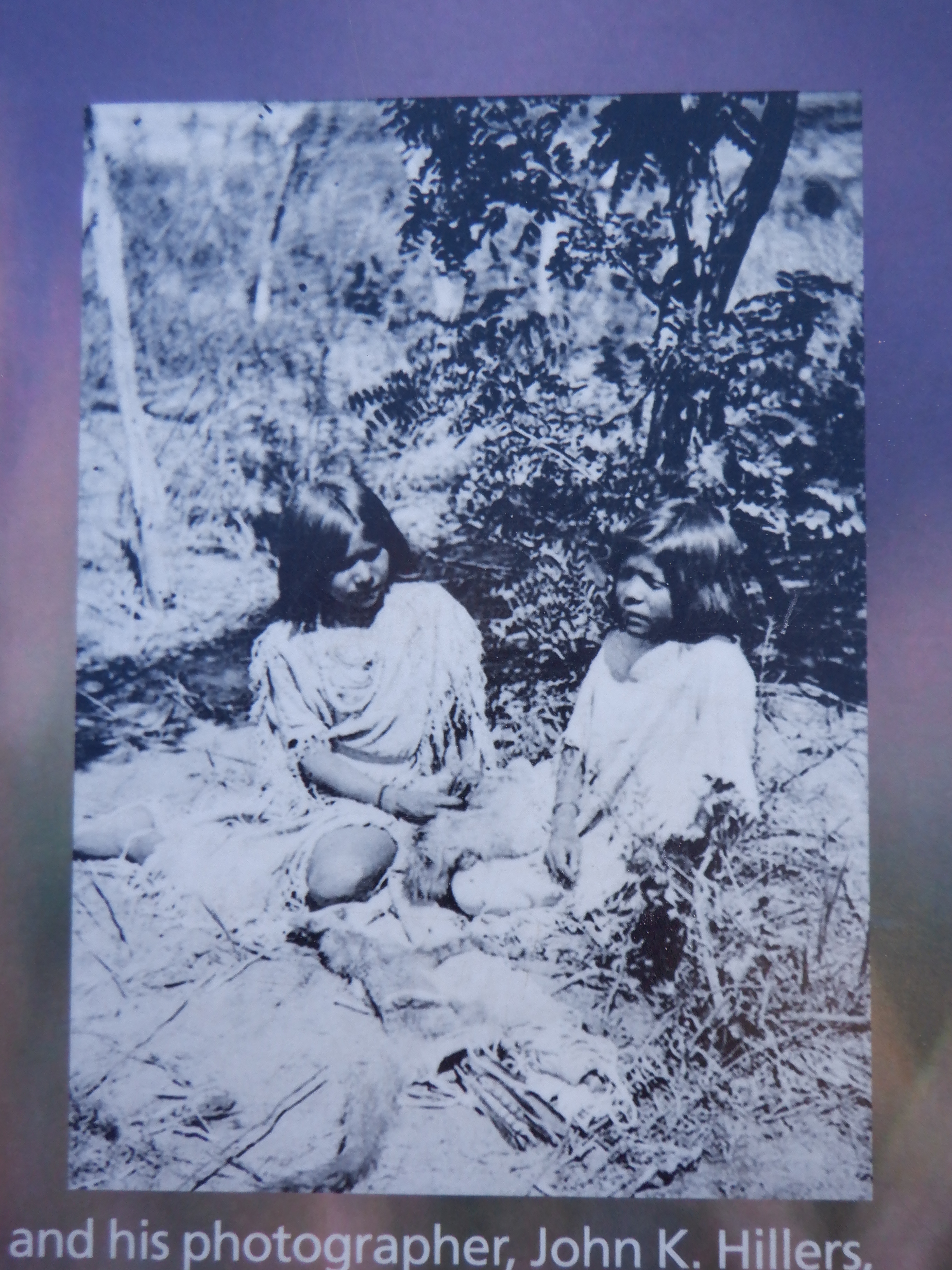
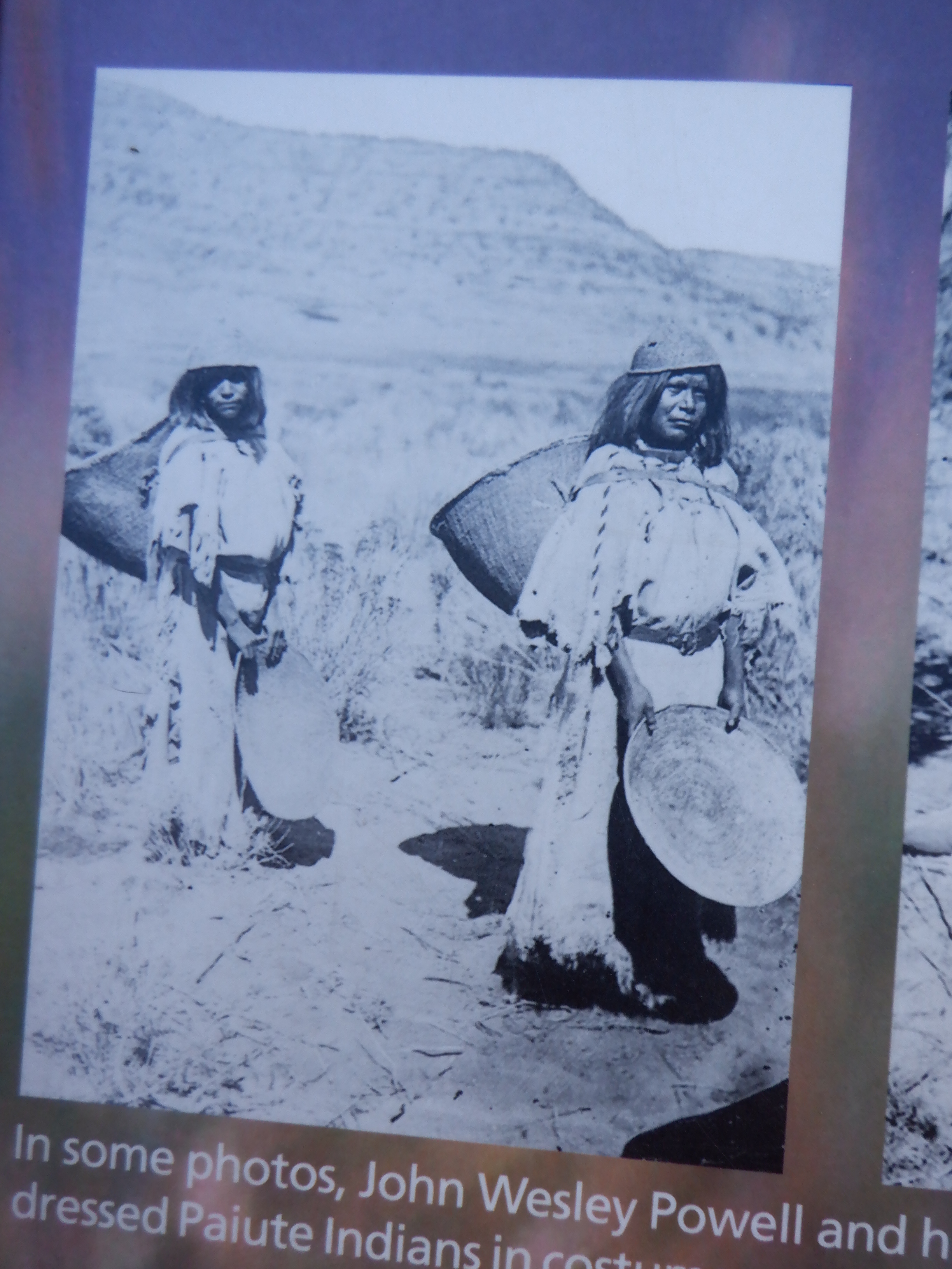
When the white man arrived in these pats, the Paiute Indians lived here. Their oral histories say that the hoodoo were a primitive people, to-when-an-ung-wa, that displeased the coyote God, Sinawava who turned them into stone as punishment. Paiute histories say; Before there were Indians, the legend People lived here. Paiute Indians only tell their oral histories in the winter. Spring, summer and autumn are for hunting and growing crops. In winter, they sit around the fire and pass on their history to the younger generations.

All the while, we climb onwards and become even more tired (if that is possible). Our pulse now races at full blast – way over 100 beats per minute. Even when we pause, our pulse continues to race – at best, we can catch our breath a little. Our leg muscles are screaming – if they feel like this today – how will they feel tomorrow?
Assuming, of course, we get out of this alive. Otherwise, we won’t care.
WE drink water like mad – even though it is cold – we’re sweating like pigs. After some more tortuous hours, we are back at the end of Queen’s Garden Trail. Here we can choose – back up Queen’s Garden, 1.5 miles or the short Navajo Loop Trial – “only” 0.6 miles. We have to go up just over 600 meters (0.4 miles), so taking the Navajo Trail means that we’ll be going up almost 1 meter for each meter we go forward.
Are we having fun yet?
Damned right we’re having fun!
As usual, the first hundred meters or so are easy – we’re beginning to think the worst is over. Now it starts getting steep. We are going up more than we are going forward. The grade continues to steepen. We enter a narrow cleft, look up and can see 20-30 hairpin turns and switchback we will need to pass above us. Like a gigantic ladder, the trial rises over 400 meters, almost vertically. No elevator – no escalator. The only thing we can do is set one leg in front of the other. We’re done panting. Now we are gasping fro ach step is agony. We are red-faced; our legs have stopped feeling like led – now they feel like they are encased in a solid concrete block. We trek bent forward, looking only at the ground in front of us.

We can only manage 2-3 levels at a time – then we are forced to stop and rest. Everyone else, even the younger crowd stops and gaps for breath. Some sit down. Despite gasping for breath, we begin to feel we are in better shape than most here. I’m almost 70 and Vinni is 62, so we aren’t spring chickens anymore. No wonder this trek is almost killing us. But clearly, many of the younger crowd don’t get any exercise at home.
As we near the top, we come across a middle-aged woman lying in the path, pale as a ghost. A couple of Rangers are busy giving her first aid. More Rangers are on their way down. She is conscious, but clearly doesn’t feel well. It probably isn’t a heart attack, just lack of oxygen, but it is a good thing it happened only 100 meters from the top. Otherwise, the Rangers would have had to call a helicopter to get her out.
When we finally reach the summit, we, like everyone else, just stand and gasp for oxygen. We hump our way out to the shuttle and back to the campground. One there, we can look at the app on my phone and see that we have trekked just over 12 kilometers (8 miles) and climbed an elevation of over 68 floors. The 68 floors we don’t believe, we were over 4 mountain tops, each more than 400 meters, so it is measuring only one mountaintop. The 12 kilometers we do believe.
Was it worth the agony? Of course it was. Words can’t describe it – perhaps our pictures can give you a small impression.
If any of you, dear readers, ever should have the urge to experience something truly indescribable, we can warmly recommend hiking in Canyonlands National Park (south) and Bryce Canyon. Words cannot describe the experience.


